1. Named ships online
Community-reported passages and estimated times for vessels near the Soo.
Open today's BoatNerd passage list ↗Named-vessel passage sources, the official boat hotline, live AIS activity, and Sault Ste. Marie visitor information
Today's Soo Locks planning checklist
There is no guaranteed minute-by-minute official web schedule. U.S. Army Corps of Engineers park rangers post estimated boat times inside the Visitor Center and maintain an official boat-schedule hotline while the center is open. For named vessels online, use BoatNerd's community passage list, then confirm movement on the live AIS map.
Community-reported passages and estimated times for vessels near the Soo.
Open today's BoatNerd passage list ↗USACE park rangers maintain the hotline while the Visitor Center is open.
Call 906-202-1333Check whether a vessel is actually approaching the lock complex before leaving.
Jump to the live vessel mapLooking for tomorrow's Soo Locks schedule? Check the same sources again on the morning of your visit. Vessel ETAs can move by hours with traffic, weather, cargo operations, and lock availability.
This page links to BoatNerd rather than copying its named-vessel schedule. AIS and community estimates are informational, can be delayed or incomplete, and must not be used for navigation.
After the live map
Current vessel movements at the Soo and across all five lakes.
The latest newspaper headline loads here.
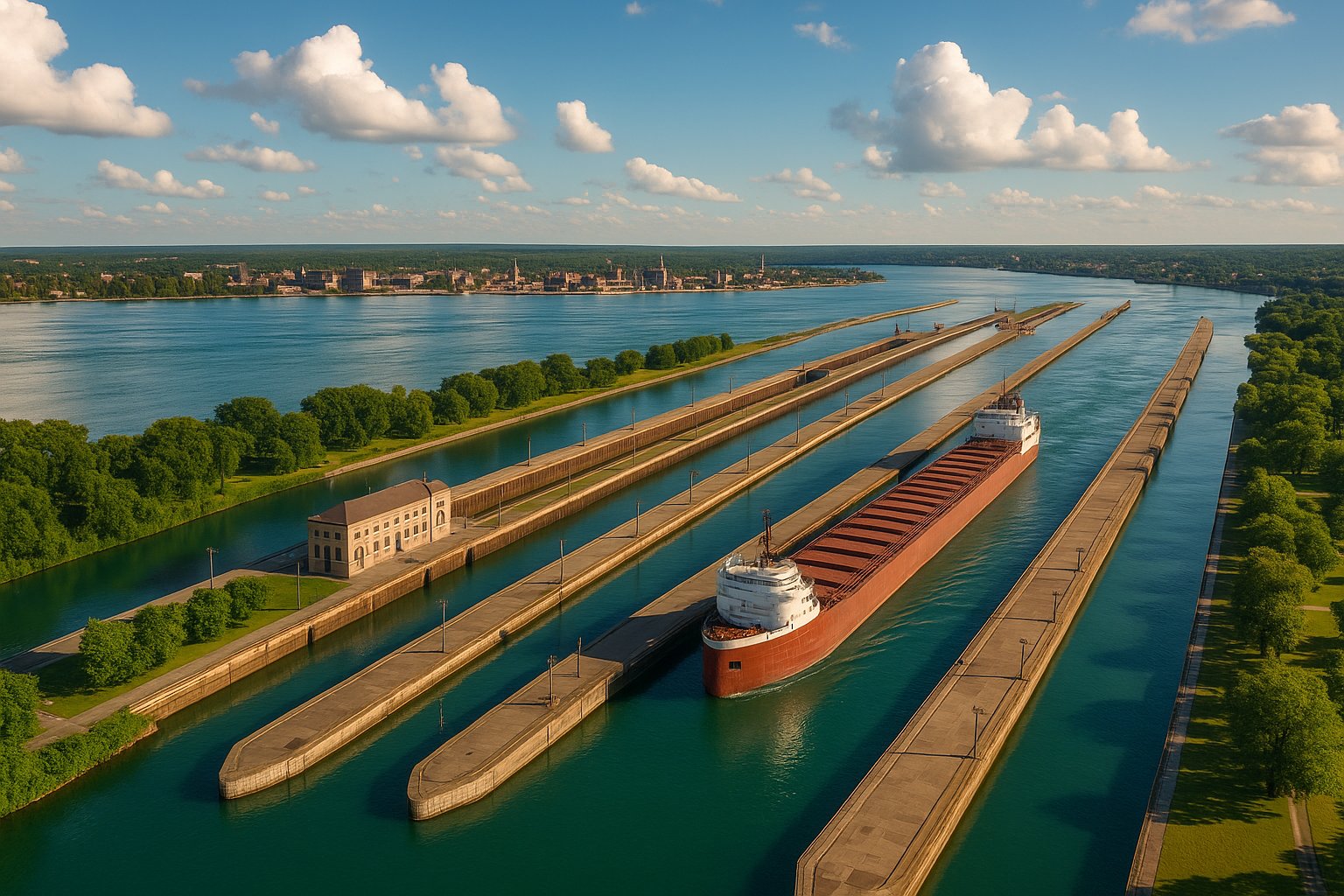
The Soo Locks from the air, Sault Ste. Marie. Photograph by August Schwerdfeger, CC BY 4.0, via Wikimedia Commons.
The Soo Locks at Sault Ste. Marie, Michigan are among the world's busiest lock systems by cargo tonnage. The U.S. Army Corps of Engineers says nearly all of America's domestic iron ore passes through the locks. They lift vessels 21 feet between Lake Superior and the lower Great Lakes, bypassing the St. Marys River rapids.
This page is a live tool. The status indicator above is calculated from the official Soo Locks operating calendar. The interactive map below plots recent AIS position reports from ships in the immediate lock area and does not require you to create or manage an API key. Below the live data is the visitor guide: lock dimensions, the new Poe-replacement lock, how to watch a vessel transit, and what each ship category looks like when it comes through.
Explore live AIS positions of vessels within the lock complex and the St. Marys River approach channels. Downbound ships arrive from the Lake Superior side; upbound traffic follows the St. Marys River toward the locks from the lower lakes.
Tap a name to find its last reported position. Blue markers indicate reported movement; amber markers indicate little or no movement; gray means speed is unavailable. Positions are received reports, not a guaranteed transit schedule.
Source: Open Waters AIS. Individual source credits appear with the reports.
The map above focuses on the Soo Locks and nearby approaches. BoatNerd provides the full Great Lakes map and a dedicated Soo passage list; MarineTraffic provides a worldwide AIS view. Off-season traffic drops to zero between mid-January and late March.
For named vessel schedules and full lock transit listings, the daily Great Lakes Gazette publishes morning summaries during the navigation season. The Gazette combines vessel reports with port data from across all five Great Lakes.
Two different questions, two different answers. For ship traffic today, the live Great Lakes freighter tracker shows vessels currently under way, including those approaching and clearing the St. Marys River, with names, headings, and destinations from AIS. For a live cam, the US Army Corps of Engineers runs the official Soo Locks camera at the Visitor Center, and the Sault Ste. Marie border page carries the International Bridge camera looking across the same stretch of river. Downbound vessels usually clear the Poe Lock 20 to 40 minutes after entering, so a ship you spot on the tracker upriver is worth walking out for.
A USGS camera on the St Marys River at Sault Ste Marie, updated through the day. It looks at the water rather than the lock chambers, so it shows you ice, weather and river conditions at the Soo, not the vessel in the lock.
Loading the camera...
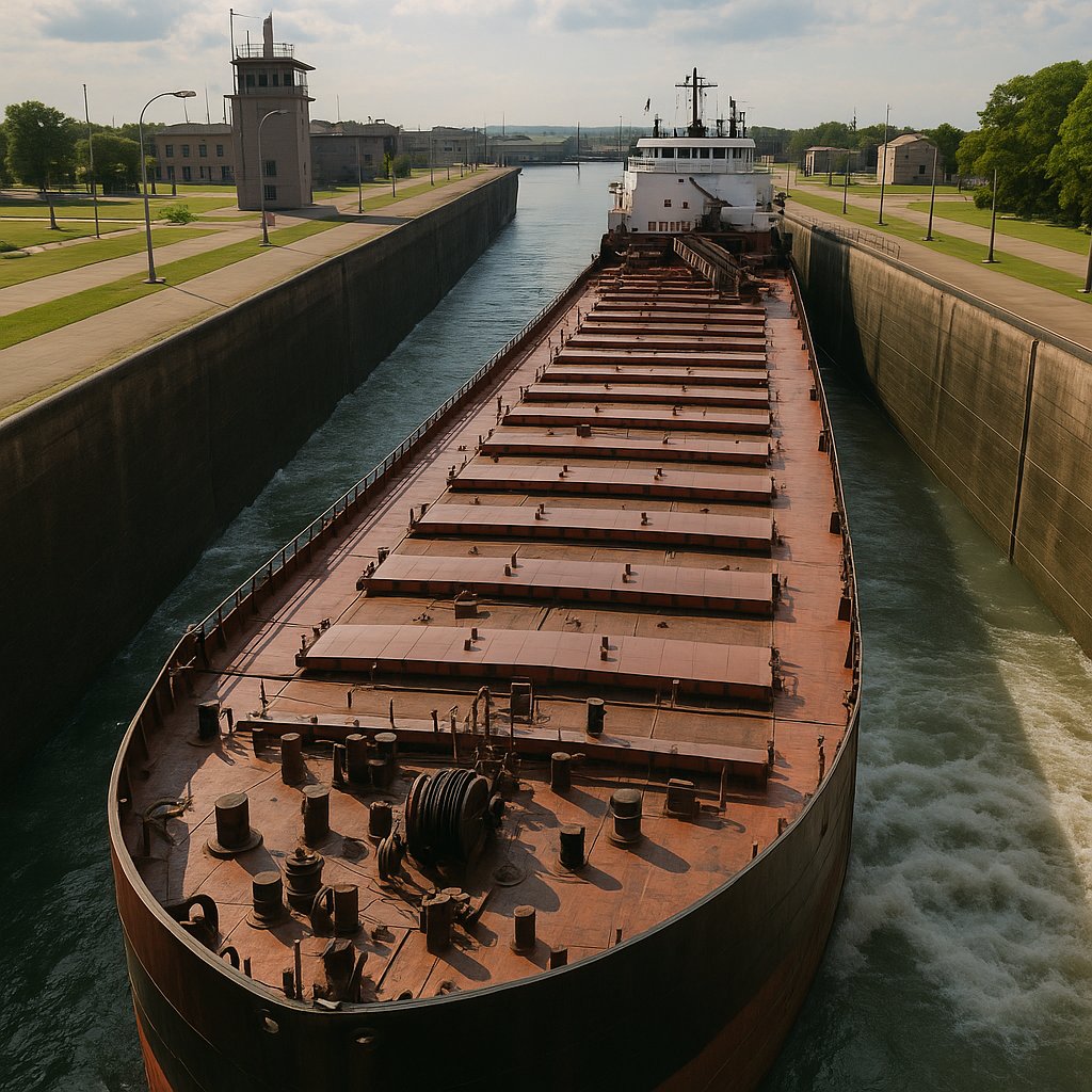
The MacArthur Lock. Photograph by Gpwitteveen, CC BY-SA 3.0, via Wikimedia Commons.
Two locks are currently operating: the Poe Lock and the MacArthur Lock. The Poe is the only lock at the Soo that can handle vessels larger than 730 feet. Every 1,000-foot laker in the U.S. fleet (the Paul R. Tregurtha, Edwin H. Gott, Edgar B. Speer, Burns Harbor, Stewart J. Cort, Indiana Harbor, and a handful of others) is dependent on the Poe to move between Lake Superior and the lower lakes. If the Poe ever goes down for an extended unplanned outage, the result would be a near-total disruption of U.S. steelmaking iron ore supply.
That single-point-of-failure problem is the reason for the new lock currently under construction on the site of the decommissioned Davis and Sabin Locks. The replacement, often called the New Poe or simply the New Lock at the Soo, will match the Poe's 1,200-foot length and 110-foot width, providing redundancy for the 1,000-footers. Construction began in 2020. The U.S. Army Corps of Engineers projects an operational date in the mid-2030s.
The Soo Locks close annually from mid-January through late March for ice conditions and scheduled maintenance. The exact close and reopen dates vary slightly year to year and are set by the U.S. Army Corps of Engineers. During the close period, no vessels transit; American and Canadian icebreakers (the USCGC Mackinaw and CCGS Samuel Risley) work to keep the surrounding lake and channel ice managed for the reopening. The Canadian Sault Ste. Marie Canal, a smaller pleasure-craft lock on the Canadian side, operates only seasonally and serves recreational traffic.
Ships transiting the Soo fall into a few recognizable categories. Once you have seen one of each, you can tell them apart from a distance.
The thirteen U.S.-flagged 1,000-foot lakers are the largest vessels on the Great Lakes. They run iron ore, coal, and limestone in lake-only service and never leave the system. They are the most photogenic vessels at the Soo. The Paul R. Tregurtha is the longest at 1,013 feet 6 inches. The Edwin H. Gott, the Edgar B. Speer, and the Burns Harbor are also commonly seen at the Poe. Only the Poe Lock can hold them.
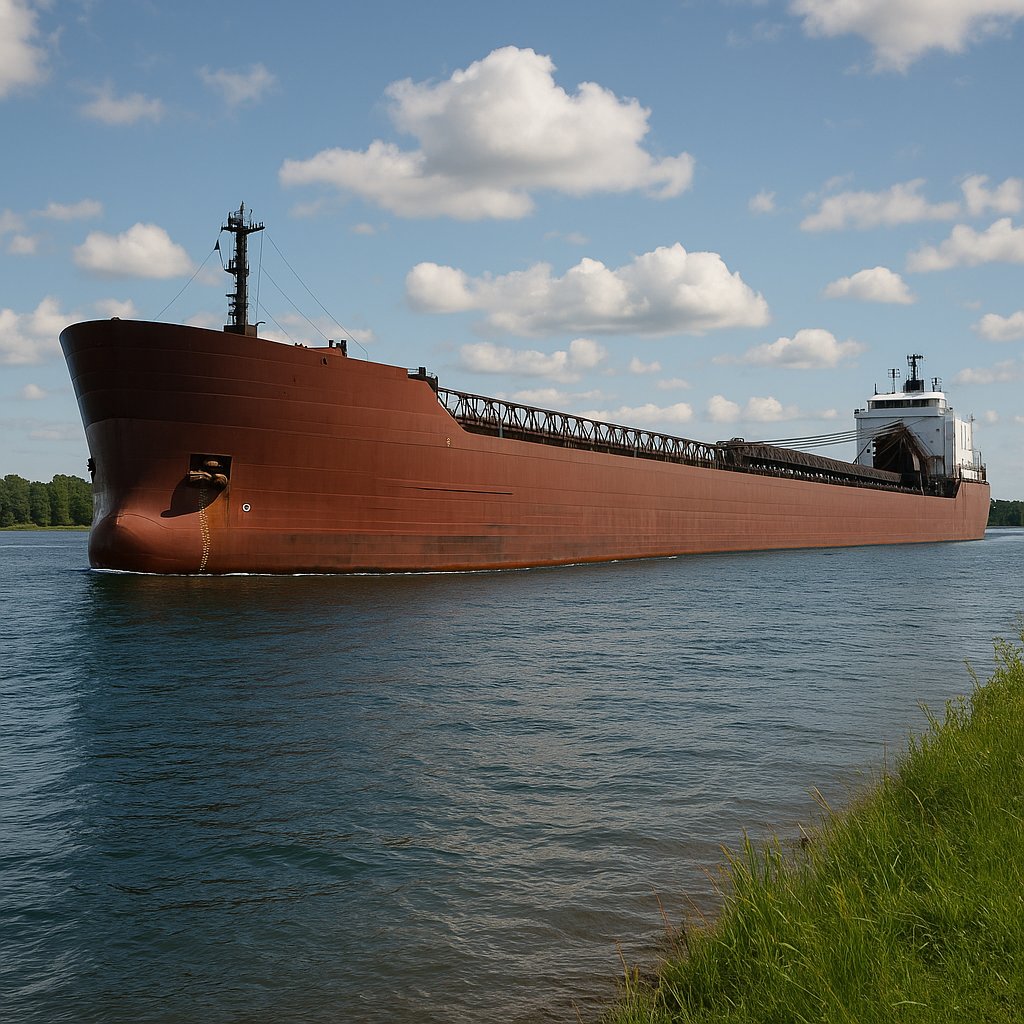
The Burns Harbor, a 1,000-footer, in the Poe Lock. Photograph by Carmen Paris, public domain, via Wikimedia Commons.
Oceangoing vessels that have transited the St. Lawrence Seaway from the Atlantic to reach the upper lakes. Salties are typically 600 to 740 feet long, limited by Seaway lock dimensions. They carry mixed cargoes (steel coils, grain, project cargo). Their hulls show ocean wear and salt staining. They often fly foreign flags. At the Soo they handle through both the MacArthur and Poe.
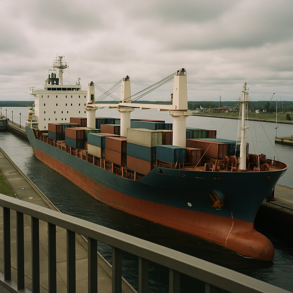
Freighters waiting their turn above the locks. Photograph by U.S. Army Corps of Engineers Detroit District, public domain, via Wikimedia Commons.
Vessels of the Canadian Algoma Central or CSL fleets. Typically 740 feet, slightly older designs, white or gray paint. They run grain from Thunder Bay, salt from Goderich, and iron ore from Quebec ports. They can transit either lock.
The American Steamship Company, Interlake, and Great Lakes Fleet vessels in the 600 to 730-foot range. These are the original post-Edmund Fitzgerald generation of bulk carriers. Both lock options available.
A pusher tug locked into a barge notch, operating as an integrated unit. Increasingly common in the U.S. fleet as a more economical alternative to traditional self-unloaders.
Lake Superior cruise traffic has grown since 2019. The Ponant Le Champlain, Viking Octantis, Pearl Mist, and other small luxury vessels transit the Soo during the summer cruise season, typically May through October.
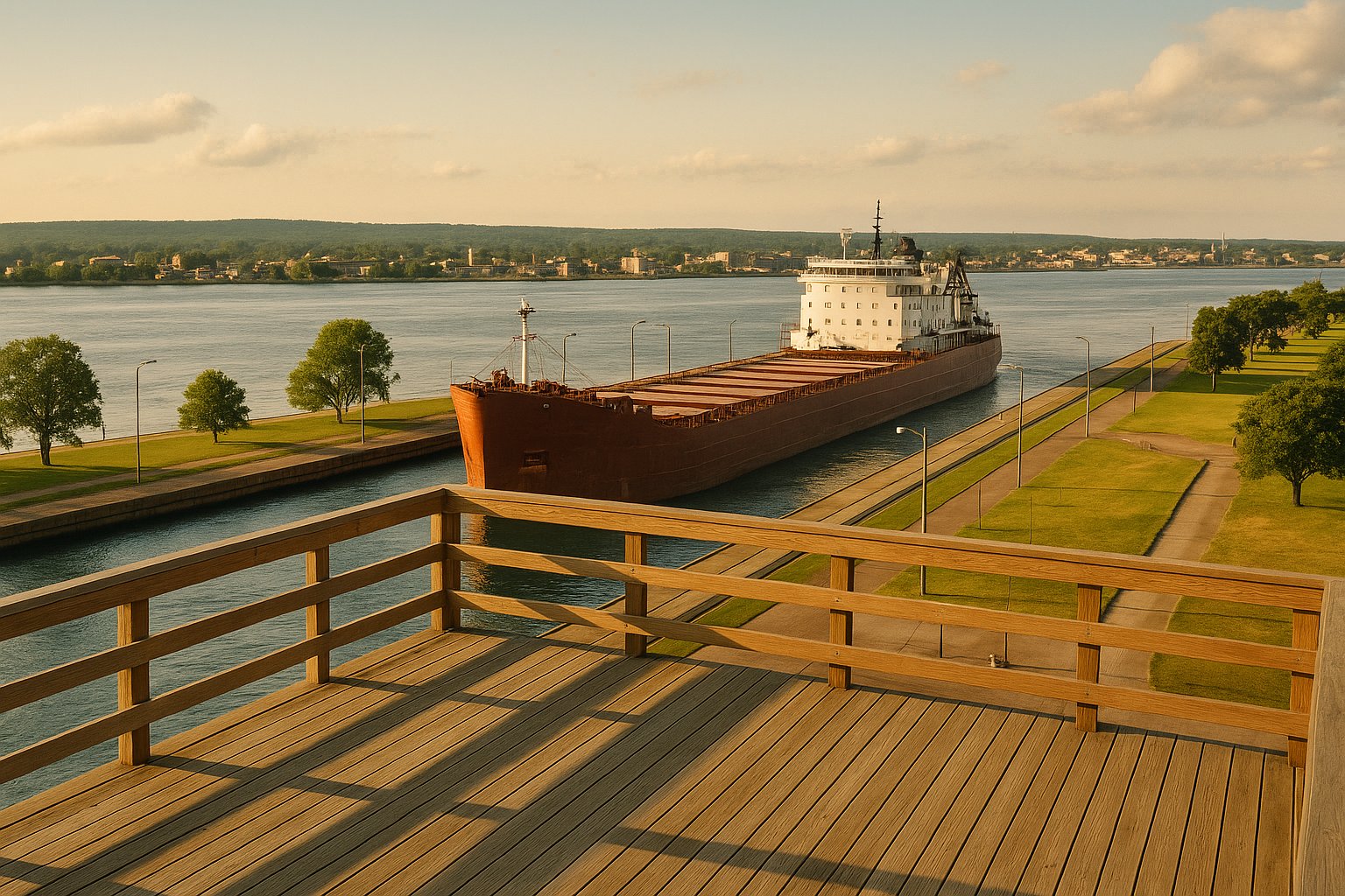
The Soo Locks Visitor Center is on Portage Avenue in downtown Sault Ste. Marie, Michigan, immediately adjacent to the MacArthur Lock. The viewing platform sits about 25 feet above the lock chamber and provides an excellent vantage for watching vessels enter, lock through, and depart. Admission is free.
The administration building beside the MacArthur Lock. Photograph by Acroterion, CC BY-SA 4.0, via Wikimedia Commons.
The indoor Visitor Center is open May 1 through October 31. USACE lists Canal Park hours of 9 a.m. to 10 p.m. in June, July, and August; 9 a.m. to 9 p.m. in May, September, and October; and 9 a.m. to 6 p.m. from November through April. Hours can change for security, construction, and special events, so confirm the official visitor page before making a long drive.
Check the BoatNerd passage list and live map above, then call the official boat-schedule hotline at 906-202-1333 while the Visitor Center is open. Rangers post estimated boat times inside the center, but every transit remains subject to change. Arrive early and allow at least 90 minutes if seeing a specific ship matters.
Peak vessel traffic runs from late spring through late fall. July and August offer the most consistent weather and the most daylight, but September and October bring fall color along the St. Marys River and slightly less crowding. The shoulder season at season open (late March / early April) and close (early January) offers spectacular ice-vessel photography but unpredictable weather.
The Canadian Sault Ste. Marie also offers vessel viewing at Roberta Bondar Park and the Bondar Pavilion. The viewing angle is different (closer to the ship channel) and there are typically fewer visitors. The two Saults are connected by the International Bridge. Before crossing, check the live Sault Ste. Marie border wait, bridge camera, warnings, and toll. The Sault Ste. Marie Michigan stop card on the Circle Tour guide and the Sault Ste. Marie Ontario stop card both have additional visitor notes.
Optional visitor gear
These categories fit a real visit to the observation deck: seeing vessel details across the chamber, steadying a phone, handling fast-changing river weather, and keeping a phone charged while you wait.
Paid links: As an Amazon Associate I earn from qualifying purchases.
Bring ship names, deck details, and traffic on the far side of the river into clearer view.
See current options on AmazonHelps steady vessel photos and video without requiring a full photography kit.
See current options on AmazonAdds lightweight protection when wind and rain change quickly along the St. Marys River.
See current options on AmazonProvides backup power for the live map, phone camera, and calls during a long vessel wait.
See current options on AmazonHow do I find today's Soo Locks ship schedule?
Use the BoatNerd Soo passage list for named vessels, confirm movement on the live AIS map, and call the official USACE boat-schedule hotline at 906-202-1333 while the Visitor Center is open. Treat every time as an estimate.
Can you watch a 1,000-footer go through the locks?
Yes. The Poe Lock handles all 1,000-foot vessels, and the Visitor Center viewing platform is immediately adjacent. The best time is during the morning or afternoon traffic peaks. Check the daily vessel schedule or the AIS map above to time your arrival.
Is there a fee to use the locks?
No. The Soo Locks are operated by the U.S. Army Corps of Engineers and are toll-free. Commercial vessels do not pay a transit fee, unlike the Panama Canal or Suez Canal. The locks are funded as part of federal navigation infrastructure.
When does the new lock open?
The new replacement lock (which will match the Poe in size) is under construction on the site of the decommissioned Davis and Sabin Locks. USACE projects an operational date in the mid-2030s. Construction began in 2020.
Why does the lock close from January to March?
Ice. The St. Marys River and the eastern end of Lake Superior freeze over during the winter, and operating the locks through pack ice damages the gates and structures. The shutdown is also used for major scheduled maintenance, dewatering inspections, and repairs that cannot be done while vessels are transiting.
What is the most-transited vessel at the Soo?
The 1,013-foot Paul R. Tregurtha makes the most transits annually, running iron ore, coal, and limestone year-round during the navigation season. The Edwin H. Gott and Edgar B. Speer also rank among the highest-frequency transits.
Can pleasure craft use the locks?
Yes. Pleasure craft use the smaller Canadian Sault Ste. Marie Canal lock on the Canadian side (not operated by USACE). The U.S. locks handle commercial vessels and occasional government and special-use traffic; pleasure craft are not typically routed through the Poe or MacArthur.
How can I get notified when specific ships are transiting?
The Great Lakes Gazette daily brief mentions notable vessel movements at the Soo. MarineTraffic offers paid vessel tracking with email alerts. The Boatnerd "Calumet River Reporter" and similar AIS-driven Discord and Twitter feeds also push notifications for specific ship arrivals.
When is the best time to visit the Soo Locks in fall?
Late September into early October. The navigation season is still running at full pace, the Visitor Center platform is far quieter than in July and August, and fall color in the eastern Upper Peninsula is typically at or near peak in that stretch. Visitor Center hours are seasonal and shorten in the fall, so confirm them before making the drive.
Four were built, and two run today. The Poe Lock, completed in 1968 at 1,200 feet by 110 feet with 32 feet of depth, is the only chamber that can take a 1,000-foot laker, which is why a Poe outage would strand a large share of the American Great Lakes fleet. The MacArthur Lock, completed in 1943 at 800 by 80 with 31 feet of depth, handles vessels up to about 730 feet. The Davis and Sabin locks, dating from 1914 and 1919, are both 1,350 feet long but only 23 feet deep, too shallow for a modern laker. They have been out of service for years and are being cleared to make room for a new lock on that site, which will give the system a second chamber capable of handling the largest vessels.
The two working chambers are different sizes. The Poe Lock is 1,200 feet long and 110 feet wide with 32 feet of depth over the sill. The MacArthur Lock is 800 by 80 with 31 feet of depth. Both raise and lower vessels through the same 21 feet, because that is the difference in surface level between Lake Superior and Lake Huron, and the whole reason the locks exist. Without them the St. Marys River drops that 21 feet through a set of rapids no freighter could pass. A lockage raises or lowers the chamber by gravity alone, with no pumps: water flows in or out until it matches the far-side level. The complete vessel passage takes longer because it must enter, be secured, wait for the gates and valves, and then exit; timing varies with vessel size, traffic, weather, and ice. The out-of-service Davis and Sabin chambers are longer at 1,350 feet but far shallower, at 23 feet.
The United States Army Corps of Engineers, Detroit District, owns and operates them. They are federal navigation infrastructure rather than a state park or a private terminal, and that has three consequences worth knowing. Passage is free to vessels, because the locks are treated as a public waterway in the same way a federal channel is. The authoritative status, schedule and closure notices come from the Corps rather than from any shipping company or port authority. And the visitor facilities on the American side, including the observation platform overlooking the MacArthur chamber, are operated by the Corps and open to the public without charge during the navigation season. The Canadian lock on the far side of the river is a separate, much smaller facility operated by Parks Canada and used mainly by recreational boats.
During the navigation season, yes, around the clock and in every weather. The season runs from about March 25 to January 15, which is roughly 296 operating days, and the locks close for the remaining ten weeks so the Corps can dewater the chambers and carry out maintenance that cannot be done with water in them. Nothing transits during that winter closure, so a January or February search for ship traffic will find none. Across a normal season the locks handle more than 7,000 lockages and about 80 million tons of cargo, most of it iron ore moving down from Lake Superior. Exact opening and closing dates shift a little each year with ice conditions, and the Corps publishes them ahead of the season. Individual chambers also close for shorter periods within the season for scheduled repairs.
Yes. The camera on this page looks at the St Marys River at Sault Ste. Marie and updates through the day. The Corps also runs its own view of the lock chambers, linked in the resources below, and the International Bridge camera on the border crossing page gives a second angle on the river.
For the western end of the lake, the Duluth ship schedule and Canal Park live cams combine fresh AIS, a supported Aerial Lift Bridge passage window, cameras and in-person viewing spots.


.jpg)
