Frankfort Municipal Marina
Betsie Bay protected basin into Lake Michigan. Strong salmon fishery off Point Betsie. Coho run especially heavy here.
A regional guide to boat launches on the Michigan Great Lakes, organized by lake and region. State parks, harbor towns, and the working ramps that locals actually use.
Michigan operates one of the most extensive public boat launch systems of any state, with more than 1,300 launches across the Department of Natural Resources, state parks, municipal harbors, county parks, and federal facilities. This page covers the launches on the four Great Lakes that border Michigan, not the inland lakes. Inland Michigan lakes get their own guide later.
Launches are grouped by lake and region. Each card lists the basics a trailer captain wants to see at a glance: number of ramps, fee structure, who operates it, and a short note on what the launch is good for and what to watch out for. Walleye launch, salmon launch, no-go in a north wind: those distinctions matter and aren't on the official DNR list.
Conditions are the missing piece of any boat-launch guide. The companion Great Lakes Buoys page shows live wave height, wind speed, and water temperature from the NDBC network. Check the buoy nearest your launch before you load the trailer. Great Lakes Levels tracks daily lake levels: low water can leave a ramp too short, high water can flood the parking lot.
This page is intentionally compact. Each launches card shows the essentials: name, lake, region, and what the spot is actually like. The Common Questions section at the bottom answers what most readers ask before they go. The companion Great Lakes Buoys page is the live-conditions counterpart to this list, and the place to check the morning of any trip.
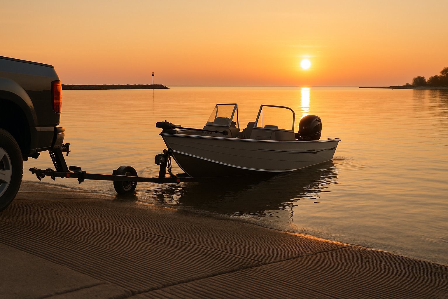
The harbor-town coast. Most Lake Michigan launches are inside protected channels that connect inland lakes (Pere Marquette Lake, Lake Macatawa, White Lake, Pentwater Lake) to the open big water. The charter fleet operates out of Ludington, Manistee, and Frankfort. Salmon and steelhead trolling defines summer here.
Betsie Bay protected basin into Lake Michigan. Strong salmon fishery off Point Betsie. Coho run especially heavy here.
Manistee Lake into Lake Michigan via the channel. Steelhead fishery in the connected Manistee River system. Tippy Dam tailwater fame upstream.
Round Lake and Lake Charlevoix into Lake Michigan via the channel. The Charlevoix drawbridge is a destination in itself. Trout and salmon offshore.
Little Traverse Bay. Open water fast; weather windows matter. Strong lake trout fishery in the spring.
Straits launch on the Lake Michigan side of the Mackinac Bridge. Heavy current, deep channel; respect freighter traffic in the shipping lane.
Pere Marquette Lake basin into Lake Michigan via the channel. Salmon and steelhead trolling fleet base. Large transient slip count.
Channel access to Lake Michigan and Muskegon Lake. Salmon trolling, perch, walleye depending on season.
Adjacent to the Grand River channel. Direct shot to Lake Michigan. High summer traffic with Coast Guard Festival activity.
On Lake Macatawa with channel access to Lake Michigan past Big Red Lighthouse. The state's busiest launch in summer.
Kalamazoo River channel into Lake Michigan. Summer congestion is significant; weekday mornings are the calm window.
Pentwater Lake channel access. Smaller fleet than Ludington; protected basin, easy launching on most wind directions.
White Lake into Lake Michigan via the channel. Old Channel Trail lighthouse landmark. Quieter than Muskegon or Grand Haven.
Black River channel. Charter fleet base. Salmon and steelhead fishery; perch and lake trout in shoulder seasons.
Southernmost Lake Michigan launch in the state. Galien River channel. Closest big-water ramp to northern Indiana and Chicago.
North side of the Straits. Closest UP launch to Mackinac Island. Walleye and salmon fisheries within trolling distance.
The most launch-dense Great Lakes coast in Michigan, anchored by Saginaw Bay. The bay offers protected launching even in conditions that would close the open Great Lakes. North of Tawas the launches get sparser but the water gets cleaner and the fishery shifts toward salmon and lake trout. The Thumb has more launches per capita than almost any other Michigan region.
At the river mouth where it enters Lake Huron. Inland Waterway access. Heavy summer traffic for the Cheboygan-to-Crooked-Lake trip.
Straits of Mackinac. The bridge looms over the ramp. Strong current and large freighters; not for inexperienced trailer captains.
Inside Tawas Bay, protected from open lake. Excellent for trailer boats targeting Tawas walleye fishery. Light congestion midweek.
On Thunder Bay. Direct shore access to the Thunder Bay National Marine Sanctuary shipwreck dive sites.
State harbor of refuge. Protected basin, easy load and unload, fuel and pump-out on site.
Direct access to inner Saginaw Bay. Shallow draft, slow speed zone out to the channel markers. Walleye fishery in spring and fall.
The unofficial walleye-tournament headquarters of Saginaw Bay. Heavy spring traffic. Long pier, dredged channel, ample trailer parking.
County park on the inner bay. Smaller crowds than Linwood, similar fishery access. Boat-only access to the bay shallows northeast.
East side of Saginaw Bay. Quiet, marshy, productive for duck hunting and bass. Ramp is shallow; high-water boats only on low pool.
Central launch in Caseville. Walleye access to the outer bay. Adjacent to county park beach, so summer congestion is real.
On the Saginaw River in north Bay City. Less wind-exposed than the open-bay ramps; useful when Saginaw Bay is rough.
East side of the Saginaw River near the bay mouth. Best wind protection of any Saginaw Bay launch on north-wind days.
At the tip of the Thumb. Direct shot to open Lake Huron. Turnip Rock kayak destination accessible from here.
The largest freshwater harbor of refuge on the Great Lakes by acreage. Open lake fishing, both shore and trolling.
Northernmost state harbor on the lower Lake Huron coast. Protected breakwater basin. Walleye, perch, and salmon depending on season.
State harbor of refuge on the open Lake Huron shore. Restored 1886 lighthouse adjacent to the basin.
Different rules apply. Most launches are inside protected bays (Munising, Grand Marais, Marquette Lower Harbor) and open Lake Superior is a different proposition once you clear the breakwater. Coast Guard advisories are not theoretical. Lake Superior weather can build from flat calm to small-craft advisory in under three hours.
On the Portage Waterway, which transits the Keweenaw Peninsula. Lift bridge to Houghton overhead. Protected from Lake Superior weather.
Top of the Keweenaw. Ferry to Isle Royale departs here. Big water once outside the harbor; lake trout and coaster brook trout offshore.
Inside Keweenaw Bay. Sheltered from open Lake Superior. Smelt run draws crowds in spring.
At the mouth of the Black River. The most western Michigan Lake Superior launch. Coaster brook trout and lake trout in the area.
Ontonagon River mouth. Direct Lake Superior access. Heavy current at the bar in spring runoff.
Cinder Pond on the Lower Harbor. Lake Superior salmon and lake trout. Cold-water boating; respect wave height from northeast.
Protected Munising Bay. The shortest boat run to the Pictured Rocks cliffs and Grand Island. Cruise ship traffic in summer.
Inside the protected bay. Open Lake Superior is a different animal once you clear the breakwater. Coho and king salmon offshore.
Concentrated in the Monroe County corner. The fishery is the western basin walleye, which is among the strongest freshwater walleye fisheries in North America. Tournament traffic and Ohio-side overflow mean Sterling fills early during the spring run.
Michigan's only Lake Erie state park launch. Direct access to the western basin walleye fishery. Heavy spring tournament traffic.
Protected harbor near Monroe. Western Lake Erie walleye and perch. Closer to the Detroit River outflow than Sterling.
Privately operated marina with public launch. Closest Michigan launch to the Maumee Bay walleye grounds.
Yes. Any state park boat launch requires a Recreation Passport on the vehicle registration of every vehicle entering the park. The annual passport is added to your license plate renewal for a small fee and covers all Michigan state parks, recreation areas, and state-operated boat launches statewide.
It depends on the operator. Most state DNR launches require a Recreation Passport. State Harbors of Refuge typically charge a daily launch fee separate from any passport. City and township launches range from free (Pinconning, North Park Bay City, Hancock Portage) to daily fees of $10-15 in higher-traffic harbor towns. County park launches vary widely.
A State Harbor of Refuge is a protected, dredged basin operated by the Michigan DNR Parks and Recreation Division, spaced along the Great Lakes coast so that recreational boaters can shelter from sudden weather. Most have full marina services in season, including transient slips, fuel, pump-out, and a launch ramp. Lexington, Port Sanilac, Harrisville, and Caseville are examples.
Linwood Beach Marina is the long-running tournament headquarters because of its proximity to the main bay walleye grounds, dredged channel, and trailer parking capacity. Bay City State Park and Pinconning Park are quieter alternatives with similar access. The east-side launches (Sebewaing, Bay Port, Caseville) are better when winds favor the eastern bay.
Yes, on both sides of the Straits of Mackinac. The Mackinaw City Public Launch is on Lake Huron just east of the bridge. The Wawatam Launch is on the Lake Michigan side of the bridge. St. Ignace Municipal is on the north side. All three are exposed to significant current and freighter traffic; new trailer boat captains should not launch their first season here.
Marquette's Lower Harbor (Cinder Pond), Munising Bay, and Grand Marais Harbor are the three with the most protection from open Lake Superior weather. Copper Harbor is the most remote and the gateway to Isle Royale. Black River Harbor at the far western end of the UP is a serious open-water launch in the right conditions.
Yes, but Michigan has only a short Lake Erie coastline. Sterling State Park is the primary launch and the closest to the famous western-basin walleye fishery. Bolles Harbor and Toledo Beach Marina (which is just over the line in some maps) are the other major options. Spring tournament traffic at Sterling can fill the parking lot by 6 a.m.