Skip to frozen Michigan places
Chris Izworski

Frozen Michigan / Winter field guide

Where Michigan becomes ice.

Sandstone cliffs draped in ice. Amber waterfalls edged with snow. Lake Michigan lighthouses disappearing into spray. Follow the formations, then discover where you can responsibly see them from land.

Explore the winter ice atlas

11 real destination experiences · archival photographs identified · access evidence reviewed October 27, 2026 · no live ice-safety claims

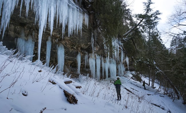
Tall blue and white ice curtains at Pictured Rocks inland cliffs in winter
Photo: National Park Service · NPS public-domain guidance · Archival winter view; not current formation evidence
Close view of Bond Falls winter ice and frozen spray
Photo: Stefan.Anderson · CC BY-SA 4.0 · display crop · Bond Falls, January 2015
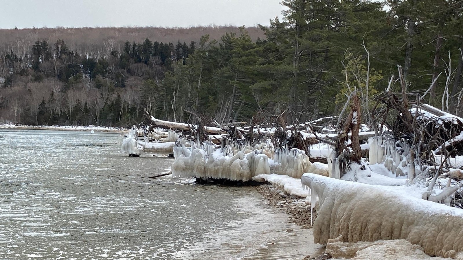
Ice encrusted driftwood at Sand Point beach on Lake Superior
Photo: National Park Service · NPS public-domain guidance · Archival shore view; not this winter
01 · Ice curtainsWhere sandstone weeps and water freezes
02 · Frozen waterfallsFlowing water, river mist and rim ice
03 · Shoreline sculpturesSpray and wave ice, safely viewed on land

Important park closure · source checked Oct 27, 2026

Munising Falls Trail is closed until further notice.

NPS reports an April 2025 washout and continues to list the trail as closed. Its September 2026 repair announcement estimates completion by late 2027, weather permitting. Do not plan Munising Falls as an accessible winter waterfall stop. Research Sand Point's separate ice-curtain viewing area instead, subject to park notices. Read the NPS repair announcement ↗

Check the official closure ↗

Understanding winter landscapes

Three very different kinds of ice

Use this field lens to understand why the formations are worth visiting. This is an explanation of physical processes, not a prediction of what's formed today.

FORMATION 01 · SEEPAGE

A curtain built drop by drop

Groundwater escapes through porous sandstone. Cold air freezes falling droplets into vertical veils and pillars that can change quickly in a thaw.

Ice can detach from the cliff; view it from a stable, authorized approach.

The ice atlas

Choose your frozen Michigan.

Browse real locations by formation, Michigan region and access evidence. “Documented” means an official seasonal approach exists, not that it's currently safe or open.

11 researched field notes, with explicit official sources and arrival limitations.

Tall blue and white ice curtains at Pictured Rocks inland cliffs in winter
Photo: National Park Service · NPS public-domain guidance · Archival winter view; not current formation evidence

Munising · Pictured Rocks · moderate

Sand Point ice curtains

Documented seasonal route · not a current-open report

Walk from the plowed Sand Point Beach lot to the inland sandstone escarpment, where groundwater builds columns and curtains.

NPS reports formations typically build from mid-December into early April; actual size and stability vary by winter.

The approachPark at Sand Point Beach, walk back along Sand Point Road about ¼–½ mile, then follow NPS ice-viewing signs uphill.

Important: Roadside parking on Sand Point Road is prohibited. It has no shoulder; traction cleats are important. No pets at the ice formations.

Ice encrusted driftwood at Sand Point beach on Lake Superior
Photo: National Park Service · NPS public-domain guidance · Archival shore view; not this winter

Munising · Lake Superior · easy

Sand Point's ice-sculpted shore

Documented seasonal route · not a current-open report

Lake spray slowly layers ice onto driftwood and beach debris while the view across Munising Bay changes daily.

NPS identifies this as the only park beach area easily reached by ordinary vehicle in winter.

The approachUse the main Sand Point Beach or road-end parking areas; view ice-covered driftwood from dry shore.

Important: Never enter lake ice or ice shelves. Deep snow, exposed wind, and slippery surfaces can make even a short walk demanding.

Sand Point viewpoint · Munising Bay · easy

Grand Island curtains, from shore

Documented seasonal route · not a current-open report

A distant glimpse of Grand Island's ice formations is possible across Munising Bay when visibility and ice development cooperate.

NPS recommends binoculars from Sand Point Beach rather than attempting any frozen-bay crossing.

The approachUse the Sand Point road-end public beach and bring binoculars or a telephoto lens.

Important: Do not walk across Munising Bay or Lake Superior ice. This marker is the safe-side viewing area, not Grand Island itself.

Ice columns at Eben Ice Caves photographed in March 2012
Photo: ThePenultimateOne · CC BY-SA 4.0 · display crop · Eben Ice Caves, March 2012

Rock River Canyon · Alger County · demanding

Eben Ice Caves

Verify winter arrival · not a current-open report

A sandstone alcove fills with hanging sheets of ice, reached through a snowy farm-field approach and a steeper forest trail.

Michigan's tourism guide describes a roughly 0.75-mile approach from the seasonal Frey Road access, including permissive private land.

The approachRead the current local access directions before traveling; confirm private-land permission, winter parking, and ice-route conditions.

Important: Do not assume access rights, cleared roads or available parking from an old guide. Icefalls and cliff-base terrain are hazardous.

Upper Tahquamenon Falls with winter snow and river ice in January 2004
Photo: James Phelps · CC BY 2.0 · display crop · Upper Falls, January 2004

Paradise · Eastern Upper Peninsula · moderate

Upper Tahquamenon Falls

Documented seasonal route · not a current-open report

Wide amber falls spill through snow-covered forest, while rim ice and winter mist transform the views from official overlooks.

Michigan DNR documents Upper Falls viewing platforms and marked park snowshoe routes in winter.

The approachUse the Upper Falls day-use entrance and official viewing paths, checking the day's winter snow and trail condition.

Important: Never descend closed steps or approach icy riverbanks. An accessible summer pathway is not a winter-surface guarantee.

Lower Tahquamenon Falls cascades surrounded by leafy forest in August 2020, not a winter conditions photograph
Photo: Joe Passe · CC BY-SA 2.0 · display crop · Actual Lower Falls · August 2020 · summer reference, not winter conditions

Paradise · Tahquamenon State Park · moderate

Lower Tahquamenon Falls

Documented seasonal route · not a current-open report

A group of smaller cascades around a river island makes a more intimate winter contrast to the huge Upper Falls.

The DNR publishes a dedicated Lower Falls winter trail map with viewing areas, parking and a marked plowed walking trail.

The approachStart from the DNR winter-map parking or the year-round Hemlock campground access, and plan for approximately a mile on the designated winter walking or snowshoe approach rather than assuming summer lot access.

Important: The Lower Falls summer parking loop may be closed to vehicles; confirm plowed parking and the winter route with the park. The connecting trail to Upper Falls is not maintained in winter; do not assume the island bridge is clear.

Munising · Wagner Falls Scenic Site · moderate

Wagner Falls' winter cascade

Verify winter arrival · not a current-open report

A short forest walk leads toward delicate tiers of water and ice over the layered rock of Wagner Creek.

Michigan DNR documents a 0.1-mile packed-gravel trail and boardwalk to a viewing platform.

The approachConfirm the small M-94 parking area is available and the boardwalk can be approached in winter before going.

Important: Winter plowing and traction maintenance are not verified by the DNR destination description; don't block M-94.

Close view of Bond Falls winter ice and frozen spray
Photo: Stefan.Anderson · CC BY-SA 4.0 · display crop · Bond Falls, January 2015

Paulding · Ontonagon County · demanding

Bond Falls in ice

Limited vehicle access · not a current-open report

Bond Falls breaks into many small cascades, some fringed with winter spray ice and snow-covered rock.

DNR describes six viewing locations, but says ordinary vehicle access is generally mid-May through mid-October.

The approachTreat this as an advanced winter-access research destination. Determine legal approaches before starting; don't drive the seasonal site road.

Important: The trail is nominally year-round but not groomed or monitored in ice and snow. Do not assume the boardwalk is accessible.

Presque Isle County · northern Lower Peninsula · moderate

Ocqueoc Falls in a deep freeze

Verify winter arrival · not a current-open report

Northern Lower Michigan has its own winter cascade story at Ocqueoc Falls, with a short trail from a designated access area.

DNR describes a paved route and public viewpoint, but the neighboring campground's seasonal dates do not establish winter plowing.

The approachCheck the DNR facility notice and local road conditions; use the designated waterfall access only if it is open.

Important: Campground facilities are seasonally closed. Avoid confusing a summer-accessible trail with a cleared winter trail.

Red Grand Haven lighthouse and winter ice on the Lake Michigan waterfront
Photo: Wayne Silver · CC BY 2.0 · display crop · Grand Haven, December 2008

Grand Haven State Park · Lake Michigan · easy

Grand Haven's winter lighthouse

Verify winter arrival · not a current-open report

The red lighthouses stand against windblown lake ice and wave spray, a changing shore scene rather than an ice crossing.

The DNR identifies the state park beach as a viewpoint of both Grand Haven lights; the city warns about pier ice and waves.

The approachChoose authorized land-based viewpoints at Grand Haven State Park, staying off pier surfaces during icy weather.

Important: Do not enter piers or shoreline ice shelves to frame a photograph. Check posted closures, wind and wave warnings.

St Joseph Michigan lighthouse and pier during a Lake Michigan winter storm in December 2005
Photo: Myron Reynard · CC BY-SA 2.0 · display crop · St. Joseph winter storm · December 2005 · not today's conditions

St. Joseph · southwest Lake Michigan · easy

St. Joseph's frozen pier lights

Verify winter arrival · not a current-open report

When waves freeze around the navigation lights, the historic piers become towering ice sculptures viewed from the lakeshore.

Regional tourism recommends views from Silver Beach or Tiscornia Park; Berrien County warns visitors to avoid the South Pier in ice.

The approachUse shoreward park overlooks, check park winter parking, and keep a large margin from any wave-washed edge.

Important: Never walk the icy pier. Ice-coated handrails and frozen spray are not safe travel surfaces.

The non-negotiable field rule

Look at the ice. Never trust it as a route.

NOAA lake-ice coverage is not ice thickness. A beautiful frozen waterfall is not a stable climbing surface. Piers, shore shelves and riverbanks can fail suddenly. Choose legitimate land viewpoints, verify actual parking and closures, dress for wind and lake-effect snowfall, and never enter frozen lake or river water because this guide shows ice.

Michigan DNR ice safety ↗ · Pictured Rocks winter regulations ↗ · Michigan DNR closures ↗