Seep-fed curtains
Eben Ice Caves
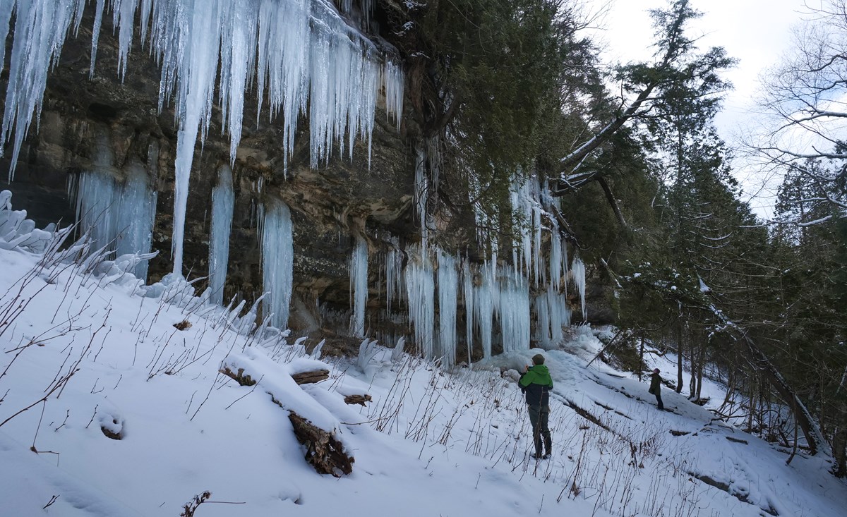
Water finds its way through sandstone, then winter slowly builds a wall of ice.
Formation not currently confirmed
Explore the evidence →Michigan field guide / winter 2026–27
Ice takes time. Make the drive for the right experience.
Explore five winter places, the cold building behind them, and the evidence still needed before an ice-formation trip.
Weather is a clue. A dated site report is confirmation.
Start here
2026–27 tracking begins November 1. Formation and current access require official checks.
Rock River Canyon Wilderness · inland curtains
Formation and access need current official checks. The 2026–27 cold record starts November 1; weather alone cannot confirm a curtain.
A dedicated ice-formation trip is not currently confirmed. Check official sources before committing to the drive.
NWS forecast context is added when a current grid is received.
Open the official point forecast ↗
Choose your date to check whether the NWS outlook covers your visit. A forecast is not a report of ice.
Check a road route and travel time ↗
Choose a starting city for trip context. No live or verified road-time estimate is claimed; use the official arrival information to plan your route.
The cold behind the scene
The 2026–27 cold record starts November 1. A curve appears only after validated observations arrive. Last winter is dated reference data, never today’s formation status.
| Date | High / low °F | Cold °F·days | Thaw °F·days |
|---|
Select up to three places. Access and dated reports matter more than the largest number.
Read the landscape
These “caves” are seasonal walls of ice beneath a ledge. Follow the ingredients; the drawing is an explanation, not today’s ice.
Groundwater and snowmelt can seep through sandstone and emerge at a ledge. A cold forecast alone cannot tell us how much water is arriving.
A river waterfall is different: flowing water, spray and the heat it carries may keep part of the falls open.
Water: the seep supplies liquid. Cold: sustained freezing can add layers. Thaw: warmth can weaken ice, while colder weather later does not prove a fallen curtain has rebuilt.
Choose your kind of winter
Seep-fed curtains
Water finds its way through sandstone, then winter slowly builds a wall of ice.
Formation not currently confirmed
Explore the evidence →Mainland ice curtains
A close look at the winter curtains growing on the mainland sandstone escarpment.
Formation not currently confirmed
Explore the evidence →Mainland shore viewing
Bring binoculars. This plan keeps your feet on the mainland.
Formation not currently confirmed
Explore the evidence →Winter waterfall
A small woodland cascade, best treated as a short stop on a Munising winter trip.
Formation not currently confirmed
Explore the evidence →Ice-framed flowing water
Listen for the river beneath winter’s frame. A complete freeze is not the goal.
Formation not currently confirmed
Explore the evidence →NPS still lists the trail as closed after April 2025 storm damage. Normal winter plowing does not reopen the falls approach.
Official reference ↗Checked 2026-10-19. A closure persists until an explicit official reopening.
The roadside attraction is documented, but land permission and legal, maintained winter stopping have not been established. No dedicated trip page or directions are offered.
Official reference ↗Checked 2026-10-19. A closure persists until an explicit official reopening.
Freezing-degree-days add the daily difference below 32°F from observed maximum/minimum temperatures. A thaw is shown separately. These are weather measurements and calculations, not a measurement of a curtain’s size or stability. No validated formation threshold is plotted.
The season curve requires complete daily history. Missing observations stay visible as gaps; an incomplete seasonal total is withheld. A model is never presented as a ranger report. Current official site reports and reviewed access are required before a place can be featured as prime viewing.
ACIS station climate records · NWS weather data · NPS ice-viewing map & safety
A current site-specific official report is needed to confirm formation. Accumulated cold and forecasts describe weather, not the actual curtain. Before November 1, the new season’s cold counter has not started.
This planner recommends mainland viewing from Sand Point only. Stay off the lake ice: shifting currents, thin ice and hidden open water make cold totals and lake-wide percentages unsuitable for judging a crossing.
This tool does not predict a complete freeze. Ice and snow can frame a still-flowing waterfall; plan around open designated overlooks.
As checked October 19, 2026, NPS still lists the Munising Falls trail as closed until further notice after storm damage. Check the linked official page for an explicit reopening.