A practical guide to canoeing the Manistee, Michigan's quieter alternative to the Au Sable.
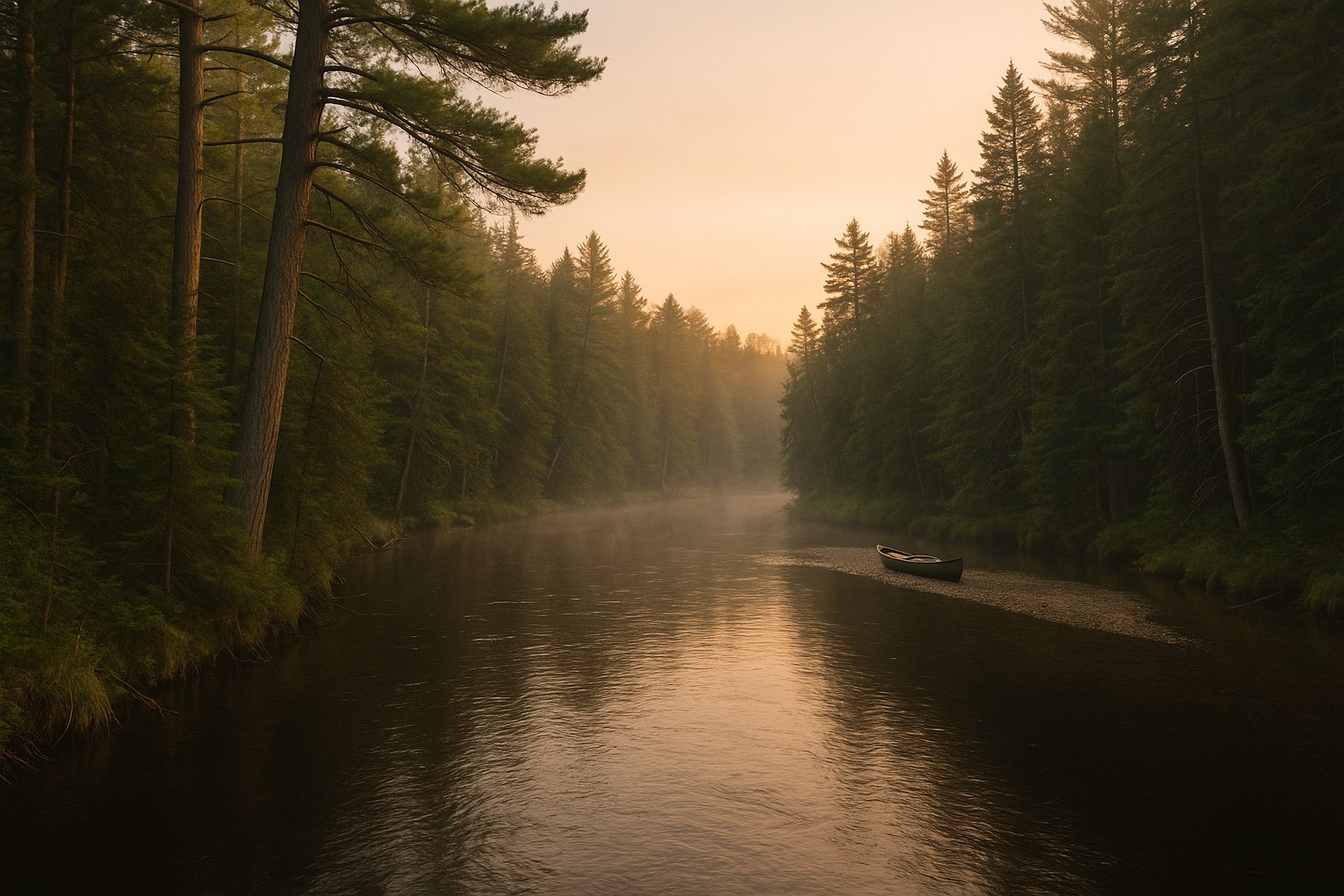
The Manistee River below CCC Bridge at dawn. The Manistee is the quieter, less-storied alternative to the Au Sable, with a federally designated Wild and Scenic stretch and a longer end-to-end run.
The Manistee runs roughly 230 miles from its headwaters in the Mackinaw State Forest near Walton to Lake Michigan at Manistee. It is one of two federally designated National Wild and Scenic Rivers in Michigan and runs largely through Huron-Manistee National Forest land in its middle and lower sections. For paddlers, the operative stretches are the upper river above Tippy Dam (where trip-planning conversations begin and end) and the unique reservoir-paddle through Tippy and Hodenpyl impoundments.
The Manistee gets compared to the Au Sable constantly, almost always to the Au Sable's advantage in fame and to the Manistee's advantage in solitude. The two rivers are different waters with different character. The Au Sable is famous, faster-flowing in the Holy Waters, with heavy summer livery traffic. The Manistee is quieter, with longer sections of unbroken forest banks and lower per-mile boat density. Both are good. The Manistee is the better choice for the paddler who wants the Wild-and-Scenic experience without the social density.
This page covers the river by section, in the order most paddlers approach it.
The Sections
Headwaters to CCC Bridge
The upper Manistee above the M-72 crossing is small, technical, and rarely paddled by liveries. Class I-II with significant strainer risk. Suitable for experienced paddlers with a willingness to portage and to expect surprises. Most livery trips start lower.
CCC Bridge to Sharon
The popular livery starting stretch. CCC Bridge (Sharon Bridge) is a major put-in. Current is moderate, clean trout-stream water, dense cedar canopy. Roughly 13-15 miles to the Sharon access. A full-day livery float or a relaxed overnight in good water.
Sharon to Yellow Trees
The Wild and Scenic core. This stretch is on national forest land with primitive river-camping sites, some marked, others informal. The current is steady, the water is clear, and the river feels remote. Strong brown trout fishery throughout. This is the section most paddlers cite when they say the Manistee is the best river in Michigan.
Yellow Trees to Red Bridge / Hodenpyl Pond
The lower of the upper-river sections, ending where the river enters Hodenpyl Pond (a dam impoundment). The river slows in the last few miles as it approaches the reservoir. Paddling Hodenpyl is a different exercise: flat water, motorboat traffic, and a long take-out at the upper end of the dam. Most paddlers take out at Red Bridge to avoid the reservoir paddle.
Tippy Dam Tailwater
Below Tippy Dam, the Manistee becomes salmon and steelhead water, not paddling water. The lower river is wadeable and fishable but the combination of strong dam-controlled current, year-round high boat traffic in fall steelhead season, and limited put-ins makes it a poor choice for canoes.
Liveries and Outfitters
Two liveries dominate the Manistee. Pine Creek Lodge runs the CCC Bridge stretch and offers shuttle for paddlers with their own boats. Schmidt Outfitters operates lower on the river and is a useful resource for the Wild and Scenic stretches. Both have decades of operation on the river and are reliable sources for current water-level information.
Water Levels
USGS gauge 04124000 (Manistee River near Wellston) is the gauge to watch. Median May-September flow runs roughly 600-900 cfs. Anything above 1,200 cfs makes the upper river fast and pushy; anything below 500 cfs starts to expose gravel bars and slow the trip. The river is dam-controlled below Tippy and natural above, which means upper-river flows respond to rainfall on a 12-24 hour lag while lower-river flows respond to dam-release decisions.
Common Questions
How long is a Manistee River day trip?
Most livery day trips run 10-15 miles on the CCC Bridge to Sharon section, taking 4-6 hours at relaxed pace. Shorter half-day trips of 6-8 miles are common on the upper stretch. The Wild and Scenic section requires camping for a true through-paddle and runs 25-30 miles depending on take-out choice.
Where can I camp on the Manistee?
On the Huron-Manistee National Forest section (Sharon to Hodenpyl), dispersed camping is allowed along the river with some restrictions: stay 100 feet from the water, no camping immediately at access points, and pack everything out. A few designated rustic sites exist. Above and below the national forest section, camping requires private permission or campground stays.
Is the Manistee River dangerous?
Not at typical flows. The river is rated Class I throughout the popular sections. The main hazards are strainers (downed trees), which are common after winter and spring storms, and low-head dams at Tippy and Hodenpyl, which are absolutely dangerous and require portage well above the dams. Take-out before either reservoir if your trip is a paddle, not a flatwater push.
Can you paddle the Manistee in winter?
Yes, in a dry suit, with experience. The river does not freeze through in most sections because of constant spring inflows. Winter paddling on the Manistee is a niche but real activity, mostly by waterfowlers and experienced cold-water paddlers. Most paddlers wait for April.
What is the difference between the Manistee and the Au Sable?
Both are National Wild and Scenic. The Au Sable runs faster in its Holy Waters section, has heavier livery traffic, a deeper trout-fishing culture, and more developed shoreline (houses and lodges in the upper stretches). The Manistee is quieter, has more national forest land along the banks, and feels more remote despite being a similar drive from southern Michigan.