Great Lakes Highway Cartography Series • 3,288 Shoreline Miles

M-22, M-28 & The Tunnel of Trees: Michigan’s Coastal Drives Field Guide

A cartographic and milepost-by-milepost driver's dossier across Michigan’s twelve most iconic coastal highway corridors. Featuring precise turnout azimuths, historic smoked-fish docks, beacon waypoints, strict RV axle & width constraints, and our regional 4-wave fall foliage timing engine.

Curated Corridors 12 Iconic Drives
Total Survey Mileage 1,130 Miles Paved
Narrowest Pavement 16 ft (M-119 Trees)
Peak Foliage Window Sep 24 – Oct 22 (4 Waves)
Authority Baseline MDOT & NOAA Nautical
🍁

Coastal Fall Color Engine & Regional Timing Waves

Fall Color Engine: Active Feed Synchronized

Great Lakes coastal foliage does not turn at once. Lake Superior’s 1,200-foot volcanic escarpments turn scarlet in late September, while Lake Michigan’s 60°F thermal water buffer protects Leelanau and Old Mission orchards well into late October. Select any wave below to isolate the highway corridors peaking in that specific calendar window:

Wave 1: High Escarpment Peak
Sep 24 – Oct 4
M-107 Porkies, M-26 Brockway Mountain, M-64 Black River Harbor
Wave 2: Superior Heartland & Dunes
Sep 28 – Oct 8
M-28 Seney Stretch, M-123 Tahquamenon, M-134 Les Cheneaux
Wave 3: Northern Straits & Bluffs
Oct 5 – Oct 15
M-119 Tunnel of Trees, US-2 Top of the Lake, US-23 Sunrise Byway
Wave 4: Lower Dunes & Peninsulas
Oct 8 – Oct 22
M-22 Leelanau, M-37 Old Mission Peninsula, US-31 Grand Traverse
Cartographer Rule of Thumb: High elevation + high latitude turns first (Porkies 1,400 ft). Deep open water buffers frost (M-22 coastline turns 12 days later than Grayling). Connected Tool: Michigan Fall Color Report →

Great Lakes Coastal Road Trip Map

Click any highway shield to view milepost stats, scenic turnout azimuths, and scroll to its field dossier.

CARTO Voyager Marine Basemap
Filter Corridors:
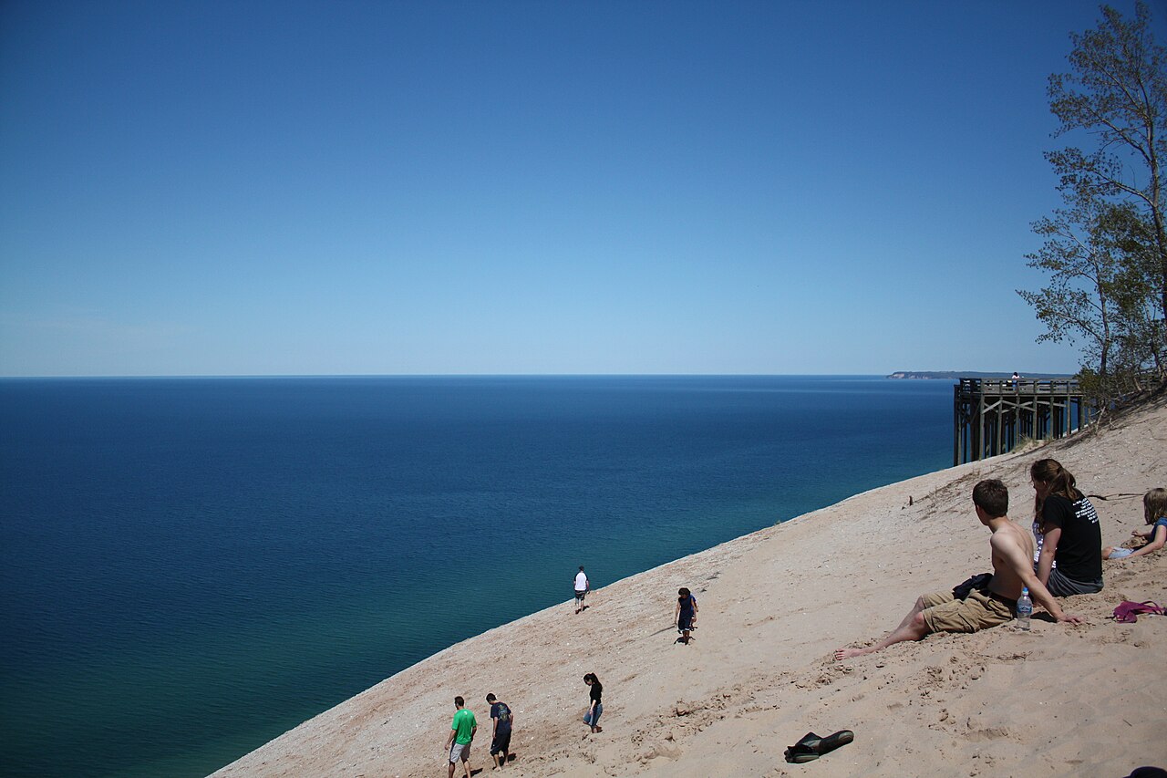
Dune Overlook view across Sleeping Bear Dunes National Lakeshore and Lake Michigan bluffs along M-22
M-22 Foliage Peak: Oct 8 – Oct 18 (Wave 4)
📍 Stretch: Manistee to Traverse City (116 Miles) 🌊 Waterway: Lake Michigan & Manitou Passage 🍁 Canopy: Sugar Maple, Beech, Oak & Vineyard Canopies

M-22: The Leelanau Peninsula & Sleeping Bear Dunes Scenic Byway

The quintessential Lake Michigan dune-and-orchard coastline tracing ancient glacial moraines.

M-22 is Michigan's most celebrated coastal state highway, hugging 116 miles of northern Lake Michigan shoreline around the horn of the Leelanau Peninsula. From the rolling orchards of Arcadia and Frankfort, past the 450-foot perched sand dunes of Sleeping Bear, to historic Leland Fishtown and Northport Point, the highway delivers a continuous sequence of cobalt-blue open water and deep hardwood forest. The microclimate created by Lake Michigan buffers autumn air temperatures, delaying frost and prolonging vibrant scarlet and burnt-gold foliage nearly two weeks later than inland Wexford and Kalkaska counties.

Asphalt & Lane Profile 2-Lane Asphalt (24 ft width), 2–4 ft paved shoulders
Elevation Gradient Lake level (577 ft) to Arcadia Crest (950 ft, 8% grades)
Lake-Effect Thermal Buffer +4°F to +7°F maritime cushion; fog common in spring mornings
Fuel & Waypoint Hubs Onekama, Frankfort, Empire, Glen Arbor, Leland, Suttons Bay
Milepost-by-Milepost Pull-Off Planner Northbound Survey
  • MP 23.4
    Scenic Turnout Arcadia Overlook ("Inspiration Point"): 120-step wooden staircase ascends 370 feet above Lake Michigan with an azimuth facing 285° true northwest toward the Manitou Islands.
  • MP 41.2
    Lighthouse Detour Point Betsie Light Station: 1.5-mile spur west on Point Betsie Rd. Historic 1858 masonry tower guarding the treacherous southern mouth of the Manitou Passage.
  • MP 58.7
    Scenic Turnout Pierce Stocking Scenic Drive (Dune Overlook): 7.4-mile loop within Sleeping Bear Dunes National Lakeshore. Stop 9 delivers a vertical 450-foot sand wall descending directly into turquoise water.
  • MP 71.3
    Bakery & Smoked Fish Carlson's Fishery & Fishtown Shanties (Leland): 5th-generation commercial fishing docks smoking fresh Lake Michigan whitefish, lake trout, and salmon sausage over real hardwood embers.
  • MP 98.6
    Lighthouse Detour Grand Traverse Light Station (Leelanau State Park): 1858 brick tower marking the navigational confluence where Lake Michigan enters Grand Traverse Bay.
⚠️ RV & Travel Trailer Cartographic Warning: M-22 is fully paved and drivable for Class A coaches, but requires defensive driving through downtown Glen Arbor and Leland, where parked cars and heavy pedestrian crossings create a 19-foot effective roadway. Long travel trailers should avoid narrow county side-cutoffs and manage brake heat down the 8% switchbacks descending from Arcadia Overlook into Frankfort.
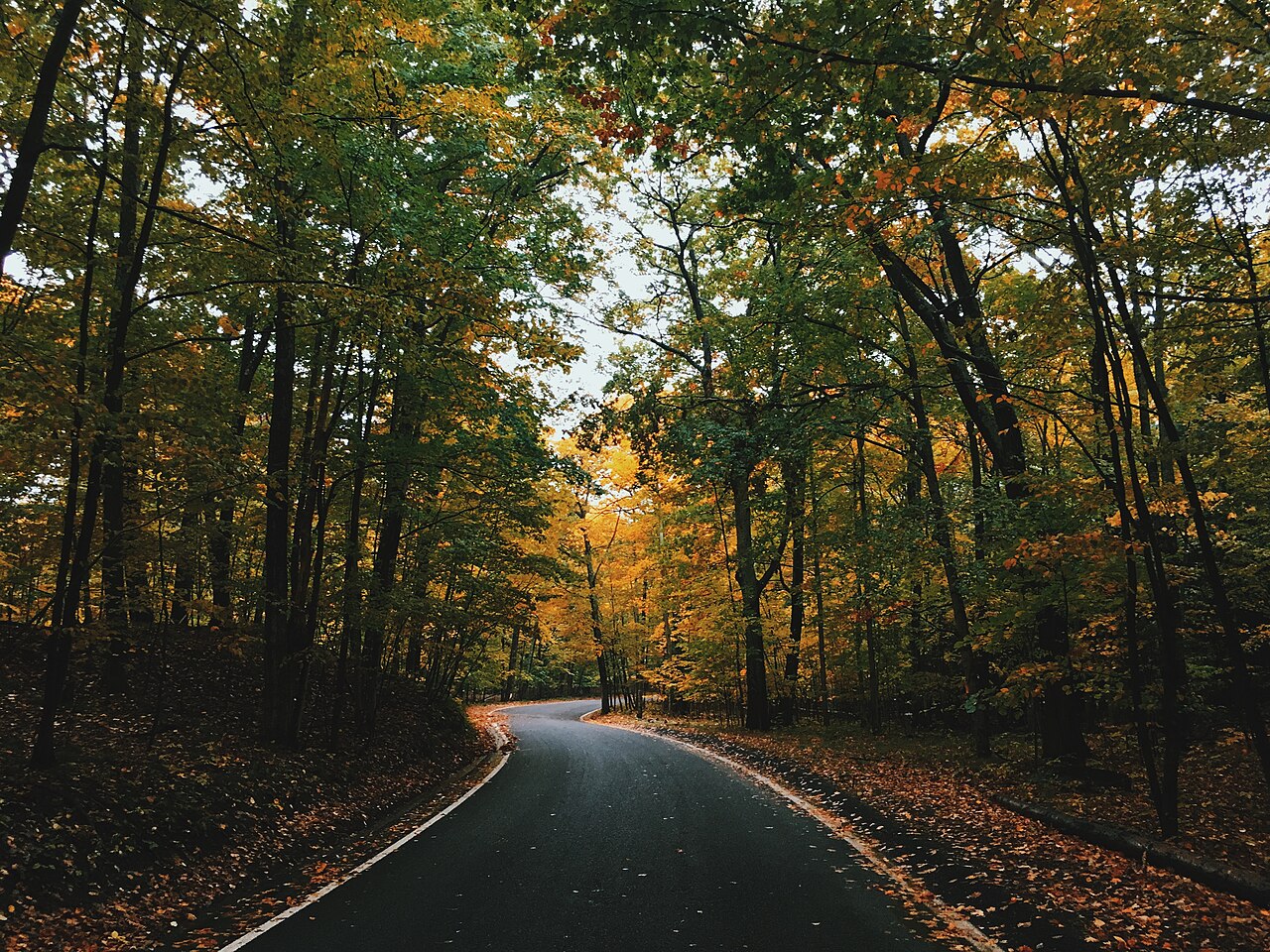
Sweeping autumn curve on M-119 Tunnel of Trees framed by towering golden-amber hardwood canopy and fallen leaves
M-119 Foliage Peak: Oct 5 – Oct 15 (Wave 3)
📍 Stretch: Harbor Springs to Cross Village (27.5 Miles) 🌊 Waterway: Little Traverse Bay & Northern Lake Michigan 🍁 Canopy: Sugar Maple, Yellow Birch, Hemlock, Red Oak

M-119: The Tunnel of Trees & Lake Michigan Bluffs

An ancient Odawa shoreline foot trail preserved as America’s narrowest, most dramatic canopy highway.

Beginning just north of Harbor Springs, M-119 transforms from a suburban two-lane into a legendary 27.5-mile single-lane feel corridor carved along the high sand-and-limestone bluffs of Lake Michigan. There is no painted centerline stripe, shoulders are nonexistent, and the towering hardwood branches interlock 30 feet overhead to create a continuous cathedral canopy. During early October, driving this route feels like moving through a glowing stained-glass tunnel of burning orange, deep amber, and yellow birch leaves, punctuated by startling vistas of Lake Michigan’s cobalt horizon far below.

Asphalt & Lane Profile 16–18 ft asphalt width, ZERO shoulders, no centerline stripe
Elevation Gradient Bluffline trace, 100 to 220 ft sheer drops toward lake
Lake-Effect Thermal Buffer Heavy canopy traps maritime humidity; evening frost delayed
Fuel & Waypoint Hubs Harbor Springs (south), Good Hart (mid), Cross Village (north)
Milepost-by-Milepost Pull-Off Planner Northbound Survey
  • MP 4.2
    Scenic Turnout Birchwood Bluff Vista: Small gravel shoulder turnout offering an elevated southwest morning perspective over Little Traverse Bay toward Petoskey’s Gaslight District.
  • MP 13.8
    Warning Milepost Devil’s Elbow Hairpin & Horseshoe Curve: Severe blind 15 mph ravine curve nestled in deep old-growth hemlocks. Local Odawa lore recounts spirits in the ravine; sound your horn lightly if blind.
  • MP 16.5
    Bakery & Smoked Fish Good Hart General Store: Operating continuously since 1874. Celebrated for fresh hot chicken pot pies, artisan cherry cookies, and local smoked trout in a wood-planked interior.
  • MP 20.1
    Scenic Turnout Middle Village & St. Ignatius Overlook: Historic timber Odawa mission church (1889) and cemetery on high sand bluffs; a steep wooden stairway leads down to a secluded driftwood beach.
  • MP 27.5
    Bakery & Smoked Fish Legs Inn at Cross Village (Northern Terminus): Landmark stone and driftwood architectural wonder built by Polish immigrant Stanley Smolak. Famous for whitefish livers, pierogi, and cliffside beer garden views facing west.
⚠️ CRITICAL ROADWAY RESTRICTION: No RVs or Travel Trailers: The Emmet County Road Commission and Michigan State Police strongly advise against motorhomes, travel trailers, campers, and wide dual-rear-wheel trucks on M-119. Pavement is narrower than two modern pickup widths combined in spots, overhanging tree trunks clip RV rooflines, and there are zero pull-offs or turnarounds between Harbor Springs and Cross Village. RVs should take Pleasantview Road (County Rd 31) north to Cross Village instead.
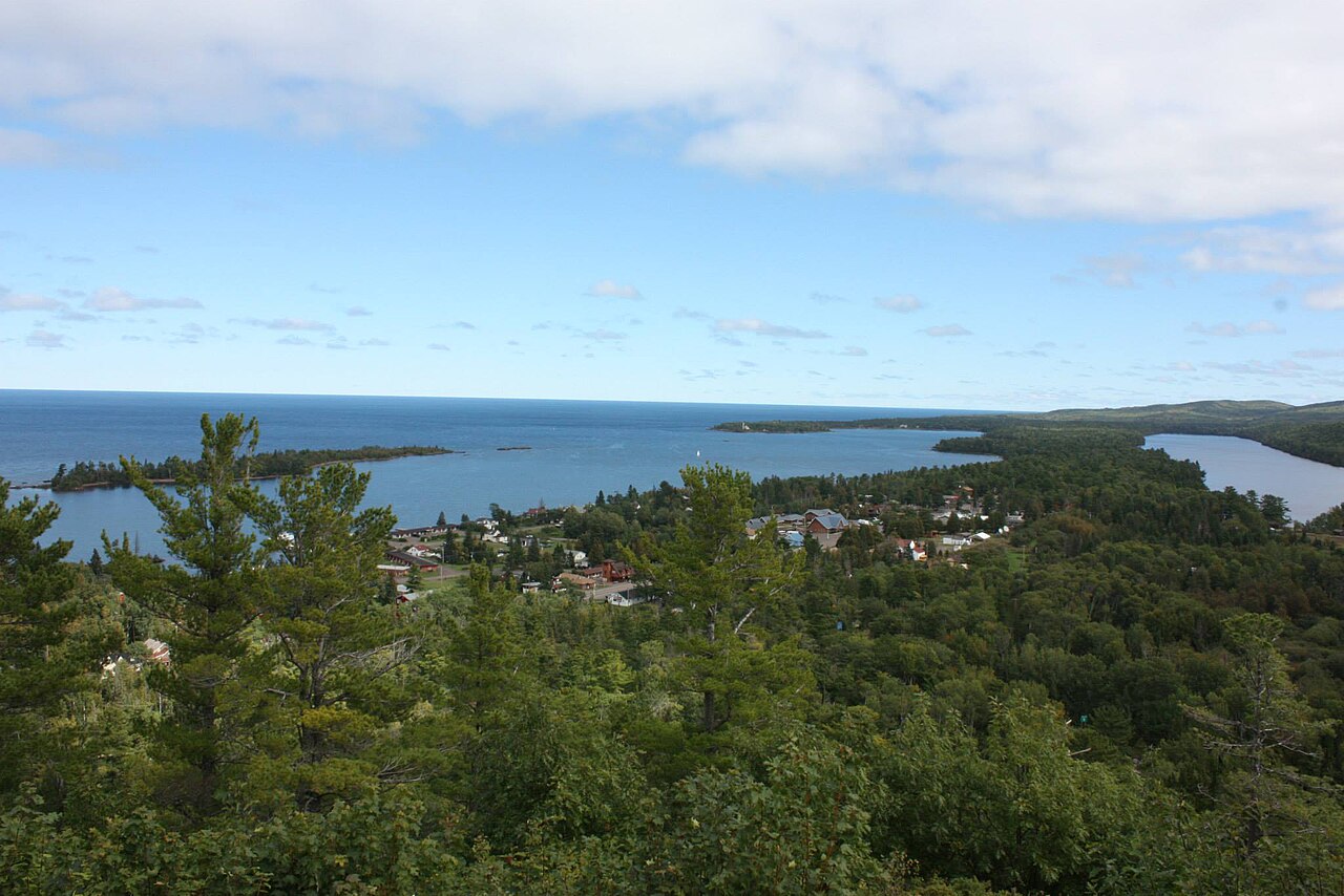
Dramatic cliffside overlook from Brockway Mountain Drive 735 feet above Copper Harbor and vast Lake Superior horizon
M-26 / Brockway Foliage Peak: Sep 26 – Oct 6 (Wave 1)
📍 Stretch: Eagle River to Copper Harbor (58 Miles + 9.5-Mile Ridge) 🌊 Waterway: Lake Superior & Keweenaw Continental Ledge 🍁 Canopy: Boreal Red Maple, Birch, Tamarack, Mountain Ash

M-26 & Brockway Mountain Drive: The Keweenaw Copper Country Trail

A billion-year-old volcanic basalt ridge rising 720 feet directly over Lake Superior's open waves.

Threading the spine of the Keweenaw Peninsula, M-26 follows an ancient volcanic shoreline of conglomerate rock shelves, roaring waterfalls, and historic 19th-century copper harbors. Between Eagle River and Copper Harbor, drivers face an unforgettable cartographic fork: continue on sea-level M-26 through the wild pebble coves of Silver River, or climb the dizzying 9.5-mile crest of Brockway Mountain Drive. Rising to 1,320 feet above sea level (720 feet above Lake Superior), Brockway is the highest paved scenic highway between the Alleghenies and the Black Hills, commanding 360-degree views across Lake Superior to the faint outline of Isle Royale.

Asphalt & Lane Profile M-26: 22 ft paved with basalt shoulders; Brockway: narrow 18 ft ridge asphalt
Elevation Gradient 601 ft at Superior shore to 1,320 ft at Brockway Summit (15% grade)
Lake-Effect Thermal Buffer Ridge catches first arctic cold fronts; earliest autumn color in Michigan
Fuel & Waypoint Hubs Houghton/Hancock, Calumet, Eagle River, Copper Harbor
Milepost-by-Milepost Pull-Off Planner Northbound Survey
  • MP 12.3
    Scenic Turnout Eagle River Falls & Historic 1915 Bridge: 60-foot cataract cascading over volcanic basalt shelves right under the historic wooden-deck pedestrian bridge.
  • MP 16.8
    Bakery & Smoked Fish The Jampot (Poorrock Abbey Monks): Byzantine Catholic monks producing legendary wild thimbleberry jam, maple-pecan muffins, fruitcakes, and chocolates in a cedar shanty beside Jacob's Falls.
  • MP 22.4
    Lighthouse Detour Eagle Harbor Light Station (1871): Octagonal red-brick lighthouse and museum complex guarding the rock-rimmed refuge harbor of the Keweenaw.
  • MP 33.1
    Warning Milepost Brockway Mountain Drive West Portal: Steep 15% winding climb up the conglomerate basalt bluff. High crosswinds and steep unguarded drops to the south valley.
  • MP 38.6
    Scenic Turnout Brockway Mountain Summit Crest (720 ft): 360-degree panoramic turnouts facing Lake Superior to the north and the carpeted inland valley of Lake Fanny Hooe to the south.
⚠️ CRITICAL WARNING: Brockway Mountain Prohibited for Large RVs: Brockway Mountain Drive has steep 15% gradients, narrow asphalt with crumbly gravel edges, unguarded cliff drop-offs, and zero space for turning a trailer around at the summit parking apron. All fifth-wheels, travel trailers, and motorhomes over 25 feet must remain on shoreline M-26 through Silver River into Copper Harbor.
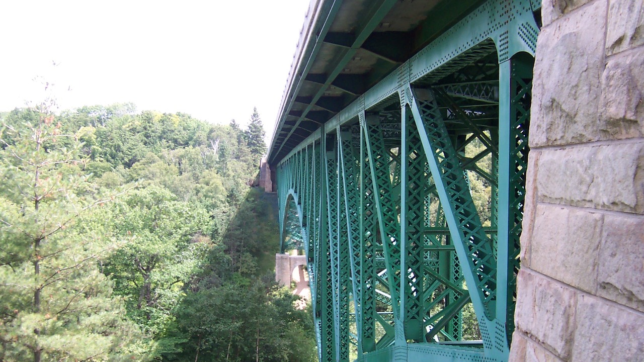
Cut River Bridge cantilever arch span and roadway crossing deep forested gorge along US-2 Top of the Lake Scenic Byway
US-2 Foliage Peak: Oct 1 – Oct 10 (Wave 3)
📍 Stretch: St. Ignace to Manistique & Escanaba (143 Miles) 🌊 Waterway: Northern Lake Michigan Dune Coast 🍁 Canopy: Paper Birch, Trembling Aspen, Red Pine, Cedar

US-2: Top of the Lake Scenic Byway

A high-speed maritime corridor tracing white silica dunes, cantilever bridges, and limestone bays.

Spanning the entire northern arc of Lake Michigan from the Mackinac Bridge westward, US-2 is one of the grandest open-water road trips in North America. For miles at a time between Epoufette, Naubinway, and Manistique, the highway runs within twenty yards of the surf line, separated only by low grass-covered sand dunes and stunted jack pines. The wide asphalt tangents offer unbroken maritime vistas where Great Lakes freighters steam along the horizon, while side turnouts lead to secret sandy beaches, historic ghost towns, and cantilever bridges suspended high over autumn-colored gorges.

Asphalt & Lane Profile 2-to-4 Lane Federal Highway (24–48 ft), 8 ft wide paved shoulders
Elevation Gradient Sea-level dunes to 147-ft gorge spans at Cut River Bridge
Lake-Effect Thermal Buffer High crosswinds off northern Lake Michigan; frequent advection fog
Fuel & Waypoint Hubs St. Ignace, Epoufette, Naubinway, Manistique, Rapid River, Escanaba
Milepost-by-Milepost Pull-Off Planner Westbound Survey
  • MP 14.8
    Scenic Turnout Gros Cap Shoreline Rest Area: Panoramic roadside pulloff with view across Straits of Mackinac to St. Helena Island Light Station.
  • MP 26.2
    Scenic Turnout Cut River Bridge Cantilever Deck: 147-foot-high steel deck cantilever bridge spanning a heavily forested autumn gorge. Wooden stairways descend 231 steps down to Lake Michigan beach.
  • MP 39.5
    Bakery & Smoked Fish Gustafson’s Smoked Fish (Brevort): Famous smokehouse specializing in maple-glazed smoked King salmon, whitefish jerky, local cheese curds, and wild blueberry jam.
  • MP 84.1
    Lighthouse Detour Seul Choix Point Light Station: 8-mile spur south to Port Inland. Active 1892 brick light station marking the only sheltered anchorage on the rocky northern coast.
  • MP 118.0
    Scenic Turnout Fayette Historic State Park & Snail Shell Harbor: 17-mile detour down Garden Peninsula. Preserved 1867 charcoal-iron smelting town nestled inside 90-foot limestone cliffs.
✓ Highly Recommended for All RVs and Commercial Rigs: US-2 is engineered with broad 8-foot paved shoulders, ample passing relief lanes, and spacious roadside turnouts that comfortably accommodate 45-foot motorhomes and double-axle travel trailers. Watch for sudden 30-knot southerly wind gusts when emerging from pine woods onto the open beach tangents near Epoufette.
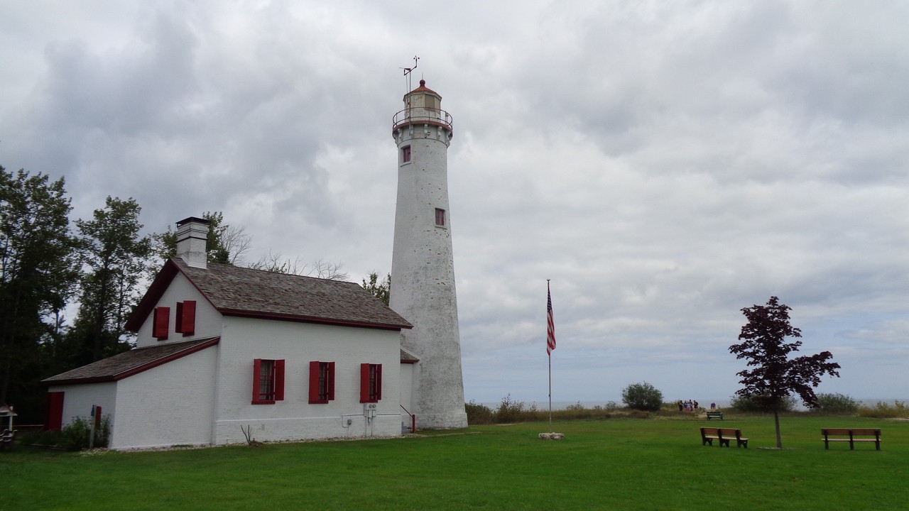
Historic Sturgeon Point Lighthouse and red-shuttered keeper quarters along Lake Huron shoreline on US-23 Sunrise Side
US-23 Foliage Peak: Oct 6 – Oct 16 (Wave 3)
📍 Stretch: Standish to Alpena & Cheboygan (200 Miles) 🌊 Waterway: Lake Huron, Saginaw Bay & Thunder Bay 🍁 Canopy: Red Oak, Sugar Maple, Jack Pine, White Cedar

US-23: The Huron Shores Sunrise Side Heritage Route

A tranquil, unhurried lighthouse corridor tracing Michigan’s sunrise freshwater ocean.

While Michigan's western shore captures the sunset crowds, US-23 along the Lake Huron "Sunrise Side" remains one of the Midwest's most rewarding and uncrowded coastal highways. Stretching 200 miles from Standish through Tawas City, Oscoda, Harrisville, Alpena, and Rogers City to the Straits of Mackinac, the route offers immediate shoreline proximity, sandy spits reminiscent of Cape Cod, working commercial fishing ports, and America's only freshwater National Marine Sanctuary preserving over 200 historic shipwrecks beneath crystal-clear water.

Asphalt & Lane Profile 2-Lane Coastal Highway (24 ft width), gentle curves, 6–8 ft shoulders
Elevation Gradient Flat lakeplain (580 to 650 ft); easy towing grades throughout
Lake-Effect Thermal Buffer Lake Huron easterly breezes keep summer cool and early fall mild
Fuel & Waypoint Hubs Standish, Au Gres, Tawas City, Oscoda, Harrisville, Alpena, Rogers City
Milepost-by-Milepost Pull-Off Planner Northbound Survey
  • MP 38.4
    Lighthouse Detour Tawas Point Light Station ("Cape Cod of the Midwest"): Victorian brick keeper's quarters and tower guarding a curving sandy hook extending into Saginaw Bay. Prime migratory birding hub.
  • MP 54.0
    Scenic Turnout River Road National Scenic Byway Junction (Oscoda): 22-mile detour west along high sandy bluffs above the Au Sable River to Lumberman’s Monument and Iargo Springs.
  • MP 82.3
    Lighthouse Detour Sturgeon Point Light Station (Harrisville): 1869 working beacon and historic lifesaving station situated in a pristine maritime state forest preserve.
  • MP 114.7
    Scenic Turnout Thunder Bay National Marine Sanctuary (Alpena): Great Lakes Maritime Heritage Center featuring glass-bottom boat shipwrecks tours and indoor schooner walk-through exhibits.
  • MP 152.0
    Lighthouse Detour 40 Mile Point Lighthouse & Shipwreck Beach: Preserved 1896 light station in Presque Isle County. The wooden ribs of the 1905 wooden steamer Joseph S. Fay rest directly on the beach gravel.
⚠️ Deer Strike Warning on Cedar Swamp Corridors: US-23 is very flat and friendly for fifth-wheels, but features the state's highest concentration of white-tailed deer crossings along low cedar swamps between Oscoda and Alpena. Reduce driving speeds significantly between twilight and dawn.
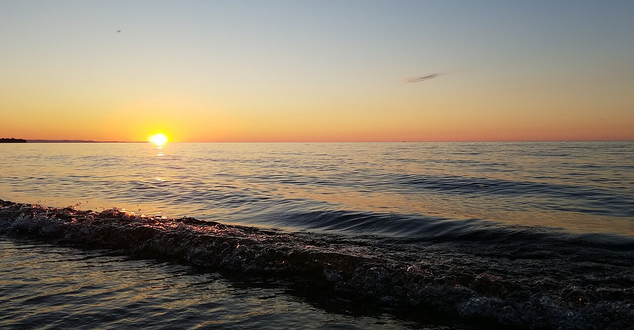
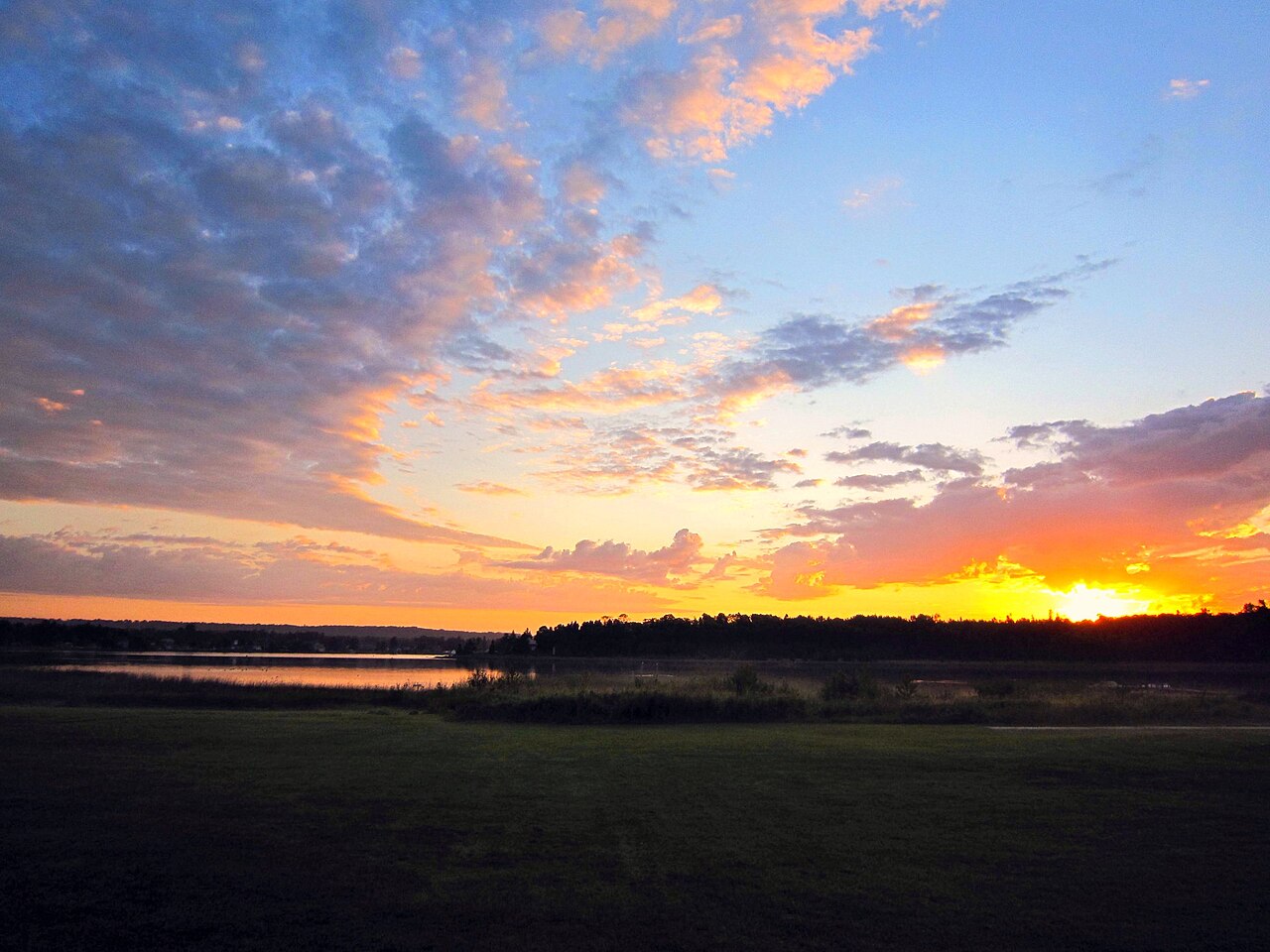
Vibrant sunset over Lake Superior surf and shoreline beach along the coastal corridor of M-28
M-28 Foliage Peak: Sep 28 – Oct 8 (Wave 2)
📍 Stretch: Munising to Seney & Sault Ste. Marie (130 Miles) 🌊 Waterway: Lake Superior Basin & Great Manistique Swamp 🍁 Canopy: Tamarack (Golden Needle), Spruce, White Birch, Aspen

M-28: Lake Superior Heartland & The Seney Stretch

A wilderness highway spanning Pictured Rocks sandstone cliffs to Michigan's legendary 25-mile tangent.

M-28 is the primary cross-peninsula artery of the Upper Peninsula, beginning along the sheer sandstone cliffs of Lake Superior at Munising and cutting east across the boreal heartland. Between Seney and Shingleton lies "The Seney Stretch"—25 consecutive miles of arrow-straight highway without a single bend or curve, slicing through the Great Manistique Swamp and Seney National Wildlife Refuge. In autumn, this boreal landscape transforms into a dramatic tapestry of flaming golden-yellow tamarack needles, dark spruce, and white paper birch beneath expansive northern skies.

Asphalt & Lane Profile 2-Lane Rural Trunkline (24 ft width), long tangent line-of-sight
Elevation Gradient 600 ft at Munising harbor to 900 ft on Seney sand plains
Lake-Effect Thermal Buffer Cold inland sinkhole; night temps drop into low 20s by October
Fuel & Waypoint Hubs Munising, Shingleton, Seney, Newberry, Sault Ste. Marie
Milepost-by-Milepost Pull-Off Planner Eastbound Survey
  • MP 6.2
    Scenic Turnout Au Train Bay Beach Overlook: Broad roadside pulloff overlooking red Jacobsville sandstone shelves and crystal-clear swimming water on Lake Superior.
  • MP 18.5
    Scenic Turnout Miners Castle Road Detour (Pictured Rocks): 6-mile paved spur north to the most famous overlook in Pictured Rocks National Lakeshore with panoramic views of Grand Island.
  • MP 45.0
    Scenic Turnout The Seney Stretch Western Marker: Entrance to Michigan's longest straight road (25 miles with zero turns). Watch for wild sandhill cranes and bald eagles over roadside bogs.
  • MP 48.2
    Scenic Turnout Seney National Wildlife Refuge Marshland Drive: 7-mile self-guided gravel wildlife auto tour through pristine pools hosting trumpeter swans, loons, and river otters.
  • MP 72.8
    Bakery & Smoked Fish Newberry Pasty Stops: Authentic miner pasties baked daily with diced beef, potatoes, onions, and yellow rutabaga wrapped in flaky lard crust.
⚠️ Fuel Planning & Moose Hazard Alert: Services are extremely sparse between Munising and Newberry (nearly 60 miles without open late-night fuel). Top your tank in Munising before heading east. Moose and whitetail deer frequently wander onto the dark asphalt at dusk along the Seney marshlands.
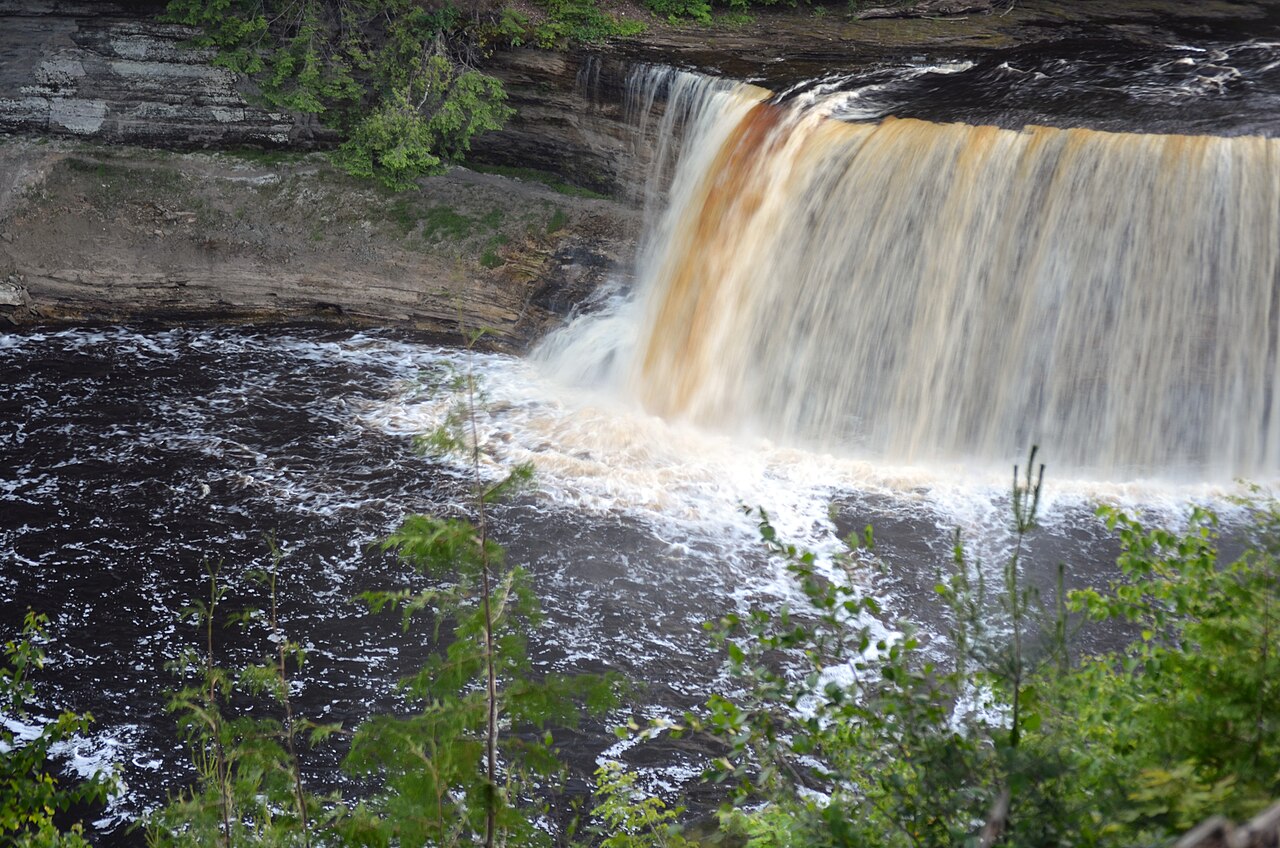
Mighty amber-tannin cataract of Upper Tahquamenon Falls surrounded by brilliant yellow birch autumn trees
M-123 Foliage Peak: Sep 27 – Oct 7 (Wave 2)
📍 Stretch: Newberry to Paradise & Trout Lake (92 Miles) 🌊 Waterway: Tahquamenon River & Lake Superior Whitefish Bay 🍁 Canopy: Paper Birch, Sugar Maple, Balsam Fir, Hemlock

M-123: The Tahquamenon Scenic Byway & Whitefish Bay

A wild horseshoe byway connecting copper-amber waterfalls, smoked-fish shacks, and shipwreck coastlines.

M-123 loops like a giant horseshoe across the wild northeastern corner of the Upper Peninsula, connecting the lumber town of Newberry to the amber cataracts of Tahquamenon Falls, the blueberry plains of Paradise, and the sandy coastline of Whitefish Bay. The highway cuts through dense boreal forests where yellow birch and red maple frame the rushing tea-colored waters of the Tahquamenon River. Continuing north to Whitefish Point, drivers reach the graveyard of Lake Superior, where the Edmund Fitzgerald met its fate during the terrible November gale of 1975.

Asphalt & Lane Profile 2-Lane Paved Byway (22–24 ft), rolling sand dunes, paved shoulders
Elevation Gradient Lake level (601 ft) to high sandy plains (880 ft)
Lake-Effect Thermal Buffer Whitefish Bay water delays coastal freeze; fog roll-ins frequent
Fuel & Waypoint Hubs Newberry, Paradise, Eckerman, Trout Lake
Milepost-by-Milepost Pull-Off Planner Loop Survey
  • MP 21.4
    Scenic Turnout Upper Tahquamenon Falls: 200-foot-wide cataract dropping 50 feet over sandstone ledges. Rich root-beer cedar tannins create amber froth framed in yellow birch canopies.
  • MP 25.8
    Scenic Turnout Lower Tahquamenon Falls: Series of five gentle cascades ringing an island in the river. Rowboat rentals and pedestrian footbridges allow exploring the island hardwood loop.
  • MP 35.1
    Bakery & Smoked Fish Paradise Smoked Fish & Berry Shacks: Roadside fish shacks selling freshly smoked Whitefish Bay lake trout, whitefish pâté, and wild thimbleberry preserves.
  • MP 46.3
    Lighthouse Detour Whitefish Point Light Station & Great Lakes Shipwreck Museum: 11-mile spur north of Paradise. Home to the historic 1861 iron-skeleton light tower and the recovered 200-lb bronze bell of the Edmund Fitzgerald.
  • MP 68.7
    Scenic Turnout Whitefish Bay Shoreline Overlooks: Paved turnouts providing long views across the water toward the blue peaks of Ontario's Laurentian Highlands.
⚠️ RV Parking and Frost Heave Notice: Upper and Lower Tahquamenon Falls both offer large pull-through RV parking bays that accommodate any size motorhome. Drivers should watch for spring frost heaves and logging truck drafts on the remote southern stretch of M-123 near Trout Lake.
Calm morning waters and pine-clad islands in Les Cheneaux archipelago along M-134 coastal byway
M-134 Foliage Peak: Oct 3 – Oct 12 (Wave 2)
📍 Stretch: I-75 Exit 359 to DeTour Village & Drummond Ferry (50 Miles) 🌊 Waterway: Lake Huron Archipelago & St. Marys Shipping Channel 🍁 Canopy: Northern White Cedar, Balsam Fir, Birch, Red Maple

M-134: The Les Cheneaux Islands & DeTour Coastal Byway

An archipelago highway through sheltered boat channels and 1,000-foot freighter shipping lanes.

Departing I-75 just north of St. Ignace, M-134 journeys eastward into "The Snows"—the 36 sheltered islands of the Les Cheneaux archipelago. This historic maritime byway winds through Hessel and Cedarville, where antique mahogany Chris-Craft runabouts rest in vintage boathouses, before terminating at DeTour Village. Here at the mouth of the St. Marys River, massive 1,000-foot iron ore carriers make a dramatic 90-degree turn from Lake Huron into the shipping channel just hundreds of yards from the coastal road.

Asphalt & Lane Profile 2-Lane Scenic Trunkline (22 ft width), 4 ft paved shoulders
Elevation Gradient Gentle shoreline contours, 580 to 640 ft elevation
Lake-Effect Thermal Buffer Sheltered bay microclimate retains warmth; morning sea mists
Fuel & Waypoint Hubs St. Ignace, Hessel, Cedarville, DeTour Village, Drummond Island
Milepost-by-Milepost Pull-Off Planner Eastbound Survey
  • MP 7.4
    Scenic Turnout Search Bay Roadside Turnout: Pristine beach access with views of Lake Huron limestone outcroppings and migrating monarch butterflies in early autumn.
  • MP 14.8
    Scenic Turnout Hessel Marina & Harbor: Historic home of the Les Cheneaux Antique Wooden Boat Show, with public docks overlooking cedar-lined channels.
  • MP 18.2
    Bakery & Smoked Fish Cedarville Bay Shanties: Local fish markets serving fresh whitefish sandwiches, smoked chub, and house-made wild blackberry tarts.
  • MP 41.5
    Scenic Turnout DeTour State Harbor Ship-Watching Overlook: Direct vantage point watching 1,000-foot freighters like the Paul R. Tregurtha navigate the DeTour Passage into the St. Marys River.
  • MP 49.8
    Lighthouse Detour DeTour Passage Ferry Dock & Reef Light: The terminal dock for the Drummond Island car ferry, offering views across open water to the offshore DeTour Reef Light.
⚠️ Drummond Island Ferry Clearance & Fare Warning: M-134 is very easy driving for all motorhomes. However, if taking the car ferry to Drummond Island, fares are charged by total bumper-to-hitch length and low-clearance trailers can scrape on the ramp during extreme low lake water levels. Measure overhangs before staging in line.
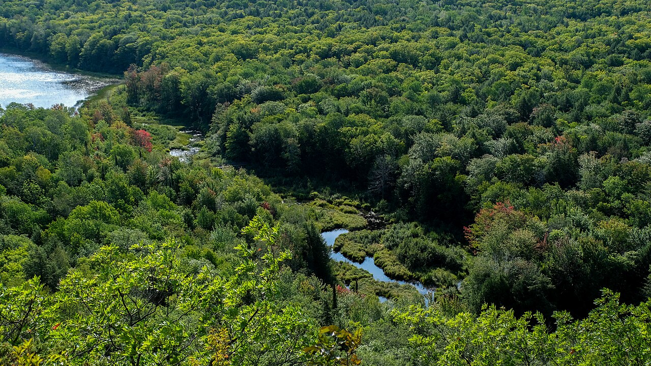
High rock cliff view of Lake of the Clouds in the Porcupine Mountains surrounded by vast flaming red maple wilderness
M-107 Foliage Peak: Sep 24 – Oct 4 (Wave 1)
📍 Stretch: Silver City to Lake of the Clouds & South Boundary (25 Miles) 🌊 Waterway: Lake Superior & Carp River Mountain Valley 🍁 Canopy: Virgin Old-Growth Sugar Maple, Yellow Birch, Hemlock

M-107 & South Boundary Road: Porcupine Mountains Wilderness Escarpment

The Midwest's premier mountain road trip, rising high above virgin maple canopies and Lake Superior.

M-107 skirts the wild rocky shoreline of Lake Superior before climbing steeply into the Porcupine Mountains Wilderness State Park—the largest tract of virgin old-growth northern hardwood forest east of the Mississippi. The highway dead-ends dramatically at the Lake of the Clouds Overlook, where sheer volcanic basalt cliffs drop 300 feet to the Carp River winding through an endless ocean of pure sugar maple. Because of the 1,400-foot elevation and northern latitude, the Porkies turn ablaze with the Midwest's first and most intense autumn colors in late September.

Asphalt & Lane Profile 2-Lane Mountain Highway (20–22 ft), steep grades, narrow gravel shoulders
Elevation Gradient 601 ft at Lake Superior to 1,420 ft at Escarpment crest (10–12% grade)
Lake-Effect Thermal Buffer Elevation overrides lake buffer; sharp freeze hits by late September
Fuel & Waypoint Hubs Ontonagon, Silver City, White Pine (inland)
Milepost-by-Milepost Pull-Off Planner Westbound Survey
  • MP 2.1
    Scenic Turnout Union Bay Shoreline Beach: Expansive red pebble beach right along Lake Superior where agate hunters scan the gravel surf line against rugged volcanic ridges.
  • MP 8.4
    Scenic Turnout Lake of the Clouds Escarpment Overlook (Terminus): Fully accessible boardwalk on the cliff edge. Unbroken vista over 60,000 acres of old-growth sugar maple blanketed in crimson and orange.
  • MP 14.2
    Scenic Turnout Summit Peak Observation Tower (South Boundary Rd): Wooden tower ascending to 1,958 feet above sea level, offering views of the Apostle Islands on clear autumn mornings.
  • MP 21.0
    Scenic Turnout Little Carp River Trailhead: Deep hemlock and cedar gorge trailhead leading down into wilderness backcountry waterfalls.
  • MP 24.8
    Scenic Turnout Presque Isle River Waterfalls Loop: Suspension bridge over Manido, Nawadaha, and Manabezho falls churning into Lake Superior through deep shale gorges.
⚠️ Steep Grades and Limited Overlook Parking: M-107's upper terminus parking apron at Lake of the Clouds fills to capacity during peak late-September fall color weekends. Large motorhomes and fifth-wheels should unhook trailers at Union Bay Campground before ascending the 12% grade to the overlook. South Boundary Road has severe frost heaves and sharp dip curves not recommended for low-clearance travel trailers.
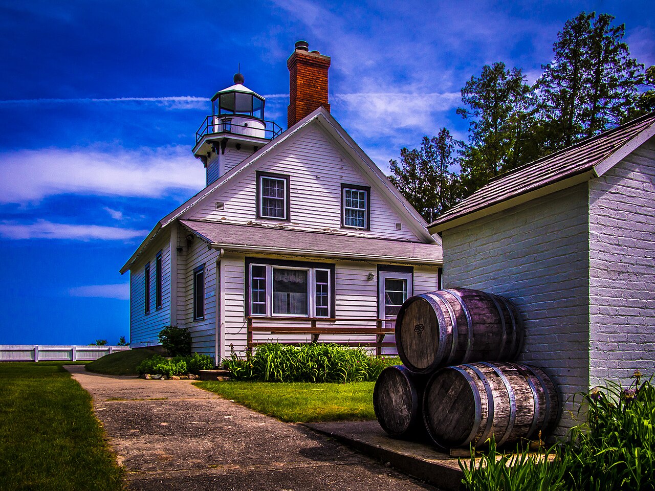
Mission Point Lighthouse situated among golden trees and clear blue waters at the tip of Old Mission Peninsula
M-37 Foliage Peak: Oct 12 – Oct 22 (Wave 4)
📍 Stretch: Traverse City to Mission Point Lighthouse (19 Miles x 2) 🌊 Waterway: East & West Grand Traverse Bays 🍁 Canopy: Riesling Vineyards, Cherry Orchards, Sugar Maple, Walnut

M-37: Old Mission Peninsula Cherry & Riesling Ridge Drive

A high centerline ridge flanked by two deep bays, rolling vineyards, and historic maritime orchards.

Jutting 19 miles northward directly into Grand Traverse Bay, M-37 (Center Road) travels along the central topographic spine of Old Mission Peninsula. The peninsula is only one to three miles wide, providing constant roller-coaster hill vistas of blue water on both sides. The deep waters of East and West Bays create a remarkable agricultural microclimate that prevents late spring frosts and extends autumn warmth late into October, making this one of the premier Riesling and pinot noir wine regions in the world—and the last region in northern Michigan to reach peak foliage.

Asphalt & Lane Profile 2-Lane Paved Highway (24 ft width), rolling ridge hills, paved shoulders
Elevation Gradient 580 ft bay shores to 840 ft hilltop ridgelines
Lake-Effect Thermal Buffer Maximum bay protection; color holds vibrant into late October
Fuel & Waypoint Hubs Traverse City (south terminus), Mapleton, Old Mission Village
Milepost-by-Milepost Pull-Off Planner Northbound Survey
  • MP 6.8
    Scenic Turnout 45th Parallel Geographic Monument: Historic roadside stone monument marking the exact midpoint between the Equator and the North Pole.
  • MP 10.4
    Scenic Turnout Chateau Chantal Hilltop Crest: High panoramic ridgeline providing 360-degree views of both East and West Grand Traverse Bays and rows of hillside vines.
  • MP 14.2
    Scenic Turnout Bowers Harbor Waterfront Park: Sheltered bay beach facing southwest with calm waters, historic stone cottages, and brilliant afternoon light.
  • MP 16.0
    Bakery & Smoked Fish Old Mission General Store: Step back into 1839 with wood stoves, antique glass candy jars, fresh sourdough breads, hot pizza, and cold pressed apple cider.
  • MP 18.9
    Lighthouse Detour Mission Point Light Station (1870): Historic square wood-framed lighthouse, log cabins, and pristine pebble beaches marking the exact northern tip of the peninsula.
⚠️ Keep RVs on Center Road (Avoid Bluff and Peninsula Drives): M-37 (Center Road) is broad, smooth, and easily driven by large RVs. However, shoreline connector roads like Bluff Road and Peninsula Drive are extremely narrow, residential, lack shoulders, and contain tight turns that will trap long fifth-wheel trailers. Remain on M-37 for the drive to Mission Point.
Suspension footbridge crossing Black River gorge into Lake Superior surrounded by dense northern wilderness
M-64 Foliage Peak: Sep 26 – Oct 6 (Wave 1)
📍 Stretch: Baraga to Ontonagon & Black River Harbor (65 Miles) 🌊 Waterway: Lake Superior Western Basin 🍁 Canopy: Red Maple, White Pine, Paper Birch, Tamarack

M-64 & Black River Harbor Scenic Byway: Western Superior Shore

A remote western frontier highway linking commercial fishing piers and roaring river canyon falls.

M-64 skirts the remote westernmost coastline of Michigan's Upper Peninsula, connecting the copper-harbor town of Ontonagon through Silver City to the Black River Harbor National Forest Scenic Byway. This is pure, untamed Lake Superior wilderness, where red sandstone conglomerate beaches meet raging river gorges. The Black River Scenic Byway descends through Ottawa National Forest alongside five consecutive waterfalls—Great Conglomerate, Potawatomi, Gorge, Sandstone, and Rainbow Falls—before terminating at an iconic wooden suspension footbridge leading onto a wild pebble beach.

Asphalt & Lane Profile 2-Lane Forest Highway (22 ft width), rolling terrain, gravel shoulders
Elevation Gradient Lake level (601 ft) to 1,200 ft high pine ridges
Lake-Effect Thermal Buffer Western basin catches severe early arctic fronts and early snow
Fuel & Waypoint Hubs Baraga, L'Anse, Ontonagon, Silver City, Bessemer/Ironwood
Milepost-by-Milepost Pull-Off Planner Westbound Survey
  • MP 12.0
    Scenic Turnout Bishop Baraga Shrine (L’Anse): Massive 35-foot bronze statue of the "Snowshoe Priest" standing high on the red bluffs overlooking Keweenaw Bay.
  • MP 34.5
    Lighthouse Detour Ontonagon Light Station (1866): 5th-order Fresnel beacon and brick keeper quarters preserving the heritage of the Ontonagon copper trade.
  • MP 36.2
    Bakery & Smoked Fish Peterson’s Fish Market (Ontonagon): Fresh lake whitefish, ciscoes, and lake trout smoked fresh over seasoned hardwood sawdust.
  • MP 52.8
    Scenic Turnout Potawatomi & Gorge Falls Trailheads: Paved forest byway turnouts with barrier-free boardwalks viewing 30-foot river falls roaring into basalt canyons.
  • MP 64.9
    Scenic Turnout Black River Harbor Suspension Footbridge: Scenic wooden pedestrian suspension bridge spanning the river mouth to an expansive Lake Superior driftwood beach.
⚠️ Mountain Canyon Curves on Black River Byway: The National Forest Byway from Bessemer down to Black River Harbor has several sharp 20 mph descent turns into river valleys. Paved turnaround loops are available at the harbor and major waterfall trailheads, but large fifth-wheels should monitor transmission and brake temperatures.
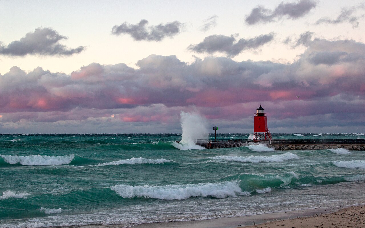
Charlevoix South Pier Light in red steel tower at the entrance of the channel from Lake Michigan into Round Lake
US-31 Foliage Peak: Oct 8 – Oct 18 (Wave 4)
📍 Stretch: Traverse City through Charlevoix to Petoskey (110 Miles) 🌊 Waterway: Grand Traverse Bay & Little Traverse Bay 🍁 Canopy: Sugar Maple, Red Oak, White Pine, Cedar Bluffs

US-31: Grand Traverse & Little Traverse Bays Scenic Shoreline

A blue-water coastal highway through historic resort harbors, bascule bridges, and Petoskey stone beaches.

US-31 between Traverse City and Petoskey is one of northern Michigan’s most celebrated coastal highways, hugging the eastern shores of East Grand Traverse Bay and curving around the dramatic limestone bluffs of Little Traverse Bay. The route leads drivers through the Victorian resort town of Charlevoix—where an iconic bascule drawbridge lifts on the hour and half-hour to let luxury yachts into Round Lake—past the million-dollar cliffside views of Bay Harbor, and into historic Petoskey. In autumn, sugar maples blaze red against the intense turquoise waters of the bays.

Asphalt & Lane Profile 2-to-4 Lane Paved Arterial (24–52 ft width), wide paved shoulders
Elevation Gradient Bay level (580 ft) to Bay Harbor bluffs (720 ft)
Lake-Effect Thermal Buffer Deep bays retain summer heat; mild frost-free October driving
Fuel & Waypoint Hubs Traverse City, Elk Rapids, Charlevoix, Bay Harbor, Petoskey
Milepost-by-Milepost Pull-Off Planner Northbound Survey
  • MP 32.4
    Scenic Turnout Elk Rapids Harbor & Dam Beach: Walkable harbor where the Chain of Lakes spills through a historic hydro dam into Grand Traverse Bay.
  • MP 58.0
    Lighthouse Detour Charlevoix South Pier Light & Bascule Bridge: Red skeletal lighthouse tower at the entrance to the Round Lake Channel. Watch the bridge raise every 30 minutes from adjacent waterfront park.
  • MP 71.5
    Scenic Turnout Bay Harbor Bluffs & Quarry Preserve: High limestone cliff vista overlooking Little Traverse Bay, former shale quarry transformed into a luxury yacht harbor.
  • MP 84.2
    Bakery & Smoked Fish Petoskey Gaslight District & Crooked Tree Bakery: Historic gas-lit brick streets with artisan bakeries, roasted coffees, and local smoked whitefish pâté.
  • MP 92.0
    Scenic Turnout Petoskey State Park Beach: Sandy beach and dunes famed for finding fossilized Devonian hexagonal coral (the state stone: Petoskey Stone) in the shoreline gravel.
✓ Highly Accommodating for RVs with Summer Weekend Traffic Notes: US-31 is completely modernized, multi-lane in stretches, and fully accessible for large motorhomes and commercial trailers. Expect weekend summer and fall color congestion in downtown Charlevoix due to the bascule drawbridge opening on the hour and half-hour.

Highway Cartographer Field Rules: Navigating Coastal Michigan

1. Respect Crown & Overhang Clearance

On canopy routes like M-119 and rural county connectors, tree trunks curve over the roadway at 11 to 12 feet. High-profile rigs can easily strike overhanging boughs or utility lines.

2. The 10-Minute Lake Fog Rule

When driving along open water tangents (US-2, US-23, M-22), warm afternoon air can generate sudden advection sea fog that rolls across the asphalt in under five minutes, reducing visibility to 50 feet. Use low beams immediately.

3. Turnout Deceleration Protocol

Scenic turnouts on high-speed routes like US-2 and M-28 lack deceleration lanes. Signal your intention at least 500 feet prior to turning to prevent rear-end collisions from fast logging trucks.

4. Fresh Smoked Fish Cooler Discipline

Smoked whitefish and lake trout from shanties in Leland, Good Hart, Brevort, and Ontonagon are warm and freshly smoked without heavy preservatives. Always keep a hard-sided cooler with fresh ice in your vehicle trunk.

Great Lakes Road Trip & Cartography FAQs

Which Michigan coastal drives have strict RV and trailer width restrictions?

M-119 (The Tunnel of Trees) and Brockway Mountain Drive (off M-26 in the Keweenaw) have the strictest restrictions. M-119 features asphalt width under 18 feet, zero shoulders, overhanging hardwood limbs at 11 to 12 feet, and blind hairpin turns with no centerline; trailers, motorhomes over 24 feet, and dually pickups are strongly discouraged or restricted. Brockway Mountain Drive features 15% grades, sharp unguarded crests, and no turning turnaround loops at the summit. Motorhomes and large travel trailers should use lower M-26 through Silver River instead.

How does the Great Lakes coastal fall color timing engine work?

Michigan fall foliage moves from northwest to southeast across 4 distinct waves. Wave 1 peaks in late September (Sep 24–Oct 4) across high-elevation Western U.P. escarpments like the Porcupine Mountains and Keweenaw spine. Wave 2 peaks in early October (Sep 28–Oct 8) across the central and eastern U.P. (M-28 Seney Stretch, M-123 Tahquamenon). Wave 3 peaks in early-to-mid October (Oct 5–Oct 15) along the northern Straits (M-119 Tunnel of Trees and US-23). Wave 4 peaks in mid-to-late October (Oct 8–Oct 22) along Lake Michigan dune corridors like M-22 and Old Mission Peninsula, where the immense thermal mass of Lake Michigan delays frost and prolongs vibrant canopy color.

Where are the best smoked fish and artisan bakeries along Michigan coastal highways?

Key culinary road-trip waypoints include Carlson's Fishery in Leland Fishtown (M-22), Good Hart General Store for warm pot pies and baked goods (M-119), The Jampot near Eagle River where Byzantine Catholic monks bake wild thimbleberry jam and muffins (M-26), Gustafson's Smoked Fish in Brevort (US-2), Peterson's Fish Market in Ontonagon (M-64), and Legs Inn in Cross Village for authentic Polish whitefish (M-119 terminus).

How does Great Lakes water temperature affect coastal driving conditions?

The Great Lakes act as massive thermodynamic engines. In spring and early summer, warm air crossing cold 40°F lake waters creates dense advection fog banks that roll inland across US-2, M-22, and M-28. In autumn, 50°F to 60°F surface waters insulate adjacent shoreline orchards from early freezing, keeping coastal hardwood canopies golden 10 to 14 days after inland forests have shed their leaves. In late autumn and winter, cold northwest arctic air over open water triggers localized lake-effect squalls that can reduce visibility to zero within a single milepost.

Can you drive M-22 in a large Class A motorhome or 30-foot travel trailer?

Yes, M-22 is fully navigable for large RVs and travel trailers, but drivers must exercise care through downtown Glen Arbor and Leland, where pedestrian traffic and street parking narrow clearance. Steep 8% climbs around Arcadia Overlook (Inspiration Point) require steady downhill gear management. RV drivers seeking high-speed travel can bypass M-22's shoreline curves using parallel US-31.

What is the recommended multi-day sequence for an epic Michigan coastal road trip?

The classic sequence begins in Manistee driving north along M-22 around the Leelanau horn to Traverse City (Day 1). Day 2 crosses Old Mission Peninsula (M-37) and travels US-31 north through Charlevoix to Harbor Springs, continuing through the Tunnel of Trees (M-119) to Mackinaw City. Day 3 crosses the Mackinac Bridge onto US-2 along northern Lake Michigan to Manistique or M-28 through Seney to Munising. Day 4 travels the Keweenaw Peninsula via M-26 to Brockway Mountain and Copper Harbor.

Connected Great Lakes Telemetry & Field Guides

Explore real-time marine observation stations, lighthouse navigational networks, wine trails, and bridge conditions paired with these coastal corridors.