Field Guide · Shoreline Astronomy & Night Sky Corridors

Michigan After Dark: The Northern Lights, Dark-Sky Preserves & Meteor Shower Field Guide

12 Unobstructed Great Lakes Shorelines, IDA Preserves & Horizon Azimuths for Kp 4+ Auroras, Meteor Showers & the Summer Milky Way

12 Audited Night Sky Bases Bortle 1 to Bortle 3 Darkness Summer Milky Way · Jun–Sep Peak Aurora Equinoxes · Sep–Apr Perseids · Aug 11–13 24/7 Gate Access Rules Audited

Good evening, skywatchers, and welcome to the night shift across the Great Lakes. If you pull up a space-weather monitor right now, you are looking at a living cosmic forecast: 93 million miles away on the solar surface, magnetic loops twist, snap, and fire a Coronal Mass Ejection into deep space. When that billion-ton cloud of magnetized plasma barrels past NOAA's DSCOVR satellite at 500 kilometers per second and slams into Earth's magnetosphere, our upper atmosphere 60 to 150 miles overhead behaves like a colossal neon tube. Solar electrons energize atmospheric oxygen, releasing brilliant bursts of emerald green photons, while ionized nitrogen glows electric violet. That is the Northern Lights—not a trick of the clouds, but the physical breath of our sun interacting with the air we breathe.

Here is your boots-on-the-ground reality from the ranger station: you can have a textbook Kp 5.0 storm lighting up space-weather feeds, but if you drive to a south-facing beach, pull off under a gas station light-dome, or let white headlights flash across your eyes, you won't see a thing. At Michigan latitudes, moderate auroral ribbons hover right on the deck—just 5 to 15 degrees above the northern waterline. If there are coastal pine bluffs or suburban sprawl between you and Canada, the show is hidden. That is why we built this field guide: pairing real-time Horizon Azimuths, Bortle darkness metrics, 24-hour DNR gate exemptions, retinal rhodopsin protocols, and smartphone night-mode camera formulas across 12 audited Michigan dark-sky sanctuaries.

The Horizon Azimuth Rule: Water Horizon vs. Light Dome

In weather forecasting, we teach people to look upwind; in night-sky observation, you must look down-azimuth. At Michigan latitudes (from 41.7°N along the Ohio border up to 47.4°N on the Keweenaw tip), the auroral oval during G1 and G2 geomagnetic storms does not sit directly overhead—it hovers hundreds of miles to our north over Ontario and Hudson Bay. That means the glowing auroral arc sits between 5° and 18° above the northern horizon—right where even a gentle treeline can hide it entirely.

  • True North Water Horizons (330° to 030°): Essential for low-Kp auroras. Lake Superior shorelines (Brockway Mountain, Whitefish Point, Miners Beach) look across 150 miles of pitch-black, uninhabited water with zero light domes down to the waves.
  • South/Zenith Horizons (150° to 210°): Essential for the summer Milky Way Galactic Core (Sagittarius and Scorpius). Stops like Negwegon State Park look South over dark Lake Huron, exposing cosmic interstellar dust lanes and the heart of our home galaxy 26,000 light-years away.
  • 360° Open Cosmic Domes: Summit overlooks (Brockway Mountain) and glacial sand amphitheatres (Sleeping Bear Dune Climb) provide wall-to-wall sky domes for meteor radiants like the August Perseids and December Geminids.

The Red-Headlamp & Dark-Adaptation Code of Honor

Human retinas are biological marvels, but they take time to tune into the cosmos. Your eye's scotopic (low-light) vision relies on rod cells powered by a chemical photopigment called rhodopsin (visual purple). Synthesizing full rhodopsin takes 20 to 30 continuous minutes in total darkness. Once your eyes are dark-adapted, your sensitivity multiplies by up to 10,000 times—suddenly revealing faint auroral ribbons, delicate airglow, and deep-sky nebulae invisible to casual eyes.

  • The Instant Bleach: A single 1-second pulse from a white LED flashlight, smartphone screen, or car headlight instantly bleaches retinal rhodopsin down to zero, wiping out 30 minutes of biological dark adaptation in a flash.
  • The Physics of Red Light (>620nm): Human rod cells are virtually blind to deep red wavelengths above 620 nanometers. Using dim red headlamps lets you read trail signs, adjust camera dials, and hike rocky beaches without resetting your night-vision chemistry.
  • Ranger Trail Etiquette: Click your headlamp to red before cracking your car door. Dim your dashboard instrument clusters, keep vehicle interior lights turned off, and never sweep any light beam horizontally toward the water or fellow observers' long-exposure cameras.

24-Hour Gate Access & Michigan State Park Rules

If you've ever arrived at a state park gate at 10:15 PM and turned around because the sign said "Closed at 10:00 PM," here is the ranger secret that unlocks Michigan's night skies: designated State Dark Sky Preserves carry a legally protected 24-hour stargazing exemption under Michigan DNR operational orders.

  • Official Stargazing Exemption: Designated Michigan State Dark Sky Preserves (Port Crescent, Wilderness, Negwegon, Thompson's Harbor, Rockport) allow 24-hour public access for visitors actively observing the night sky, provided their vehicle displays a valid Michigan Recreation Passport.
  • What Rangers Look For: When conservation officers patrol day-use lots after midnight, active observers with reclining lawn chairs, red headlamps, binoculars, telescopes, or camera tripods are fully permitted. Unauthorized tent camping, sleeping inside vehicles, or lighting beach bonfires in day-use zones remains strictly prohibited.
  • National Lakeshore Corridors: Pictured Rocks and Sleeping Bear Dunes beaches are open 24 hours year-round with a standard federal park entrance pass.

Smartphone Night-Mode Astrophotography Cheat Sheet

Here is good news from the field desk: you do not need a \$3,000 camera rig to capture breathtaking auroras and Milky Way clouds. The smartphone in your pocket has a high-ISO computational sensor that gathers faint green photons and cosmic dust lanes your naked eye perceives as silver mist. Here is your pocket cheat sheet:

Apple iPhone (11 Pro through 16 Pro)

1. Mount phone to a rigid tripod or wedge firmly between beach rocks.
2. Open Camera, select 1x wide lens (largest aperture, maximum light intake).
3. Tap the yellow Night Mode moon icon in the corner.
4. Drag the duration slider from Auto to Max (30 seconds). Note: 30s only unlocks when internal gyroscopes detect zero hand tremor.
5. Set a 3-second self-timer so your finger tap does not vibrate the shot.

Max 30s Exposure · 1x Lens

Google Pixel (Pixel 4 through 9 Pro)

1. Open Google Camera and swipe to Night Sight.
2. Clamp phone to a tripod facing your target horizon.
3. Keep the device completely still for 3 seconds until the shutter button automatically morphs into a Star Icon (Astrophotography Mode).
4. Press shutter; the camera will capture and stack exposures for 2.5 to 4 minutes, outputting both a pristine high-resolution still and a 1-second motion timelapse.

Auto-Stacking · 4-Min Computational

Samsung Galaxy & Android Pro Mode

1. Open Camera → More → Expert RAW or Pro Mode.
2. Set ISO to 1600 or 3200.
3. Set Shutter Speed to 15s or 20s (longer than 25s causes Earth's rotation to trail stars).
4. Set Manual Focus (MF) slider to 0.9 (just a hair before infinity to keep pinpoint stars razor-sharp).
5. Set White Balance (WB) to 4000K–4300K to prevent orange ambient light wash.

Manual ISO 3200 · 20s Shutter

Filter 12 Michigan Dark-Sky Destinations

Showing 12 of 12 audited night-sky bases
Target Sky:
Region:
Darkness:
Stop 01 · Emmet County · Straits of Mackinac

Headlands International Dark Sky Park

The Straits Benchmark · 550 Acres of Wilderness Shoreline · 24/7 Outdoor Stargazing Lawn

Bortle 2 · SQM 21.75 Certified IDA Dark Sky Park 24/7 Public Access Perseids Premier Site

Designated in 2011 as one of the world's first nine International Dark Sky Parks, Headlands is the undisputed flagship of Michigan night-sky conservation. Covering 550 pristine acres along two miles of undeveloped Lake Michigan and Straits coastline just west of Mackinaw City, this county-managed sanctuary was designed from the ground up for stargazers. Its waterfront observatory features an expansive outdoor amphitheatre and viewing lawn right on the water's edge.

From an atmospheric standpoint, Headlands offers a textbook dark-sky setting: looking north-northwest across the Straits of Mackinac toward St. Helena Island, your line of sight spans open water with zero direct light sources. The faint illumination from the Mackinac Bridge three miles to the east is naturally baffled by dense coastal cedar bluffs, giving you a clean, high-contrast window for viewing auroral curtains at Kp 4.5+ or watching the Perseid radiant send fireballs streaking overhead in mid-August.

Horizon Azimuth & Light Dome
340° NNW · Straits Water Horizon
Open water horizon across Lake Michigan toward St. Helena Island. Zero local lighting north; faint bridge illumination 3 miles east is shielded by coastal bluffs.
Night Gate Access Open 24/7/365 · Free Admission
Primary Targets Aurora (Kp 4.5+), Perseids, Star Clusters
Facilities & Terrain Paved Observatory Lot, Restrooms, Bleachers
Red-Light Protocol Strict Red-Only · Zero White Light Permitted
Historic Mackinac Straits shoreline near Headlands Dark Sky Park
Straits of Mackinac dark-sky corridor west of Mackinaw City. Photo: Wikimedia Commons (CC BY-SA 3.0).
Ranger Access Protocol No overnight camping or pitching of tents in the park or parking lots. You may bring sleeping bags, reclining camp chairs, blankets, and telescopes for active stargazing in the outdoor viewing area until dawn.
Check Straits Aurora Forecast ↗ Check Mackinac Bridge Conditions ↗ View on Google Maps · area only ↗
Stop 02 · Keweenaw County · Lake Superior Summit

Brockway Mountain Overlook & Keweenaw Dark Sky Park

734-Foot Lake Superior Overlook · Bortle 1 Pitch Black · Unbroken Canadian Water Horizon

Bortle 1 · SQM 21.95 IDA Certified Keweenaw Park 360° Summit Dome Low-Kp 4 Aurora King

Rising 734 feet above Lake Superior (1,338 feet above sea level) on the volcanic spine of the Keweenaw Peninsula, Brockway Mountain is widely regarded by astronomers and meteorologists as the crown jewel of dark-sky platforms east of the Mississippi. Certified in 2022 by DarkSky International as part of the Keweenaw Dark Sky Park, this high-latitude outpost sits at 47.47°N—placing you hundreds of miles closer to the auroral oval than observers in lower Michigan.

Step onto the summit ridge and you are standing on billion-year-old basalt lava flows, looking out over 150 miles of completely unbroken Lake Superior water toward Thunder Bay and Isle Royale. Because your northern horizon is totally free of terrain obstacles and human light, faint auroral ribbons that require a major Kp 6 storm in southern Michigan regularly blaze across the camera sensor here at modest Kp 4.0 levels. Faint airglow ripples and zodiacal light are routine naked-eye occurrences.

Horizon Azimuth & Light Dome
000° True North · 360° Horizon Over Lake Superior
Completely unhindered open water to the North, Northwest, and Northeast. Zero light pollution domes. The absolute benchmark for low-horizon auroral ribbons.
Night Gate Access Brockway Mountain Drive Open 24/7 (May–Nov)
Primary Targets Aurora (Kp 4.0+), 360° Meteor Radiants, Airglow
Facilities & Terrain Paved Mountain Summit · Extreme Wind Exposure
Red-Light Protocol Strict Red-Light · Park in designated summit pull-offs
Lake Superior wilderness horizon view looking north from the Keweenaw Peninsula
Lake Superior wilderness dark-sky horizon north toward Isle Royale. Photo: Wikimedia Commons (CC BY 2.0).
Astrophotographer Summit Warning Temperatures on the Brockway summit routinely plummet 15–25 degrees colder than inland towns with severe lake gale gusts. Heavy windbreaks, down parkas, hand warmers, and weighted tripod anchor bags are mandatory even in July and August.
Check Keweenaw Aurora Forecast ↗ Check Meteor Shower Radiants ↗ View on Google Maps · area only ↗
Stop 03 · Keweenaw Peninsula · M-26 Coastal Shelf

Great Sand Bay & Eagle Harbor M-26 Shoreline

Water-Level Wave Reflections · Bortle 1 Sky · Yooperlite UV Beachcombing Base

Bortle 1 · SQM 21.92 Shoreline Reflection King 24/7 Roadside Pull-Offs Yooperlite UV Corridor

While Brockway Mountain provides the elevated aerial perch, Great Sand Bay and the rugged basalt coves of Eagle Harbor along scenic Highway M-26 place your tripod right at the water's edge. There is a primal, breathtaking rhythm here: listening to the cold pulse of Lake Superior surf crash against the cobbles while watching an emerald auroral arc cast shimmering reflections across wet shoreline sand and rolling wave foam.

Great Sand Bay features an accessible timber boardwalk and broad sand-and-gravel strand with pull-offs directly off M-26. And here is a veteran ranger tip: during quiet lulls between geomagnetic sub-storms, switch on a filtered 365nm longwave UV flashlight. This shoreline is one of Michigan's premier hunting grounds for "Yooperlites"—syenite stones rich in fluorescent sodalite that ignite in blazing volcanic embers beneath the ultraviolet beam.

Horizon Azimuth & Light Dome
330° NNW · Lake Superior Shoreline Water Level
Completely unblocked northern water horizon. The low shore angle captures brilliant reflection beams across wave crests and wet shoreline sand.
Night Gate Access 24/7 Roadside MDOT Pull-Offs · No Gates
Primary Targets Aurora Wave Reflections, Yooperlite UV Hunting
Facilities & Terrain Boardwalk at Great Sand Bay, Sand/Cobble Beach
Red-Light Protocol Use red lights on beach; dim vehicle lights when parking
Northern Lake Superior shoreline cobble beach and waves
Lake Superior shoreline looking north into pristine dark skies. Photo: Wikimedia Commons (CC BY-SA 3.0).
UV Light Etiquette Connection When hunting Yooperlites between aurora exposures, keep 365nm UV beams aimed strictly down at your feet. Never point high-intensity UV lights toward other photographers' long-exposure camera sensors.
Open Rockhound Field Guide (Yooperlite Specs) ↗ Check Keweenaw Aurora ↗ View on Google Maps · area only ↗
Stop 04 · Alger County · Pictured Rocks National Lakeshore

Miners Beach & Sand Point (Pictured Rocks)

Sandstone Sea Cliffs · Bortle 2 Wilderness · Grand Island Channel Reflections

Bortle 2 · SQM 21.82 National Lakeshore 24/7 Park Access Perseids Sand Amphitheatre

Pictured Rocks National Lakeshore preserves nearly 40 miles of Lake Superior coastline backed by colossal 200-foot multicolored sandstone sea cliffs and ancient northern hardwood forest. Certified as an International Dark Sky Park in 2025, this national lakeshore benefits from a powerful natural topographic shield: the high Munising escarpment behind the cliffs completely swallows municipal light from the south, leaving the northern lake basin in pure, unpolluted shadow.

Miners Beach is an astronomer's dream—a mile-long sandy crescent facing almost due North (010° azimuth) straight into the deepest trenches of Lake Superior. To your west, the massive sandstone monolith of Miners Castle looms as a dramatic dark silhouette against the dancing auroral glow. Nearby Sand Point offers protected, glass-calm waters facing north-northeast over Grand Island Channel, turning the lake into an emerald mirror on quiet nights.

Horizon Azimuth & Light Dome
010° NNE · Pictured Rocks Open Superior Water
Completely dark northern water horizon. The southern tree escarpment blocks 100% of any faint town light from Munising.
Night Gate Access Open 24/7 · NPS Entrance Pass Required
Primary Targets Aurora Curtains (Kp 4.5+), Perseids, Milky Way Arch
Facilities & Terrain Paved Parking, Vault Toilets, Sand Strand
Red-Light Protocol Red Headlamp Mandate along beach trail
Miners Beach at Pictured Rocks National Lakeshore looking north over Lake Superior
Miners Beach shoreline at Pictured Rocks looking north. Photo: Wikimedia Commons (CC BY 2.0).
National Lakeshore Night Rules Carry a valid National Park Service pass in your vehicle window. Bear country precautions apply: store all food inside locked vehicles and pack out every scrap of waste. Stay off steep sandstone cliff faces after dark.
Check Munising Aurora Forecast ↗ Check Lake Superior Wave Buoys ↗ View on Google Maps · area only ↗
Stop 05 · Chippewa County · Eastern Lake Superior

Whitefish Point & Great Lakes Shipwreck Museum Beach

The Graveyard of Lake Superior · Historic 1861 Lighthouse Silhouette · Deep Pitch Dark

Bortle 2 · SQM 21.85 Maritime Landmark 24/7 Public Beach Boardwalk Edmund Fitzgerald Corridor

Jutting like a spearhead into eastern Lake Superior at the entrance to Whitefish Bay, Whitefish Point is sacred ground in Great Lakes maritime lore. Seventeen miles to the northwest in 530 feet of icy water rests the hull of the SS Edmund Fitzgerald. By day, it is a bustling maritime sanctuary; by night, it transforms into one of the most hauntingly beautiful and atmospherically pristine dark-sky outposts on the continent.

The skeletal iron tower of Whitefish Point Light—first illuminated in 1861—stands stark and silent against a vast, ink-black sky dome. The public beach boardwalk lets you set your tripod low on the cobble strand, framing the historic beacon against dancing emerald auroral pillars or the brilliant spray of the Perseid meteor stream. Because you are gazing out over 160 miles of open Canadian lake wilderness, the horizon is totally light-free down to the wave crests.

Horizon Azimuth & Light Dome
350° N · Open Lake Superior to Ontario Wilderness
Completely unobstructed water horizon. Zero Canadian light pollution. The lighthouse lens flash has an automated land-side baffle that minimizes beach glare.
Night Gate Access Public Beach Access Open 24/7 · Free Parking
Primary Targets Aurora Lighthouse Silhouettes, Perseids, Airglow
Facilities & Terrain Paved Parking Outside Gate, Wooden Beach Boardwalk
Red-Light Protocol Strict Red-Light · Whitefish Point Bird Observatory Corridor
Whitefish Point Light tower on Lake Superior
Whitefish Point Light on eastern Lake Superior. Photo: Wikimedia Commons (CC BY-SA 3.0).
Bird Observatory Sanctuary Etiquette Whitefish Point is a globally important migratory bird sanctuary. During spring and fall migration, thousands of songbirds and owls roost in the coastal pines. Keep noise to a whisper and stay strictly on boardwalks and gravel paths.
Check Whitefish Point Aurora ↗ Edmund Fitzgerald Memorial Coordinates ↗ View on Google Maps · area only ↗
Stop 06 · Ontonagon County · Western Upper Peninsula

Porcupine Mountains: Union Bay & Summit Peak

Michigan's Darkest Wilderness · Bortle 1 Abyss · 60,000 Acres of Old-Growth Forest

Bortle 1 · SQM 21.96 State's Darkest Sky 24/7 Day-Use Stargazing Deep Space Galactic Core

Protecting 60,000 acres of primeval hemlock and northern hardwood wilderness, the "Porkies" represent the largest intact virgin forest ecosystem east of the Mississippi. Nestled along the wild western edge of the Upper Peninsula, the Porcupine Mountains hold Michigan's darkest measured sky brightness—clocking an extraordinary SQM reading of 21.96 mag/arcsec². This is true Bortle 1 darkness: not just an absence of city light, but the presence of the deep cosmos, where the Milky Way is bright enough to cast faint shadows on the ground.

At Union Bay, the cobble shoreline looks due north into the pitch-black heart of Lake Superior, creating an unrivaled front-row seat for low-Kp auroras. For full-sky immersion, drive inland to Summit Peak (1,958 feet above sea level) and ascend the wooden observation tower: you will gaze across an unbroken 360-degree celestial amphitheatre stretching south toward the Ottawa National Forest and north across the boundless lake waters.

Horizon Azimuth & Light Dome
355° N · Wilderness Lake Superior Shoreline
Completely pristine Bortle 1 darkness in all quadrants. Zero light domes. The Milky Way casts visible shadows on the cobble beach under scotopic eye adaptation.
Night Gate Access 24-Hour Stargazing Access · Recreation Passport
Primary Targets Deep Space Nebulae, Kp 3.5+ Auroras, Zodiacal Light
Facilities & Terrain Paved Park Road, Cobble Beach Strand, Summit Tower
Red-Light Protocol Essential · Deep Wilderness Bear Habitat
Remote pristine Lake Superior shoreline in Upper Michigan
Pristine Lake Superior wilderness shoreline under dark skies. Photo: Wikimedia Commons (CC BY-SA 4.0).
Wilderness Bear Etiquette The Porcupine Mountains host Michigan's densest black bear population. Never leave coolers or snack bags unattended on the beach while checking long-exposure camera screens. Keep headlamps equipped with red filters to avoid blinding wildlife.
Check Western U.P. Aurora ↗ Explore Porkies Waterfalls Guide ↗ View on Google Maps · area only ↗
Stop 07 · Leelanau County · Lake Michigan Shoreline

Sleeping Bear Dunes: Dune Climb & Lake Michigan Overlook

Massive Sand Amphitheatre · Unobstructed 360° Zenith · Summer Milky Way Core

Bortle 3 · SQM 21.55 National Lakeshore 24/7 Stargazing Bowl Perseids Premier Site

Towering hundreds of feet above Lake Michigan on perched glacial moraines, Sleeping Bear Dunes National Lakeshore offers one of the most awe-inspiring night-sky environments in the American heartland. The base of the Dune Climb forms a colossal natural sand bowl: insulated from headlights and wind, it grants you an unobstructed 360-degree vista of the zenith sky where the Milky Way cascades like a celestial river from horizon to horizon.

During August's Perseid meteor shower, hundreds of families spread blankets across the soft, cooling sand to watch brilliant bolides leave ionization trails overhead. For adventurous night hikers, trekking to the first high dune ridge opens a breathtaking view west-northwest across the Manitou Passage. Faint Traverse City glow 25 miles east is blocked by the towering dune ridge, leaving the starry waters of North and South Manitou Islands in clean dark contrast.

Horizon Azimuth & Light Dome
300° WNW · Lake Michigan & Manitou Passage
Open water horizon across Lake Michigan toward Wisconsin. Faint Traverse City glow 25 miles east is completely blocked by the high glacial dune ridge.
Night Gate Access Open 24/7 · NPS Entrance Pass Required
Primary Targets Perseid Meteors, Summer Milky Way Arch, Kp 5+ Aurora
Facilities & Terrain Large Paved Lot, Restrooms, Sand Dunes
Red-Light Protocol Red Headlamp Mandate on the dune trail
Sleeping Bear Dunes shoreline looking across Lake Michigan
Sleeping Bear Dunes Lake Michigan shoreline. Photo: National Park Service (Public Domain).
Dune Sand Thermal Warning Bare dune sand radiates heat into space with astonishing speed after twilight. By midnight, sand temperatures can drop 30 degrees colder than daytime air. Always bring heavy ground tarps and insulated foam mats to prevent hypothermia.
Open Meteor Shower Radiants Tracker ↗ Sleeping Bear Beach Conditions ↗ View on Google Maps · area only ↗
Stop 08 · Emmet County · Straits of Mackinac West

Wilderness State Park Dark Sky Preserve

Designated State Dark Sky Preserve · Waugoshance Peninsula · 26 Miles of Coastline

Bortle 2 · SQM 21.78 State Dark Sky Preserve 24/7 Stargazing Exemption True North Water Reach

Encompassing over 10,000 acres 11 miles west of Mackinaw City, Wilderness State Park guards 26 miles of untamed Lake Michigan and Straits coastline. As an officially designated Michigan State Dark Sky Preserve, it protects the wild Waugoshance Point peninsula—a finger of land extending straight into the northern waters of Lake Michigan toward the Beaver Island archipelago.

Because the park is nestled well west of the I-75 corridor, ten miles of dense pine and cedar forest completely swallow the ambient light of Mackinaw City and St. Ignace. Looking northwest across Waugoshance Point (325° azimuth), you are staring into open water toward the uninhabited islands of the Straits. It is one of the premier Lower Peninsula listening posts for capturing low-horizon auroral ribbons and tracking faint summer meteors.

Horizon Azimuth & Light Dome
325° NW · Waugoshance Point & Straits Water
Open water on three sides (North, West, and South). The eastern municipal lights of Mackinaw City are blocked by 10 miles of dense forest canopy.
Night Gate Access 24-Hour Dark Sky Exemption · Recreation Passport
Primary Targets Aurora Ribbons, Open Star Clusters, Meteor Showers
Facilities & Terrain Day-Use Parking Lots, Vault Restrooms, Coastal Trails
Red-Light Protocol Strict Red-Light · Plover Nesting Boundaries
Wilderness State Park Lake Michigan shoreline
Wilderness State Park coastline on Lake Michigan. Photo: Wikimedia Commons (CC BY-SA 3.0).
Piping Plover Conservation Zone Parts of Waugoshance Point are critical federally protected nesting grounds for the endangered Piping Plover between April and August. Follow all posted boundary ropes and remain on designated open beach corridors.
Check Northern Lower Aurora ↗ Michigan Dark-Sky Directory ↗ View on Google Maps · area only ↗
Stop 09 · Huron County · Tip of Michigan's Thumb

Port Crescent State Park Dark Sky Preserve

Saginaw Bay Open Horizon · Dedicated Astronomy Platform · Metro Detroit's Dark Haven

Bortle 3 · SQM 21.45 State Dark Sky Preserve Dedicated Viewing Platform Closest to Metro Detroit

Situated at the northern apex of Michigan's "Thumb" where the Pinnebog River empties into Lake Huron, Port Crescent State Park is officially designated as a Michigan State Dark Sky Preserve. For skywatchers living in Metro Detroit, Flint, Saginaw, and Bay City, this is your premier drive-in celestial haven—delivering pristine Bortle 3 skies within an easy 2.5-hour road trip.

The park features a purpose-built Dark Sky Viewing Platform complete with viewing benches and educational astronomy signage near the day-use beach. Looking north and northwest (335° azimuth) across the vast expanse of Saginaw Bay, there is zero light pollution between your eyes and the distant shores of Tawas and Au Sable. The light domes of Detroit and Flint 90 miles to your south are completely walled off by coastal dunes, making Port Crescent a proven sentinel for watching Kp 5+ auroras dance over the water.

Horizon Azimuth & Light Dome
335° NNW · Saginaw Bay & Lake Huron Horizon
Wide open water across Saginaw Bay. Distant Detroit and Flint light domes 90+ miles to the south are completely hidden behind coastal pine bluffs.
Night Gate Access 24-Hour Dark Sky Exemption · Recreation Passport
Primary Targets Kp 5+ Auroras, Perseid Meteors, Telescope Viewing
Facilities & Terrain Paved Parking, Viewing Platform with Benches, Toilets
Red-Light Protocol Red Headlamp Protocol · Turn headlights off on arrival
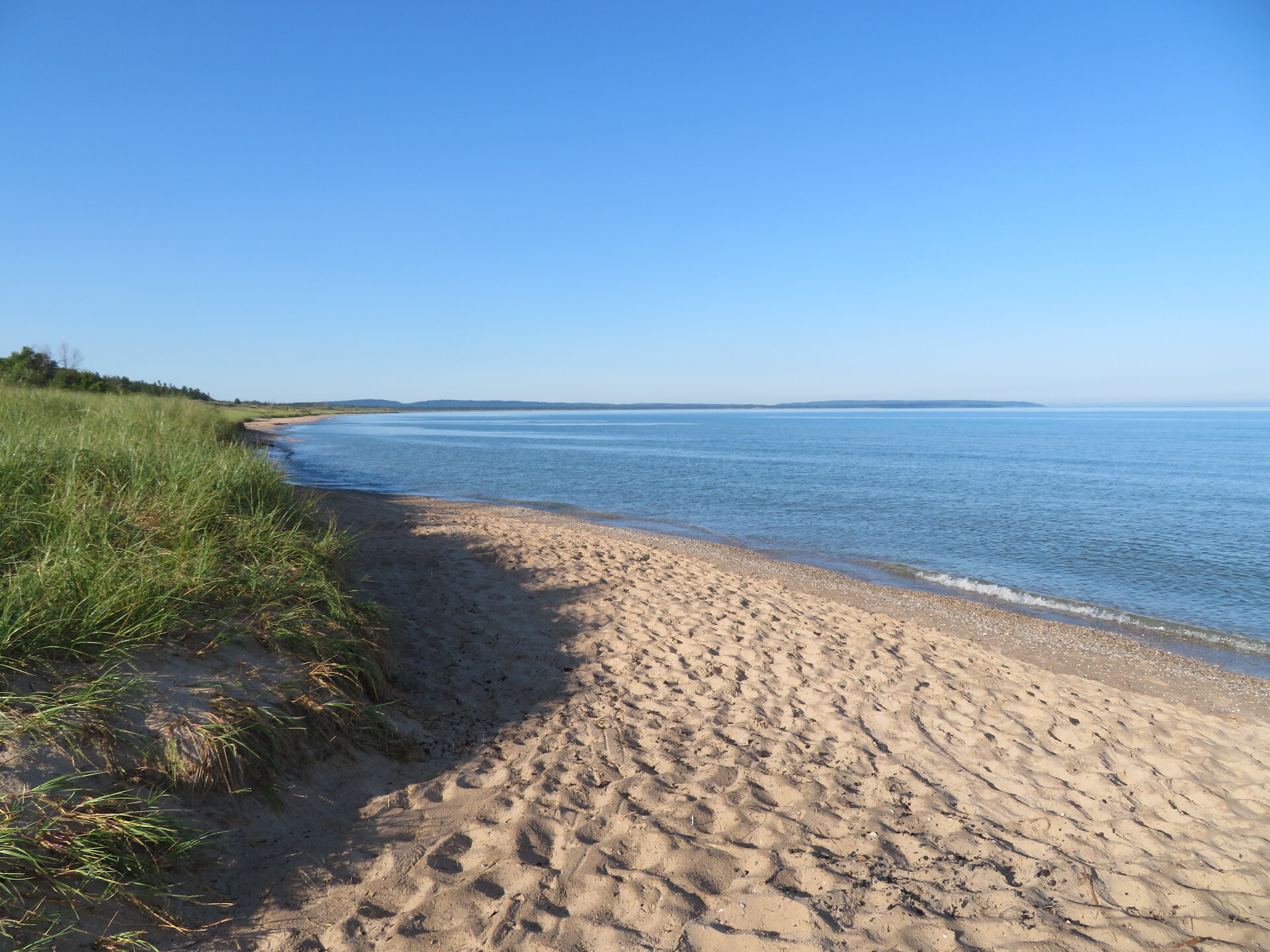
Coastal dunes and beach on the Great Lakes looking north
Great Lakes coastal dunes and beach facing north. Photo: Wikimedia Commons (CC BY-SA 3.0).
Thumb Metro Traveler Rule Because Port Crescent is the closest dark-sky preserve to Southeast Michigan, clear-sky weekend parking lots can fill quickly. Arrive at dusk to claim a platform bench and park in reverse for a safe, low-beam exit after midnight.
Check Saginaw Bay Aurora ↗ Saginaw Bay Beaches Guide ↗ View on Google Maps · area only ↗
Stop 10 · Alcona County · Lake Huron Sunrise Coast

Negwegon State Park Dark Sky Preserve

Undeveloped Wilderness Beach · Bortle 2 Black · Summer Milky Way Core Horizon

Bortle 2 · SQM 21.82 State Dark Sky Preserve Milky Way Galactic Core King True Wilderness Sand Coast

Tucked away along an unpaved sand trail between Harrisville and Ossineke, Negwegon State Park is one of the most remote and undeveloped coastal wilderness sanctuaries in Michigan's Lower Peninsula. Officially protected as a State Dark Sky Preserve, it encompasses over 4,000 acres of coastal bogs, low dunes, and pristine white-sand beach where your only night companions are the wind and the surf.

While northern shorelines focus on the aurora, Negwegon holds a special place in astronomical science: it faces East and South-Southeast (160° azimuth) straight into the darkest waters of Lake Huron. During summer nights from June through September, this southern water horizon is Michigan's ultimate window for capturing the Milky Way Galactic Core—the dense star clouds of Sagittarius and Scorpius, silhouetted by massive interstellar dust lanes that block the light of billions of ancient suns.

Horizon Azimuth & Light Dome
160° SSE · Boundless Dark Lake Huron Horizon
Pristine pitch-black southern water horizon. Zero Canadian or Michigan municipal light domes south across the water. Unrivaled contrast for summer galactic dust lanes.
Night Gate Access 24-Hour Stargazing Access · Recreation Passport
Primary Targets Summer Milky Way Galactic Core (Jun–Sep), Zodiacal Light
Facilities & Terrain Rustic Sand Lot, Vault Toilet, Sand Footpath to Beach
Red-Light Protocol Mandatory on Wilderness Trail Walk-In
Remote pristine Great Lakes coastal wilderness beach looking out over open water
Undeveloped Great Lakes sandy wilderness coast. Photo: Wikimedia Commons (CC BY-SA 3.0).
Access & Vehicle Advisory The access road into Negwegon is seasonal sand and dirt. During wet spring freezes or after heavy rain, deep sand ruts require cautious driving or all-wheel drive. Cell service is minimal; download your maps offline before departing US-23.
Open Meteor Shower Tracker ↗ Michigan Dark-Sky Directory ↗ View on Google Maps · area only ↗
Stop 11 · Presque Isle County · Northern Lake Huron

Thompson's Harbor State Park Dark Sky Preserve

7.5 Miles of Limestone Cobble · Bortle 2 Dark · Remote Presque Isle Coastal Shelf

Bortle 2 · SQM 21.80 State Dark Sky Preserve Rustic Coastal Trails Zodiacal Light Haven

Guarding over 5,000 acres of ancient coastal dunes, limestone fens, and northern cedar forest along US-23, Thompson's Harbor State Park protects 7.5 miles of undeveloped Lake Huron shoreline. Designated as a Michigan State Dark Sky Preserve, this rugged coastal park offers some of the purest, least-traveled dark skies anywhere in the Great Lakes basin.

Reaching the shoreline requires a peaceful 0.5-mile to 1-mile walk along marked footpaths beneath a cathedral of cedar and birch. When you emerge onto the limestone cobble beach, you face north-northeast (030° azimuth) into the dark reaches of Lake Huron between Rogers City and Cheboygan. In early spring before astronomical twilight, this low-dust corridor is one of the Midwest's best locations for photographing the Zodiacal Light—the eerie, triangular pyramid of sunlight reflected off interplanetary dust grains along the plane of the solar system.

Horizon Azimuth & Light Dome
030° NNE · Lake Huron Coastal Cobble Shelf
Open water northeast toward northern Lake Huron. Zero light pollution from Canada or Cheboygan. Pristine dark sky corridor.
Night Gate Access 24-Hour Dark Sky Exemption · Recreation Passport
Primary Targets Aurora (Kp 4.5+), Zodiacal Light, Andromeda Galaxy (M31)
Facilities & Terrain Trailhead Parking off US-23, Rustic Trails, Cobble Beach
Red-Light Protocol Red Headlamp Required for night trail walk-in
Northern Lake Huron coastal shoreline cobble and beach
Presque Isle County Lake Huron coastline. Photo: Wikimedia Commons (CC BY-SA 3.0).
Trail Navigation Alert You will be walking marked woodland trails in total darkness to reach the shore. Bring a primary red headlamp, a backup red flashlight, and ensure your smartphone compass or handheld GPS is active before leaving your vehicle.
Check Northern Huron Aurora ↗ Presque Isle Lighthouses Guide ↗ View on Google Maps · area only ↗
Stop 12 · Alpena County · Presque Isle Coastal Basin

Rockport State Recreation Area Dark Sky Preserve

Historic Deep-Water Shipping Pier · Limestone Quarry Basin · Telescope Friendly

Bortle 2 · SQM 21.76 State Dark Sky Preserve Solid Telescope Pier 360° Quarry Dome

Encompassing over 4,200 acres along Lake Huron north of Alpena, Rockport State Recreation Area is an officially protected Michigan State Dark Sky Preserve with an industrial heritage that amateur astronomers adore. Once a bustling limestone shipping port, it now offers the most vibration-free, structurally solid observation platform in Michigan.

The centerpiece of Rockport is the massive concrete deep-water shipping pier extending directly into Lake Huron, surrounded on three sides by pure darkness. For telescope operators, motorized equatorial mounts, and heavy astrophotography rigs, this immovable pier eliminates the ground tremors that plague sandy beaches. Looking northeast across the water toward Middle Island (045° azimuth), the sky is pitch black, with Alpena's southern light dome blocked by high limestone quarry walls.

Horizon Azimuth & Light Dome
045° NE · Deep-Water Lake Huron Pier Overlook
Completely unhindered northeast water horizon over Lake Huron toward Middle Island. Alpena's southern light dome is shielded by inland limestone bluffs.
Night Gate Access 24-Hour Dark Sky Exemption · Recreation Passport
Primary Targets Telescope Planetary/Nebulae Viewing, Kp 4.5+ Aurora
Facilities & Terrain Paved Access Road, Deep-Water Pier, Level Gravel Surface
Red-Light Protocol Strict Red-Light · Watch pier water edges
Historic deep-water shipping pier at Rockport State Recreation Area extending into Lake Huron
Rockport deep-water pier jutting into Lake Huron. Photo: Wikimedia Commons (CC BY-SA 4.0).
Pier Safety at Night The old limestone shipping pier has no safety railings along its outer edges. Use a red headlamp at all times when walking the pier structure, wear sturdy boots, and maintain at least 6 feet of clearance from water drop-offs.
Check Alpena Aurora Forecast ↗ Shipwreck Viewing Field Guide (Alpena Wrecks) ↗ View on Google Maps · area only ↗

Dark-Sky Ranger Golden Rules: Night Vision & Leave No Trace

Preserving world-class darkness on Michigan's coastlines requires disciplined, community-minded etiquette. Follow these four non-negotiable rules whenever visiting a state preserve or lakeshore:

Frequently Asked Questions: Michigan Night Skies & Auroras

What Kp index is required to see the northern lights in Michigan?

At northern Lake Superior shorelines like the Keweenaw Peninsula, Whitefish Point, or Pictured Rocks (46.5°N to 47.5°N), a photographic green arc or faint naked-eye auroral band is regularly visible on an open water horizon at Kp 4.0 to Kp 4.5. Overhead auroral curtains with distinct purples and dancing pillars typically require Kp 5.5 to Kp 6.0 in the Upper Peninsula, and Kp 6.5 to Kp 7.0 in Southern Lower Michigan.

Why is an open water northern horizon so critical for Michigan aurora viewing?

Because Michigan sits between 41.7°N and 47.4°N, moderate aurora storms (Kp 4–5) generate an auroral oval located hundreds of miles to the north over Ontario and Hudson Bay. This places the visible ribbons just 5° to 15° above the northern horizon. If you are surrounded by trees or facing south/west toward cities, tree lines block the view and artificial light domes wash out the contrast. Looking north across Lake Superior or northern Lake Huron offers 100 to 160 miles of zero light pollution down to the waterline.

Are Michigan State Park Dark Sky Preserves open all night?

Yes. While standard Michigan State Park day-use areas close at 10:00 PM, state law and Michigan DNR operational orders explicitly permit 24-hour access for visitors actively stargazing and observing the night sky in designated state dark-sky preserves (such as Port Crescent, Wilderness, Negwegon, Thompson's Harbor, and Rockport), provided vehicles display a valid Michigan Recreation Passport. Pitching unauthorized tents or overnight camping in day-use parking lots remains strictly prohibited.

What is the red-headlamp rule at dark-sky parks?

Human retinas require 20 to 30 minutes in total darkness to synthesize rhodopsin (visual purple), which allows the human eye to detect faint deep-sky nebulae and auroral greens. A single pulse of white flashlight or smartphone screen light bleaches rhodopsin in milliseconds, resetting night vision adaptation for half an hour. Red light (wavelength above 620nm) does not destroy rhodopsin. Park etiquette requires turning on red lights before exiting your vehicle and pointing beams at your feet.

How do you photograph the northern lights or Milky Way on an iPhone or Android phone?

Mount the phone securely to a rigid tripod or wedge it against a rock—handheld shots will blur. On iPhone, open Camera, tap the Night Mode moon icon, and slide the exposure duration to maximum (10 seconds handheld, or 30 seconds once the gyroscope senses total tripod stability). On Google Pixel, switch to Night Sight; when motionless, the shutter button transforms into an Astrophotography star icon (taking up to 4 minutes of stacked exposures). Always use a 3-second self-timer so your finger tap does not shake the sensor.

When is the best time of year to see the Milky Way vs. the Northern Lights in Michigan?

The Galactic Core of the Milky Way is a summer target: it rises in the southern sky (constellations Sagittarius and Scorpius) and is best viewed on moonless nights from late May through September. The Northern Lights occur year-round but peak around the spring (March-April) and autumn (September-October) equinoxes due to the Russell-McPherron effect, when Earth's magnetic dipole tilts favorably to couple with the interplanetary magnetic field.