Skip to Michigan winter trails
Chris Izworski

Michigan Winter Trails / Winter field guide

Snowshoe, ski & fat-tire trails—sorted by winter rules.

A summer trail map can send a winter driver down an unplowed seasonal lane or put snowshoes straight into a groomed classic ski track. Explore 15 audited Michigan winter trail systems and 50 named DNR and NPS loops with track etiquette, fat-tire windows, bridge closures, and live snow-depth handoffs.

Explore the 15 trail systems

15 trail systems · 50 named DNR/NPS loops · 7 quarantined winter blockers · access evidence reviewed October 28, 2026 · no live plowing claims

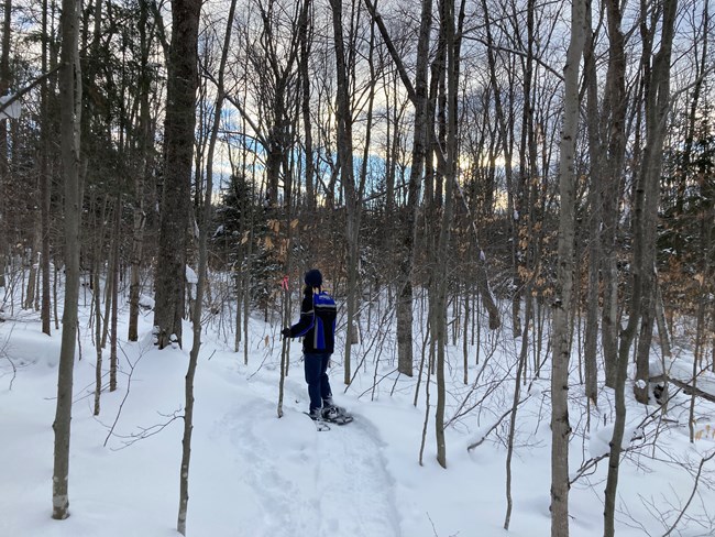
Snow-covered hemlocks and deep powder along the marked Munising Snowshoe Trail at Pictured Rocks National Lakeshore
Photo: National Park Service · NPS public-domain guidance · Munising Snowshoe Trail, January 2021
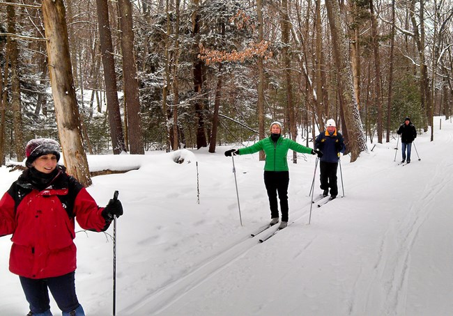
Cross-country skier gliding along a snowy corridor at Sleeping Bear Dunes National Lakeshore
Photo: National Park Service · NPS public-domain guidance · Sleeping Bear XC skiing
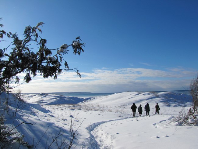
Visitors snowshoeing across deep snow in Sleeping Bear Dunes National Lakeshore
Photo: National Park Service · NPS public-domain guidance · Sleeping Bear snowshoeing
01 · Dedicated snowshoe loopsMarked singletrack where classic ski rails aren't set
02 · Ski-shared pathwaysParallel classic tracks + outer snowshoe lane
03 · Fat-tire & boot windowsDec 15–Mar 15 dune window, microspikes & seasonal roads

Official DNR & GIS winter access audit · source checked Oct 28, 2026

Hartwick Pines Au Sable footbridge closure, Tahquamenon ski-only loop & unplowed seasonal roads.

1. Hartwick Pines State Park: The DNR park notice and official trail map document an indefinite footbridge closure on the 3.0-mile Au Sable River Foot Trail—making it out-and-back only rather than a complete loop (and raw state GIS layers conflict with the published winter map). 2. Tahquamenon Falls State Park: The Upper Falls 1.0-mile Lantern Loop is cross-country ski only (snowshoes prohibited), and the 4–5 mile River Trail between Upper and Lower Falls is not maintained in winter. 3. Anderson Lake & Negwegon approaches: Anderson Lake State Forest Campground roads are unplowed in winter, and Negwegon's 3.5-mile Sand Hill Road approach is unpaved and rough in snow. Open Tahquamenon Upper winter map (PDF) ↗

Check Hartwick Pines DNR notice ↗

Understanding winter trail rules

Four very different kinds of winter tread

Use this decoder to match your snowshoes, classic skis, fat-tire bike or microspikes to the right corridor before stepping onto the snow.

TRAIL MODE 01 · DEDICATED SNOWSHOE

Marked snowshoe loops keep you clear of classic ski tracks

Dedicated snowshoe loops—such as Pictured Rocks Munising Snowshoe Trail (2.65 mi), Tahquamenon Lower Falls Green (1.6 mi) and Blue (2.4 mi) loops, and Vasa Pathway Orange (1.5 mi), Green/Yellow (0.6 mi) and Red (0.25 mi) loops—give snowshoers their own singletrack without crossing set ski rails.

Even at parks with dedicated snowshoe loops, watch for ski-only boundaries: Tahquamenon Upper Falls 1.0-mile Lantern Loop is cross-country ski only.

The winter trail atlas

Choose your Michigan winter trail system.

Browse 15 researched trail systems by primary mode, Michigan region, loop effort and winter access documentation. “Documented” means an official winter trail map or seasonal guidance page exists, not that the parking lot is plowed today.

15 researched trail systems, with 50 named loops, official sources and seasonal road limitations.

Snow-draped hemlocks and deep Lake Superior snowbelt powder along the Munising Snowshoe Trail in Pictured Rocks National Lakeshore
Photo: National Park Service · NPS public-domain guidance · Munising Snowshoe Trail, January 2021

Munising · Pictured Rocks · easy · 2.65 mi

Pictured Rocks — Munising Snowshoe Trail

Documented winter trail page · not a current-open report

A dedicated 2.65-mile snowshoe loop winding through snowbelt hemlock and northern hardwood forest near Munising—giving snowshoers a marked Lake Superior snow-belt loop without crossing set classic ski tracks.

Audited NPS route: Munising Snowshoe Trail (2.65 mi loop · dedicated snowshoe singletrack)

NPS documents this marked snowshoe trail alongside sand beach and Sand Point snowshoe exploring.

The approachCheck NPS winter alerts and start from the signed Munising Snowshoe Trail access; bring full snowshoes after Lake Superior lake-effect squalls.

Important: The adjacent Munising Falls canyon trail remains closed until further notice following the April 2025 washout and 2026–2027 repair contract. On groomed Munising ski trails, never walk or snowshoe on the set ski track.

Lower Tahquamenon Falls cascades surrounded by leafy forest in August 2020, not a winter snow photograph
Photo: Joe Passe · CC BY-SA 2.0 · display crop · Actual Lower Falls · August 2020 · summer reference, not winter snow

Paradise · Tahquamenon Lower Falls · moderate · 1.6 & 2.4 mi

Tahquamenon Lower Falls — Green & Blue Snowshoe Loops

Documented winter trail map · not a current-open report

Two dedicated winter snowshoe loops mapped on the official Michigan DNR Lower Falls Winter Trail Map, pairing boreal forest snowshoeing with winter overlooks of the Lower Tahquamenon cascades.

Audited DNR routes: Green Snowshoe Trail (1.6 mi loop) · Blue Snowshoe Trail (2.4 mi loop) · Lower Falls Boardwalk Overlook (0.6 mi)

Published on the official DNR Lower Falls Winter Trail Map PDF with marked winter parking and snowshoe routing.

The approachStart from the DNR winter-map parking off M-123 and plan for roughly a one-mile winter walking or snowshoe approach if the inner summer concession loop is gated.

Important: The 4–5 mile River Trail connecting Lower Falls to Upper Falls is not maintained in winter per the official DNR winter map—do not attempt it as a casual afternoon walk.

Upper Tahquamenon Falls with winter snow and river ice in January 2004
Photo: James Phelps · CC BY 2.0 · display crop · Upper Falls, January 2004

Paradise · Tahquamenon Upper Falls · easy · 0.75 & 1.0 mi

Tahquamenon Upper Falls — Packed Walk & Marked Snowshoe Corridor

Documented winter trail map · not a current-open report

Michigan's signature winter waterfall walk pairs a packed forest footpath to the 200-foot-wide Upper Falls brink with a separate 1.0-mile marked snowshoe loop—and a strict ski-only boundary on the Lantern Loop.

Audited DNR routes: Upper Falls Brink & Gorge Walk (0.75 mi) · Marked Snowshoe Trail (1.0 mi loop) · Quarantined for foot/snowshoe: Lantern Loop (1.0 mi · Ski-only)

DNR maintains the Upper Falls winter day-use lot off M-123 and publishes a dedicated Upper Falls Winter Trail Map.

The approachEnter at the Upper Falls day-use area off M-123; bring microspikes for packed snow on the gorge viewing steps or snowshoes for the 1.0-mile forest loop.

Important: The 1.0-mile Lantern Loop is designated cross-country ski only—snowshoes and winter boots are prohibited on the Lantern Loop.

Paradise · Whitefish Bay snowbelt · moderate · 1.6–3.4 mi

Paradise Pathway — Three Ungroomed U.P. Loops

Conditional winter arrival · not a current-open report

Three stacked state forest pathway loops just west of Paradise on M-123 where backcountry classic skiers and snowshoers share quiet pine ridges without commercial resort crowds.

Audited DNR routes: South M-123 Loop (1.6 mi) · North M-123 Loop (3.2 mi) · North Ridge Loop (3.4 mi)

Trailhead sits directly off paved state highway M-123, avoiding deep seasonal forest roads, though turn-in snowbank clearance varies after squalls.

The approachApproach via M-123 near Paradise and expect ungroomed, skier-tracked snow across all three loops.

Important: When skiers have broken a two-track glide line through deep snow, snowshoers should break a parallel line to the side rather than postholing the ski track.

Eastern U.P. · Chippewa County · demanding · 2.0 & 5.7 mi

Pine Bowl Pathway — Short & Long Ridge Loops

Conditional winter arrival · not a current-open report

A classic hilly Eastern Upper Peninsula state forest pathway near the Pine River with a manageable 2.0-mile inner loop and a demanding 5.7-mile outer ridge circuit.

Audited DNR routes: Pine Bowl Short Loop (2.0 mi) · Pine Bowl Long Outer Loop (5.7 mi) · Caution: Full 5.9-mi ski network has steep wooded descents

Managed by the DNR Sault Ste. Marie forest unit; steep glacial ridges reward experienced Nordic skiers while the 2.0-mile loop suits shorter outings.

The approachVerify rural county road plowing before turning toward the trailhead; choose the 2.0-mile Short Loop unless prepared for steep hills.

Important: Keep snowshoes off set downhills on the outer 5.7–5.9 mile network where skiers cannot easily snowplow or step out of tracks.

Escarpment and hardwood basin at Porcupine Mountains Wilderness State Park in autumn, not a winter snow photograph
Photo: Stevenliuyi · CC BY-SA 4.0 · display crop · Porcupine Mountains · autumn reference, not winter snow

Ontonagon · Western U.P. · demanding · Nordic & snowshoe network

Porcupine Mountains — Winter Nordic & East M-64 Approach

Seasonal road closures · not a current-open report

Western Upper Peninsula old-growth wilderness where 200+ inches of seasonal lake-effect snow close the summer M-107 escarpment highway and concentrate winter travel onto the Porkies Nordic ski and snowshoe network near the ski area.

Audited DNR routes: Porkies Nordic Ski & Snowshoe Network (East M-64 / Ski Hill hub) · Seasonal gate: M-107 to Lake of the Clouds closed to cars

DNR operates the Porcupine Mountains Winter Sports Complex and surrounding Nordic/snowshoe trails at the eastern M-64 entrance near Silver City.

The approachRoute to the eastern M-64 park entrance near Silver City and the Porkies Winter Sports Complex; never attempt to drive closed interior summer roads.

Important: M-107 west to Lake of the Clouds and South Boundary Road are closed to wheeled vehicles in winter and serve as snowmobile corridors.

Traverse City · Vasa Pathway · easy · 0.25, 0.6 & 1.5 mi

Vasa Pathway — Dedicated Snowshoe Loops

Documented winter trail map · not a current-open report

Traverse City's flagship winter trailhead separates snowshoers and winter walkers onto three color-coded snowshoe loops so the championship 3K, 5K, 10K and 25K Nordic ski courses stay fast and undisturbed.

Audited DNR routes: Vasa Orange Snowshoe Loop (1.5 mi) · Vasa Green/Yellow Snowshoe Loop (0.6 mi) · Vasa Red Snowshoe Loop (0.25 mi)

DNR and TART Trails publish dedicated color-coded snowshoe loops starting from the Bartlett Road Vasa Trailhead.

The approachAccess via the Bartlett Road trailhead east of Traverse City and follow the color-coded snowshoe blazes rather than the wide ski deck.

Important: Walking or snowshoeing on the groomed 3K, 5K, 10K and 25K cross-country ski courses is prohibited; stay on the marked snowshoe loops.

Traverse City · Vasa Corridor · moderate · groomed singletrack

Vasa Pathway — Winter Fat-Bike & Groomed Corridor

Conditional snow-crust rules · not a current-open report

Sharing the Vasa corridor coordinates near Traverse City, the groomed Winter Sports Singletrack gives fat-tire riders a dedicated packed snow ribbon—strictly separate from the ski-only loops and dependent on sub-freezing crust.

Audited DNR/TART corridor: Vasa Winter Sports Singletrack (groomed fat-bike corridor · wide tires & low PSI required)

Provides a dedicated northern Michigan winter fat-bike singletrack experience adjacent to the Vasa trailhead network.

The approachCheck current grooming and freeze state before riding; air fat tires down (often 3–5 PSI) so tires float on top of the snow deck.

Important: Do not ride fat bikes on the Nordic ski loops unless explicitly signed, and turn back if warm temperatures cause tires to leave ruts deeper than 1 inch.

Cross-country skier gliding along a snow-covered trail in Sleeping Bear Dunes National Lakeshore
Photo: National Park Service · NPS public-domain guidance · Sleeping Bear XC skiing

Empire & Glen Arbor · Sleeping Bear Dunes · moderate · 1.5–5.0 mi

Sleeping Bear Dunes — Heritage Trail & 10 Ski/Snowshoe Loops

Documented NPS winter page · not a current-open report

Northern Lower Michigan's deepest National Park Service winter trail roster: the groomed Sleeping Bear Heritage Trail plus 10 named mainland loops spanning coastal perched bluffs, historic farmsteads, and maple-beech hills.

All 10 audited NPS loops + Heritage Trail: Heritage Trail (groomed classic/skate) · Empire Bluff (1.5 mi) · Cottonwood (1.5 mi) · Windy Moraine (1.5 mi) · Pyramid Point (2.7 mi) · Treat Farm (2.8 mi) · Platte Plains (3.3 mi) · Good Harbor Bay (3.5 mi) · Duneside (3.7 mi) · Bay View (4.6 mi) · Shauger Hill (5.0 mi)

NPS grooms the Heritage Trail for classic and skate skiing and documents all mainland backcountry ski/snowshoe trailheads along M-22 and M-109.

The approachUse mainland trailheads off M-22 and M-109 (Pierce Stocking Scenic Drive itself is closed to cars in winter, with winter parking at the entrance lot).

Important: Never walk or snowshoe on set parallel ski tracks on the Heritage Trail or Scenic Drive, and note that pets are prohibited on the Heritage Trail from December 1 through March 31.

Visitors snowshoeing through deep snow drifts at Sleeping Bear Dunes National Lakeshore
Photo: National Park Service · NPS public-domain guidance · Sleeping Bear snowshoeing

Glen Arbor · Sleeping Bear Dunes · moderate · 2.5 & 3.1 mi

Sleeping Bear Dunes — Alligator Hill & Bluff Snowshoe Approaches

Documented NPS winter page · not a current-open report

High-elevation moraine loops above Glen Lake and the Manitou Passage where deep Lake Michigan snow-belt squalls reward full snowshoe floatation and winter bluff photography.

Audited NPS routes: Alligator Hill Easy/Intermediate Loop (3.1 mi) · Old Indian Trail Loop (2.5 mi)

NPS documents Alligator Hill off Stocking Drive / Forest Haven Rd and Old Indian Trail off M-22, plus January–February ranger-led snowshoe hikes from Empire.

The approachStart from the Stocking Drive / Forest Haven Rd trailhead near Glen Arbor for Alligator Hill or M-22 for Old Indian Trail.

Important: Never descend steep Lake Michigan sand bluffs in winter—snow-covered dune faces hide unstable cornices and icy 400-foot slopes.

Towering white pines along the forest footpath in Hartwick Pines State Park in July 2016, not a winter snow photograph
Photo: Guettarda · CC BY-SA 4.0 · display crop · Hartwick Pines · July 2016 · summer forest reference, not winter snow

Grayling · Hartwick Pines State Park · easy · 1.25 & 2.0 mi

Hartwick Pines — Old Growth Forest Loop & Mertz Grade

Documented winter park page · not a current-open report

Walk or snowshoe beneath 160-foot old-growth white pines just off I-75 in Grayling—with an audited warning about the indefinite Au Sable River Foot Trail bridge closure.

Audited DNR routes: Old Growth Forest Foot Trail (1.25 mi loop) · Mertz Grade Pathway (2.0 mi loop) · Quarantined as loop: Au Sable River Foot Trail (3.0 mi · Bridge closed indefinitely)

Direct paved access off M-93 just east of I-75 Exit 259 with a plowed main visitor center parking lot.

The approachUse microspikes or snowshoes on the 1.25-mile Old Growth Forest loop, or snowshoes/skis on the 2.0-mile Mertz Grade loop.

Important: The footbridge on the 3.0-mile Au Sable River Foot Trail is closed indefinitely per the DNR park notice—visitors can hike out-and-back only, not a continuous loop.

Unpaved Sand Hill entrance road winding through forest at Negwegon State Park in August 2020, not a winter snow photograph
Photo: Notorious4life · CC0 1.0 · display crop · Negwegon Sand Hill Rd · August 2020 · unpaved road reference, not winter snow

Black River / Alpena · Negwegon State Park · demanding · 3.1–3.7 mi

Negwegon State Park — Lake Huron Backcountry Loops

Unpaved seasonal approach · not a current-open report

Over 10 miles of undeveloped Lake Huron coastal pine, bog, and beach-ridge trails for self-reliant winter snowshoers and backcountry skiers—guarded by a rough 3.5-mile unpaved entrance road.

Audited DNR routes: Potawatomi Trail (3.6 mi loop) · Algonquin Trail (3.7 mi loop) · Chippewa Trail (3.1 mi loop)

Three interconnected backcountry loops mapped on the official DNR Negwegon trail map along undeveloped Lake Huron shoreline.

The approachConfirm Sand Hill Road snow conditions before leaving US-23 / Black River Road; carry offline maps and vehicle recovery gear.

Important: Reaching the parking area requires ~3.5 miles on unpaved Sand Hill Road, which is rough even in summer and not reliably passable for low-clearance sedans in deep snow.

Expansive open sand dunes between Silver Lake and Lake Michigan at Silver Lake State Park
Photo: Dale Fisher / USACE · NPS public-domain / USACE public domain · Silver Lake Dunes · archival dune terrain reference

Mears · Silver Lake State Park · moderate · Dec 15–Mar 15 window

Silver Lake State Park — Winter Fat-Tire Dune Window

Documented Dec 15–Mar 15 season · not a current-open report

Once ORV season closes for winter, Michigan DNR opens Silver Lake's 450-acre open dune sea to fat-tire bicycles from December 15 through March 15—creating one of the Midwest's most unusual winter rides.

Audited DNR winter rule: Silver Lake Open Dune Fat-Bike Window (Dec 15–Mar 15 · minimum 3.5-inch tire width required)

DNR explicitly establishes the December 15 through March 15 fat-tire bike window and 3.5-inch minimum tire width on the Silver Lake State Park page.

The approachAccess via the Silver Lake ORV parking lot during the December 15–March 15 window with a Michigan Recreation Passport and tires at least 3.5 inches wide.

Important: Fat biking on the open dunes is allowed only Dec 15–Mar 15; stay within designated boundaries and never ride onto Lake Michigan shelf ice.

Timber blockhouse overlook above forested dunes at Muskegon State Park in March 2019
Photo: rossograph · CC BY-SA 4.0 · display crop · Muskegon State Park Blockhouse, March 2019

North Muskegon · Muskegon State Park · moderate · 8 loops (0.3–3.1 mi)

Muskegon State Park — Dune Ridge, Lost Lake & Winter Complex

Documented winter park page · not a current-open report

Eight distinct wooded dune, bog, and Lake Michigan ridge loops right alongside the Muskegon Luge Adventure Sports Park—making this West Michigan's most versatile winter trail hub.

All 8 audited DNR loops: South Loop (0.3 mi) · Scenic Loops (1.2 mi) · Dune Ridge (1.4 mi) · Nordic Loop (1.7 mi) · Devils Kitchen (2.2 mi) · Lost Lake (2.5 mi) · Hearty Hiker (2.5 mi) · Water Tower (3.1 mi)

Scenic Drive and the Winter Sports Complex lots are active all winter, offering both free state park foot/snowshoe loops and ticketed lighted Nordic/snowshoe trails.

The approachUse the Blockhouse, Lost Lake or Snug Harbor trailheads for state park hiking/snowshoe loops, or the Luge Adventure Sports Park for lighted groomed trails.

Important: Keep winter boots off the groomed Nordic ski tracks at the Winter Sports Complex, and never walk out onto Lake Michigan ice shelves.

Snow-covered reeds and frozen marsh channels at Tobico Marsh in Bay City State Park during February 2016
Photo: Guettarda · CC BY-SA 4.0 · display crop · Tobico Marsh in winter, February 2016

Bay City · Saginaw Bay · easy · 0.9, 1.3 & 5.1 mi

Bay City State Park — Tobico Marsh & Saginaw Bay Loops

Conditional winter surface · not a current-open report

Flat, family-friendly winter walking, snowshoeing, and cross-country skiing around one of the largest coastal wetlands on the Great Lakes—paired with winter bald eagle and waterfowl viewing along Saginaw Bay.

Audited DNR routes: Tobico Marsh Trail (5.1 mi loop) · Lagoon Trail (1.3 mi loop) · Frank N. Andersen Nature Trail (0.9 mi loop)

Paved year-round highway access off M-247 north of Bay City with level wetland loops and observation towers.

The approachBring microspikes when freeze-thaw cycles glaze the paved/packed marsh loop, or snowshoes/touring skis after fresh Saginaw Bay snow.

Important: Stay on land trails and observation decks—never walk onto Tobico Lagoon or Saginaw Bay ice from the marsh trails.

Statewide DNR & NPS Winter Route Audit · 50 Curated Loops + 7 Quarantined Blockers

5 Additional Audited Park Systems & 7 Quarantined Winter Blockers

Together with the 15 primary dossiers above, these five additional Michigan state parks and forest pathways complete all 50 audited loops in our winter trail dataset—followed by the seven routes explicitly quarantined from casual winter walking.

Boyne Falls · 2 Audited Loops (1.5 & 0.5 mi)

Spring Brook Pathway

Loop 1 (1.5 mi) and Cutoff Loop (0.5 mi) wind through northern hardwoods and conifers off M-75 / Chandler Hill Rd near Boyne Mountain. Open to XC skiing and snowshoeing; turn-in plowing varies.

DNR Spring Brook Pathway ↗
Lake Huron · 5 Audited Loops (0.5–2.0 mi)

Harrisville State Park

Includes the 2.0-mile paved/packed Heritage Trail plus four Cedar Run Loops (0.5, 0.8, 1.3 and 1.6 mi) through cedar and pine forest along US-23 just south of Harrisville.

DNR Harrisville State Park ↗
Port Austin · 3 Audited Loops (0.9–4.1 mi)

Port Crescent State Park

Gold (0.9 mi), Yellow/Brown (2.0 mi) and Red (4.1 mi) loops. Coordinate split: main entrance (44.0005, -83.0596) and day-use trailhead (43.9879, -83.0811) sit ~2 miles apart along M-25.

DNR Port Crescent State Park ↗
Stevensville · 2 Audited Loops (0.5 & 1.6 mi)

Grand Mere State Park

Paved Accessible Loop (0.5 mi) and Sand Trails (1.6 mi) behind Lake Michigan dunes. Winter caution: active hunting zone in season (wear blaze orange) and never climb icy coastal dune faces.

DNR Grand Mere State Park ↗
St. Clair River · 2 Audited Loops (1.5 & 1.5 mi)

Algonac State Park

Blazing Star Prairie (1.5 mi) and Oak Savanna (1.5 mi) flat lakeplain loops along M-29 near St. Clair River freighter viewing. Expect wet or icy freeze-thaw footing in mid-winter.

DNR Algonac State Park ↗

Why 7 Michigan Routes Are Quarantined from Casual Winter Walking

Our route-access audit explicitly quarantines seven routes where unplowed roads, closed bridges, or ski-only rules block winter foot travel:

  • 1–3. Anderson Lake Pathway Loops 1–2 (1.3 mi), 1–3 (3.0 mi) & 1–4 (4.2 mi) · Marquette County: Quarantined (UNPLOWED_SEASONAL_ROAD) — DNR warns that Anderson Lake State Forest Campground and pathway access roads are not plowed in winter.
  • 4. Hartwick Pines Au Sable River Foot Trail (3.0 mi) · Crawford County: Quarantined as a loop (BRIDGE_CLOSED_OUT_AND_BACK + GIS_VS_PDF_MISMATCH) — indefinite footbridge closure restricts travel to out-and-back only.
  • 5. Tahquamenon Upper Falls Lantern Loop (1.0 mi) · Luce County: Quarantined for snowshoers/walkers (SKI_ONLY_NO_SNOWSHOE) — official DNR Upper Falls Winter Trail Map designates the Lantern Loop as cross-country ski only.
  • 6. Muncie Lakes Pathway Full Network (9.8 mi) · Grand Traverse County: Quarantined for casual winter boot hikes (SKI_NETWORK_COMPLEXITY) — multi-junction groomed ski network where casual walkers risk postholing set tracks.
  • 7. Pine Bowl Pathway Full Ski Network (5.9 mi) · Chippewa County: Quarantined for beginner winter walkers (SKI_NETWORK_STEEP_DESCENTS) — outer hills feature steep wooded descents best reserved for experienced skiers or snowshoers using the 2.0-mile Short Loop (#05).

The non-negotiable winter trail rules

Respect the ski track. Never trust a seasonal road in January.

Snow depth is not grooming, and a summer trailhead pin is not a plowed winter parking lot. Stay off parallel classic ski rails when walking or snowshoeing, obey seasonal fat-tire windows and pet rules, never descend steep Lake Michigan or Lake Superior bluff faces in winter, and verify live snow and road conditions before leaving a paved highway.

Michigan DNR winter recreation ↗ · Sleeping Bear winter rules ↗ · Michigan DNR closures ↗