St. Lawrence SeawayFollow the ships. Understand the journey.
A freighter slips between concrete walls. The gates close, the water rises, and an ocean-going ship takes another step inland. Find recent ship reports, choose a public place to watch, and explore the engineering that makes the journey possible.
Freshness and coverage vary along the river. We do not infer lock occupancy, queue order or arrival times from AIS. Times are Eastern. For shore viewing; not for navigation.
A place to watch
Make a little room for the river.
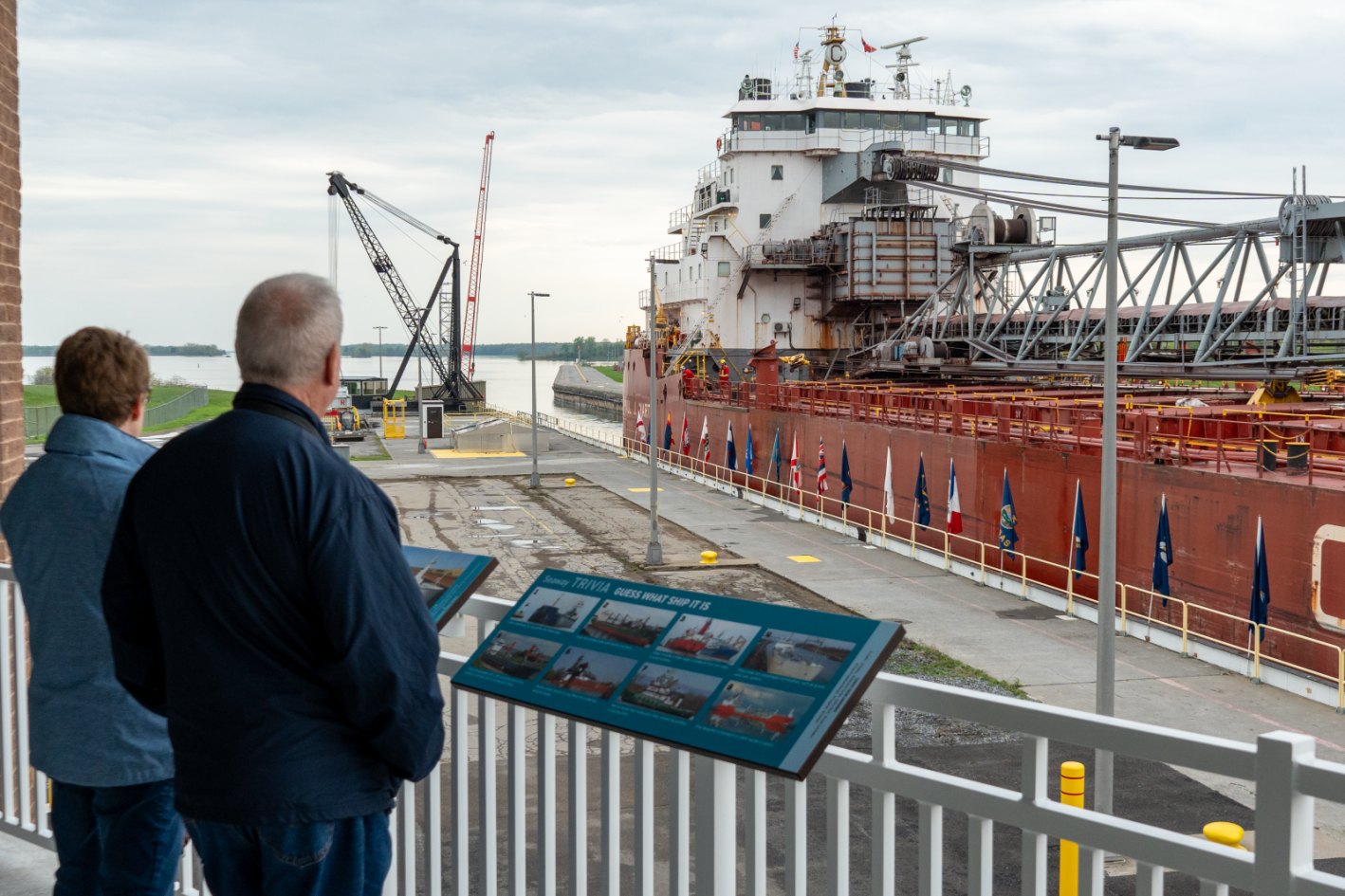
Seaway Visitor Center · Eisenhower Lock
Watch the chamber from the public observation decks, then step inside for exhibits and a ship-handling simulator. Leave room in your visit for a ship to arrive; the river keeps its own timetable.
76 Barnhart Island Road, Massena. Free admission. The operator currently lists 9 a.m.–5 p.m.; daily Memorial Day–Labor Day, Wednesday–Sunday outside peak season. Confirm current access before setting out.
Interactive educational model · not live telemetry
Choose a lock, then follow the gates, water and ship. The sequence is accelerated and schematic; real dimensions, operating steps and water levels vary.
Eisenhower · reference lift 11.6 m
1 · Enter the chamber at the starting water level.
Gates can open only after water levels on both sides match. Iroquois uses an illustrative 1.2 m adjustment here; its actual difference varies. Seaway reference booklet ↗
The Seaway's water staircase
Follow the seven locks from Montreal toward Lake Ontario. This chart adds the reference lift at each chamber; it is not a water-surface elevation profile. River gradients are omitted and the horizontal steps are equally spaced.
Choose a step to explore that lock.
Reference lifts and accessible chart data
Published approximate lifts; Iroquois shown as an illustrative adjustment.
Lock
Reference lift
Kind
Saint-Lambert
4.5 m
Lift lock
Côte-Sainte-Catherine
9.1 m
Lift lock
Lower Beauharnois
12.5 m
Lift lock
Upper Beauharnois
12.5 m
Lift lock
Bertrand H. Snell
13.7 m
Lift lock
Dwight D. Eisenhower
11.6 m
Lift lock
Iroquois
Variable · example 1.2 m
Control lock
An exercise in scale
How close is the fit?
The reference chamber is 233.5 m long and 24.4 m wide. Change the example ship, or use complete dimensions from a selected AIS report.
Illustrative ship dimensions. Not a selected ship or a clearance approval.
8.0 m of total reference length and 0.6 m of total width remain.
Total differences, not clearance on either side. This comparison does not establish draft, air draft, mooring requirements or permission to transit.
Choose the experience, then check the traffic
Two ways to spend time with the Seaway.
Close-up engineering · United States
Eisenhower Lock, Massena
Observation decks, exhibits and a working lock make this the first detailed stop in our Seaway guide. A ship passing through becomes a lesson in scale, water and patience.
South Dundas documents green space, parking and ship watching beside the control lock. Expect a river landscape and a comparatively small, variable water-level adjustment.
The Thousand Islands, Montreal and Beauharnois are available as ship-report regions. Public viewing inventory is still being verified there; a ship or lock marker does not establish shore access.
Look beyond a single afternoon
The shape of a shipping season.
These official BTS/GLS monthly records put the live map in seasonal context. They describe the published Seaway performance series, not counts at this selected lock, unique ships, or the number you will see during a visit.
Choose a month for its reported value.
Historical snapshot retrieved October 23, 2026. Missing values stay unreported, not zero. We use reviewed 2022–2024 monthly records; later source entries mix reporting dates and are not silently aggregated into this chart. BTS source data ↗
Read the monthly values as a table
Month · 2024
Commercial vessel transits
January
Not reported
February
Not reported
March
Not reported
April
226
May
252
June
230
July
204
August
224
September
238
October
279
November
274
December
290
Before you go
Keep the official desk within reach.
Shipping seasons, visitor hours and navigation operations have different clocks. Check the current notice and the selected lock's official order of turn before building a day around a ship.
Welland carries ships between Lake Ontario and Lake Erie through eight more locks. Continue into your existing canal guide for its ship map, lock stories and public viewing spots.
Use the regional map for recently received public AIS positions and the official Seaway map and vessel-transit information for source context. Our live reports cover selected areas from Montreal toward Lake Ontario, not the entire Atlantic-to-Great-Lakes waterway.
How many locks are in the St. Lawrence Seaway?
There are seven between Montreal and Lake Ontario and eight in the Welland Canal. Welland connects Lake Ontario and Lake Erie. The Soo Locks provide the separate connection toward Lake Superior.
Where is a good public place to watch a ship in a lock?
Eisenhower Lock in Massena has an official Seaway Visitor Center and observation decks. Iroquois Point is another documented public ship-watching location. Confirm access and current traffic before traveling.
Does no AIS report mean there are no ships?
No. A receiver gap, an older position or a source problem can leave the map without fresh reports. Use the official Seaway vessel-transit information and keep the report timestamps in view.
How this guide reads the river
Open Waters supplies recent public AIS reports from multiple contributors. We screen position ages, deduplicate ship identities and show received reports in five researched areas. Receiver coverage is not a complete traffic census. Official queue information remains at the Seaway source. The models are educational; the charts use dated historical records. Reference and access research reviewed October 23, 2026.