Chris Izworski / Lake Superior Circle Tour / 10-day field guide
Lake Superior field guide · 10 days · Duluth to Duluth

Lake Superior Circle Tour: ten days along the wild shore

Watch a freighter slip beneath Duluth's lift bridge. Walk the copper-colored cliffs of Pictured Rocks. Hear the big water at Tahquamenon, then follow Ontario's granite shore toward Thunder Bay.

This is the day-by-day trip I'd build around: one good experience at a time, overnight towns you can picture, and the tools to decide what makes sense on the day you're there. You can't see every park in ten days. That's the point of choosing well.

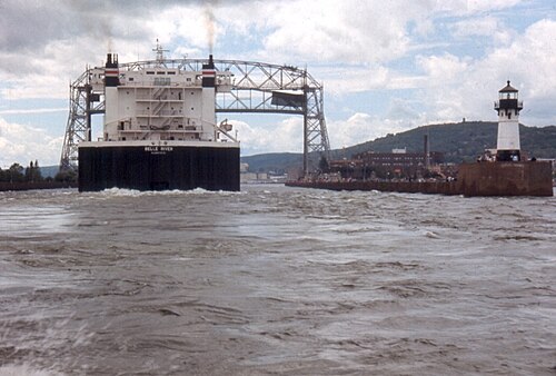
A large Great Lakes freighter approaching Duluth's ship canal and the harbor lighthouse
Duluth's ship canal: the working lake is part of the journey. Photo: Chris Light · CC BY-SA 4.0 · optimized thumbnail
10 daysTake a balanced loop, with choices for each stop
31 stops mappedThe complete route and all destinations are in the main explorer
2 crossingsCheck U.S. and Canadian entry requirements

Choose the experience, then use the right tool. Each day below pairs a real place and photograph with tools already built for that stretch of shore. Follow the planner links for current available observations, park-specific trade-offs and official sources. Day 9 is a long travel day; Day 10 includes a border crossing.

Need a different pace? Explore the full 7-, 10-, and 15-day itineraries.

Make this your trip · Source-checked planning

How much driving are you willing to trade for time at the lake?

Tell the planner how long you have, when you're traveling and what you love. It compares the actual 7-, 10-, and 15-day published routes, recommends places from those specific days, and points you to the tools that answer the next question. No fabricated extra road legs or lodging reservations.

Starting point: Duluth, Minnesota · Counterclockwise Lake Superior loop. To choose another start or direction, use the full 31-stop route map.

What makes this trip worth taking?

See where your preferences meet the road

Under a five-hour sample driving limit, days 7, 9 run too long. The final Pigeon River park approach still needs verification.

Without JavaScript, the ten-day photograph-rich field guide below and the full route map are still available.

The 15-day published route spreads the long northern Ontario stretch across two days, although it still needs independent road-approach and park-access checks.

The complete ten-day route with photographs, overnight suggestions and specialist tools is below. Browse the field guide.

The page remains readable without JavaScript. Interactive controls require a modern browser.

Driving figures are conservative editorial allowances, not traffic forecasts. Crossing reserves are unverified when official waits are absent. All parks, lodging, boat tours, border requirements and roads must be checked independently. No purchase or booking is made.

Ten days. Ten different stretches of shoreline.

From harbor towns to quiet bays, here's where I'd focus my time. The stop choices and photographs are destination-specific, not today's live conditions. Open a linked tool when a decision depends on current access or observations.

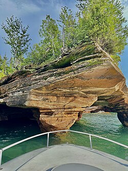
Red sandstone caves on an Apostle Islands shore
Apostle Islands sea caves; reaching them depends on conditions and the experience you book. Photo: DataThread · CC BY 4.0 · optimized thumbnail
DAY 01 · Harbors and islands

Bayfield

Room for a meaningful stop

Duluth → Superior → Bayfield. Apostle Islands afternoon; overnight Bayfield.

Begin where the freighters pass beneath Duluth's lift bridge. By evening, the coast has traded ore docks for the quiet harbors of Bayfield, where distant islands rise just above the horizon.

Which Bayfield experience will you actually have time for?

Use the afternoon for Bayfield and a view of the islands. A boat cruise is a separate commitment to weather and departure times.

Before you commit: Do not schedule a full island excursion on top of a late arrival.
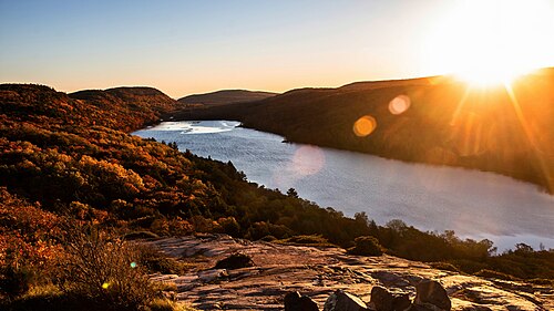
Lake of the Clouds bordered by autumn forests in the Porcupine Mountains
Lake of the Clouds is a signature overlook; road access must be checked for your season. Photo: Stevenliuyi · CC BY-SA 4.0 · optimized thumbnail
DAY 02 · Waterfalls and old forest

Porcupine Mountains area

Room for a meaningful stop

Bayfield → Ashland → Black River → Porcupine Mountains. Overnight near the Porkies.

The south shore turns from bays to iron country. In the Porkies, the mountains begin to crowd the shore and the forest feels older, darker, and farther from town.

Choose a waterfall approach or the Lake of the Clouds overlook.

Choose one waterfall or overlook on the way. Check park road conditions before promising a sunset view.

Before you commit: Black River Harbor waterfalls take their own drive and walks; they are not a free roadside stop.

Rocky Lake Superior shoreline in Porcupine Mountains Wilderness State Park
The Lake Superior shoreline within the Porkies; not a trail access confirmation. Photo: Yinan Chen · Public domain · optimized thumbnail
DAY 03 · A day that isn't a race

Ontonagon

Room for a meaningful stop

Porcupine Mountains hiking day, then Ontonagon. Short drive leaves time for Lake of the Clouds and the lakeshore.

Give the lake room to change its mind. A calm shoreline at breakfast may be rolling with surf by afternoon. Today is about the sound of water below the trees, not checking off more highway markers.

Spend the morning in the Porkies instead of adding another highway leg.

Spend meaningful time on one permitted park trail or overlook; drive to Ontonagon afterward.

Before you commit: Remote trails and the Lake of the Clouds approach may have separate seasonal road restrictions.

Copper Harbor and Lake Superior from Brockway Mountain Drive in Michigan's Keweenaw Peninsula
Copper Harbor from Brockway Mountain Drive; the scenic road may be seasonal. Photo: Alan Wilcox · CC0 1.0 · optimized thumbnail
DAY 04 · Copper Country

Houghton, L'Anse or nearby Copper Country

Room for a meaningful stop

Ontonagon → Copper Country loop → L'Anse. Prioritize Quincy Mine, Brockway Mountain, or Copper Harbor.

The Keweenaw is the peninsula that keeps going when you think you've reached the end. Old mine buildings, rocky coves, and the long view from Brockway Mountain deserve more than a drive-through.

Mining history or Copper Harbor? Pick your priority.

Choose one copper-country experience: mining heritage, a shore drive, or an extended peninsula outing.

Before you commit: Do not treat the 52-mile Houghton gateway distance as the whole Copper Harbor loop.

Rugged Lake Superior shore near Presque Isle Park in Marquette, Michigan
Presque Isle Park is worth exploring even when no freighter is approaching. Photo: The ed17 · CC BY-SA 4.0 · optimized thumbnail
DAY 05 · The iron-ore coast

Marquette

Room for a meaningful stop

L'Anse → Marquette. Presque Isle, Black Rocks, downtown, and an ore-dock watch if a vessel is loading.

In Marquette, Lake Superior meets an old ore town. Walk the rocky Presque Isle shoreline, then look toward the huge ore docks. The harbor makes more sense when you see how this region's mines reached the water.

Leave time to explore Marquette's waterfront.

Walk Presque Isle or the harbor, then make time for a local meal.

Before you commit: Ore boats are not on a guaranteed schedule. A view of the ore dock is still worthwhile without one.

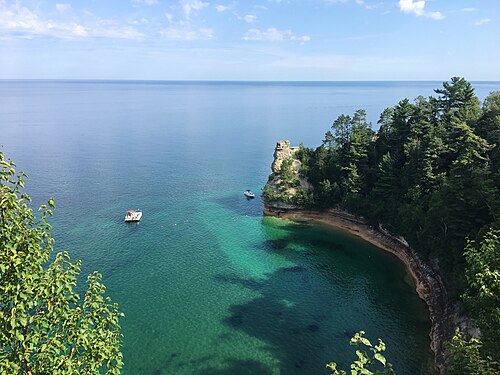
Sandstone cliffs and teal water at Miners Castle in Pictured Rocks National Lakeshore
Miners Castle in calm weather; cruise and trail access need separate checks. Photo: National Park Service · Public domain · optimized thumbnail
DAY 06 · The sandstone coast

Munising

Room for a meaningful stop

Marquette → Pictured Rocks/Munising. Reserve a cruise, kayak tour, or Chapel-area hike; overnight Munising.

Here the cliffs turn the color of copper and brick, with springs painting dark streaks down the sandstone. Pictured Rocks is not a single viewpoint. The cruise and the trail offer different experiences, and weather can change both.

Choose Pictured Rocks by water or by trail.

Choose a reserved boat trip or a practical land-based overlook and hike after consulting NPS conditions.

Before you commit: Boat trips, sea conditions, trails and the Munising Falls access notices must be checked individually.

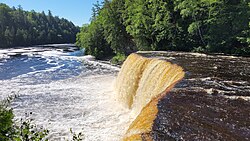
Amber-colored water spilling across Tahquamenon Upper Falls
Tahquamenon Upper Falls; allow time for distinct Whitefish Point and Soo visits. Photo: Mojnsen · CC BY-SA 4.0 · optimized thumbnail
DAY 07 · Falls, shipwrecks and locks

Sault Ste. Marie, Michigan

Room for a meaningful stop

Munising → Tahquamenon Falls → Whitefish Point → Sault Ste. Marie, Michigan.

Tahquamenon's amber water is loud enough to feel beneath your feet. Farther north, Whitefish Point remembers the ships the lake never returned. By evening, the Soo Locks bring the same shipping story back to life.

One deep stop beats three hurried ones.

Stand above Tahquamenon's Upper Falls, explore the shipwreck stories at Whitefish Point, or time a Soo Locks visit around a reported vessel. Pick one to enjoy fully, and leave the others as shorter visits or another day.

Before you commit: The Lower Falls, the Shipwreck Museum, and the Soo Locks each mean separate arrivals, parking, and time on foot. Check park hours and ship reports rather than racing between them.

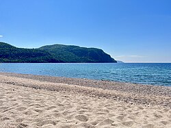
Broad sandy beach under green cliffs at Old Woman Bay in Lake Superior Provincial Park
Old Woman Bay on Lake Superior's Ontario shoreline. Photo: Beckettlc · CC0 1.0 · optimized thumbnail
DAY 08 · Ontario's wild shore

Wawa

Room for a meaningful stop

Cross at Sault Ste. Marie → Lake Superior Provincial Park → Wawa. Build in border time.

Beyond Sault Ste. Marie, granite outcrops cut through the forest and the road bends around coves that barely appear on a highway map. This is the part of the drive where you want an unhurried stop by the water.

Old Woman Bay or a longer park walk?

Pull off at Old Woman Bay for a shoreline visit, or choose one permitted Lake Superior Provincial Park trail. The best version of this day leaves time for the Canadian coast to surprise you.

Before you commit: The park's individual trail and day-use seasons differ. Border documents and any current closure alerts are separate checks.

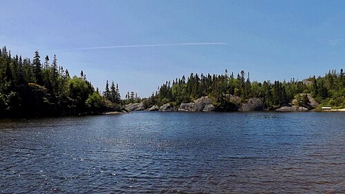
Rocky coastline and evergreen forest at Hattie Cove in Pukaskwa National Park
Hattie Cove is a worthwhile detour, not a promise it fits the long transit day. Photo: Andre Carrotflower · CC BY-SA 4.0 · optimized thumbnail
DAY 09 · The long northern run

Thunder Bay

Give this day some breathing room

Wawa → White River → Marathon/Pukaskwa → Nipigon → Thunder Bay. Long driving day; choose one longer stop.

The northern shore is immense. The highway sometimes climbs inland, leaving the open water hidden behind ridges and spruce forest. The quiet of Hattie Cove is worth a separate visit when the schedule allows it.

Protect the drive and choose one stop in the north.

Choose one stop in the Marathon/Pukaskwa or Nipigon area. Start early and protect a meaningful daylight margin.

Before you commit: A visit deep into Pukaskwa adds substantial time beyond the published gateway miles.

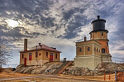
Split Rock Lighthouse above a rocky Minnesota Lake Superior headland
Split Rock Lighthouse, archival cropped photograph; ticketed history and park trails differ. Photo: Randen Pederson · CC BY 2.0 · optimized thumbnail
DAY 10 · Minnesota's waterfall coast

Duluth

Verify the final road approach

Thunder Bay → Pigeon River → Grand Portage → Grand Marais → North Shore parks → Duluth. Choose one longer park visit or two brief stops; the other named parks are pass-through waypoints.

After the border, waterfalls and headlands appear all along the North Shore. Split Rock stands over the shore like a sentinel. Decide whether you want a lighthouse visit or a waterfall walk, then return to Duluth without racing the light.

Choose one North Shore stop before Duluth.

Choose Gooseberry Falls for a river walk or Split Rock for the lighthouse and rocky shore. Leave extra North Shore parks for another visit instead of collecting parking lots.

Before you commit: Border delays, the drive to each park entrance, and remaining daylight all matter. Decide on one meaningful stop, then enjoy the final drive to Duluth.

See the geography

The whole shore, in one loop

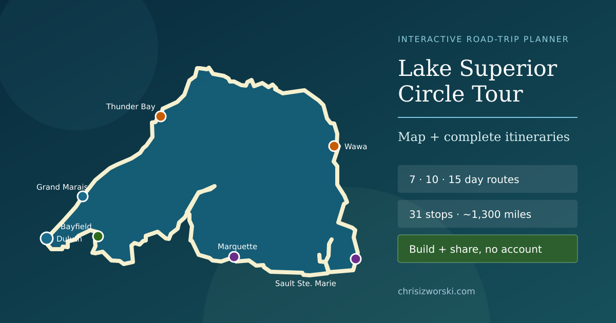
The day cards are the journey. The 31-stop interactive map is where you change direction, choose a different starting point and see how the shorelines relate to each other.

The map is not turn-by-turn navigation. Verify your actual driving route, park approaches, border waits and operating seasons before setting off.

Explore the full Circle Tour map
Map of the complete Lake Superior shoreline route across Wisconsin, Michigan, Ontario and Minnesota

How much time can you spend along the way?

This is an optional gut check for the itinerary, not a prediction of arrival time. Adjust your available hours and season; the planner flags days that may be too crowded or have incomplete road evidence.

The day-by-day guide above works without this interactive check.

What do the mileage numbers actually tell me?

The original ten-day itinerary totals approximately 1,358 published planning miles, but that sum is not a measured driving route. It doesn't prove the stops fit, predict an arrival time or establish a park is open. For example, the roughly 52-mile Ontonagon–Houghton gateway estimate does not include the Copper Harbor scenic detour; the 38-mile Thunder Bay–Pigeon River reference reaches the border, not the Grand Portage park entrance.

For unavailable official crossing waits, the guide reserves an unverified 45-minute border-time allowance. For the sample time budget, the Rust engine uses the published day estimates divided by 47 mph with a 20% allowance for slower travel, plus planned visit time. This is an editorial comparison, not an actual road-speed forecast. When a leg has an unresolved approach or a winter-sensitive experience lacks confirmation, the result is withheld; it never becomes a green light to drive.

Check the authorities before you go

These official sources provide context for roads, border requirements and park access. A link is not evidence that today's route or facility is open. Last editorial reconciliation: 2026-11-14.

Return to the full Circle Tour map, original itineraries and all 31 stops