Skip to Michigan White Christmas escapes
Chris Izworski

White Christmas & Christmas-Week Escapes / Field guide

Where Christmas week actually looks like winter in Michigan.

Detroit's historical NOAA White Christmas probability is 34.7% and Saginaw's is 45.7%—while Marquette sits near 96% and the Gaylord/Boyne highlands climb to 70–80%. Compare 10 Michigan Christmas-week destination towns by NOAA 1-inch snow-depth climatology, holiday atmosphere, and no-snow backup itineraries—then check your exact city or ZIP in the live White Christmas tools.

NOAA 1991–2020 1-inch snow-depth normals · 10 destination towns · Christmas countdown engine · reviewed October 28, 2026 · climatology is not a live December 25 snowfall guarantee

Snow and ice along the Keweenaw Waterway and Portage Lake Lift Bridge near Houghton in December 2004
Photo: Dcclark · CC BY 2.5 · Keweenaw Waterway in December 2004 · 95%+ U.P. snowbelt
Historic snowy farmstead at Port Oneida in Sleeping Bear Dunes National Lakeshore in January 2011
Photo: NPS · Port Oneida · Public domain · Port Oneida snow scene, January 2011
Snow-covered Frankenmuth streetscape and historic Lager Mill in January 2015
Photo: Crisco 1492 · CC BY-SA 4.0 · Frankenmuth in winter snow, January 2015
01 · NOAA 1991–2020 Normals34.7% Detroit → 45.7% Saginaw → 51.1% Flint → 75%+ Gaylord → 96% Marquette
02 · 45-Day Snowpack WindowStarting mid-November, surviving snow depth on the ground matters alongside history
03 · 7-Day NWS ForecastInside December 18–25, hourly NWS rain vs. snow and thaw temperatures decide the outcome

Connected White Christmas tool network · verified Oct 28, 2026

Snow on the ground vs. snow falling on December 25: check your exact city before you travel.

1. The official 1-inch rule: NOAA and the National Weather Service define a White Christmas as at least 1 inch of snow on the ground on December 25—not necessarily snow falling from the sky that morning. 2. Why Southern Michigan is a coin flip: Lake-effect snow bands require cold air crossing Lake Michigan or Lake Superior; a single mid-December rain event often wipes out southern Lower Michigan snow cover while adding 12 inches of snow to Gaylord, Boyne, Munising, and Marquette. 3. Christmas-to-New-Year week crowds: December 24 through January 1 is peak holiday lodging week at Northern Michigan ski hills and Frankenmuth; book dining, heated vineyard igloos, and lift tickets early.

All 4 holiday planning windows · available side-by-side

Four Christmas & winter snow planning windows

Every stage of the Christmas-week snow calendar is shown below at once—no window selector required. The current Michigan calendar stage is automatically highlighted.

Oct – Nov 10 · Climatology & Booking

Use NOAA 30-Year Normals & Machine-Snow Backups

More than 45 days before December 25, your strongest signal is NOAA 1991–2020 1-inch snow-depth climatology: choose 90%+ Upper Peninsula towns, 65–80% Northern Lower snowbelts with resort snowmaking, or holiday-lights towns that shine even without snow.

Best bases: Marquette (~96%) · Keweenaw (95%+) · Gaylord (75–80%) · Petoskey & Boyne (68–72%) · Frankenmuth

Open NOAA Probability Map →
Nov 11 – Dec 17 · 45-Day Snowpack

Existing NOHRSC Ground Snowpack Joins History

Inside 45 days of Christmas, surviving snow on the ground shifts local White Christmas odds above or below the 30-year baseline. Track early lake-effect snowpack across the U.P. and Gaylord/Boyne plateau alongside CPC outlooks.

Snowpack watch: Marquette · Houghton · Porkies · Munising · Gaylord · Petoskey & Boyne

Check U.S. City & ZIP Calculator →
Dec 18 – Dec 25 · 7-Day NWS Lock-In

Short-Range NWS Snow vs. Rain Decides the Outcome

Inside the final week before December 25, local National Weather Service hourly forecasts for rain, snow, and above-freezing dewpoints overtake climatology. Verify whether existing snowpack will survive or a Christmas Eve band will whiten the ground.

Christmas week: Marquette · Gaylord · Petoskey & Boyne · Traverse City · Frankenmuth · Muskegon

Open Christmas 2026 Forecast →
Dec 26 – Mar · New Year & Deep Winter

New Year Escapes & Peak January–March Snowpack

Between December 26 and March, Michigan enters its deepest snowpack and ice-curtain window. Use these same 10 holiday escape towns for New Year’s week ski trips, January/February ice curtains in Munising and Tahquamenon, and next year's planning.

Deep winter: Marquette · Houghton · Munising Ice · Tahquamenon · Petoskey & Boyne · TC Igloos

Open Winter Weekend Getaways →

Holiday trip strategy

Four tiers of Michigan Christmas-week escapes

Select a probability tier below to see how elevation, lake-effect fetch, resort snowmaking, and holiday lights change your Christmas-week odds.

TIER 01 · 90%–96% UPPER PENINSULA SUPERIOR SNOWBELTS

Near-certain December 25 snowpack along Lake Superior

In NOAA's 1991–2020 U.S. Climate Normals, the Lake Superior snowbelt across Michigan's Upper Peninsula ranks among the most reliable White Christmas zones in North America outside the high Rockies. Marquette (~96%), Houghton/Hancock (95%+), the Ironwood/Porcupine Mountains Gogebic Range (92%+), Munising (90%+), and Sault Ste. Marie/Tahquamenon (~88%) regularly build multi-foot lake-effect bases before winter solstice.

Travel rule: Pack winter emergency gear, check MDOT MiDrive and Mackinac Bridge wind advisories, and always keep a town-based backup plan if a Christmas Eve blizzard closes rural U.P. trailheads.

The Michigan Christmas-Week Atlas

Compare 10 snowy holiday escape towns.

Filter by NOAA 1991–2020 White Christmas probability tier, Michigan region, holiday experience style, and timeline stage. Every card separates historical climate odds from live weather and includes a built-in backup plan if December turns mild.

10 of 10 researched Michigan Christmas-week escape towns shown. Historical NOAA odds do not guarantee current-year December 25 snow.

Red Marquette Harbor Lighthouse above Lake Superior in Marquette, Michigan
Photo: Paul R. Burley · CC BY-SA 4.0 · Marquette Harbor Light · warm-season landmark reference

Upper Peninsula · Marquette & Negaunee · ~96% NOAA historical probability

Marquette & Negaunee: ~96% Historical White Christmas Benchmark

Highest city-base White Christmas probability in Michigan · Walkable harbor + ski hill

NOAA's 1991–2020 U.S. Climate Normals place the Marquette high-elevation/lake-effect corridor at roughly 96% for having at least 1 inch of snow on the ground on December 25—making Marquette Michigan's gold-standard Christmas-week city for families who want deep snowpack alongside historic downtown hotels, restaurants, and Marquette Mountain skiing.

Christmas-Week Plan: Christmas Eve morning ski or fat-bike ride + Presque Isle Park land-based Lake Superior overlook → downtown Washington/Third Street holiday lights & dinner.

If December is unusually mild: Marquette Mountain's machine snowmaking and the paved/plowed Iron Ore Heritage Trail keep outdoor recreation active even if early-December lake-effect totals lag behind normal.

Before you go: Stay off icy shoreline boulders at Presque Isle Black Rocks during December gales, and verify live Marquette odds and snowpack in the White Christmas calculator.

Snow and ice along the Keweenaw Waterway near Houghton in December 2004
Photo: Dcclark · CC BY 2.5 · Keweenaw Waterway in December 2004

Upper Peninsula · Houghton, Hancock & Calumet · 95%+ historical snowbelt tier

Houghton, Hancock & The Keweenaw: Copper Country Deep-Snow Christmas

3-direction Lake Superior lake-effect fetch · Mont Ripley, Nordic loops & Victorian Calumet

Surrounded by Lake Superior, the Keweenaw Peninsula routinely accumulates several feet of December snow before Christmas week—giving Houghton, Hancock, and historic Calumet a true Nordic winter atmosphere complete with the illuminated Portage Lake Lift Bridge, Michigan Tech / Maasto Hiihto ski trails, and Mont Ripley.

Christmas-Week Plan: Morning Nordic ski on Maasto Hiihto or Michigan Tech trails → afternoon turns at Mont Ripley → evening walk along snowy Shelden Avenue in Houghton and red-sandstone historic Calumet.

If a Christmas blizzard hits: Keep your itinerary anchored along plowed US-41 between Houghton, Hancock, and Calumet rather than driving exposed coastal roads toward Copper Harbor.

Before you go: Check Holiday week operating hours for Keweenaw National Historical Park partner sites and verify trail grooming before heading out on snowmobiles (season opens Dec 1).

Frozen cascades and snow-covered boulders at Bond Falls in the Western Upper Peninsula in January 2015
Photo: Stefan.Anderson · CC BY-SA 4.0 · Bond Falls in winter, January 2015

Western U.P. · Ironwood, Bessemer & Porcupine Mountains · 92%+ historical snowbelt tier

Ironwood, Bessemer & Porcupine Mountains: Big Snow Country Holiday

Western U.P. Gogebic Range ski & wilderness hub · ABR Nordic, Big Powderhorn & Porkies

Where cold northwest winds cross the widest reach of Lake Superior and hit the Gogebic Range, Ironwood, Bessemer, and the Porcupine Mountains form Michigan's earliest-opening natural snow corridor—anchoring Christmas-week trips at ABR Trails, Big Powderhorn / Snowriver Mountain Resort, and the Porkies Winter Sports Complex.

Christmas-Week Plan: Day 1: Cross-country skiing or snowshoeing in the Porcupine Mountains (East M-64 entrance) or Ironwood's ABR / Wolverine Nordic trails. Day 2: Downhill skiing on the Gogebic Range + Bond Falls winter boardwalk detour.

If December winds are severe: Trade exposed Lake Superior shoreline stops for the deep, wind-sheltered hemlock and cedar river valleys of the Montreal and Presque Isle corridors.

Before you go: Remember that M-107 to Lake of the Clouds and South Boundary Road in the Porcupine Mountains are closed to wheeled vehicles in winter; access the park via M-64 near Silver City.

Snow-covered hemlocks along the Munising Snowshoe Trail at Pictured Rocks National Lakeshore
Photo: National Park Service · Pictured Rocks · NPS public-domain guidance · Munising Snowshoe Trail, January 2021

Central U.P. · Munising & Pictured Rocks · 90%+ historical snowbelt tier

Munising & Pictured Rocks Gateway: Hemlock Snowshoe Trails & Early Ice

Deep snowshoe forest by Christmas · Early ice curtain watch along Sand Point Road

Munising sits squarely inside the central Lake Superior lake-effect belt, giving Christmas-week visitors a 90%+ historical shot at deep forest snow on the 2.65-mile Munising Snowshoe Trail, Wagner Falls Scenic Site, and Sand Point Beach—while early-winter cold begins building the first sandstone seepage ice curtains along Sand Point Road.

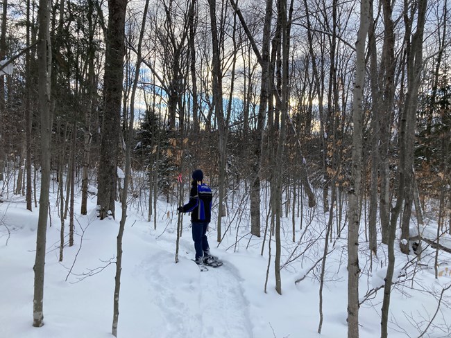
Christmas-Week Plan: Morning snowshoe hike on the marked Munising Snowshoe Trail (2.65 mi) → afternoon walk out to Sand Point Beach & Wagner Falls boardwalk → cozy dinner in Munising.

Important Christmas-week reality check: While snow on the ground is historically near-certain by December 25 in Munising, towering blue ice curtains and Eben Ice Caves often need prolonged January/February sub-freezing degree days to reach full height—so treat snowshoeing and waterfalls as your Christmas headline and early ice curtains as a bonus.

Before you go: Munising Falls Trail remains closed until further notice following the April 2025 slope washout and 2026–27 repair contract, and never walk onto Munising Bay ice.

Upper Tahquamenon Falls flowing through snow and river ice in January 2004
Photo: James Phelps · CC BY 2.0 · Upper Tahquamenon Falls, January 2004

Eastern U.P. · Tahquamenon Falls & Sault Ste. Marie · ~88% historical snowbelt tier

Sault Ste. Marie & Tahquamenon Country: Snowy Waterfalls & Holiday Freighters

Easiest U.P. White Christmas drive off I-75 · Late-December freighters still locking through

Because the Poe Lock at Sault Ste. Marie remains open to Great Lakes shipping until January 15, Christmas week in the Eastern U.P. offers a rare double experience: watching late-season 1,000-foot lake freighters steam through icy St. Marys River channels, paired with a snowy walk to the roaring 200-foot-wide Upper Tahquamenon Falls.

Christmas-Week Plan: Day 1: Tahquamenon Upper Falls packed gorge walk (0.75 mi) & 1.0-mile marked snowshoe loop + Lower Falls winter overlook. Day 2: Sault Ste. Marie Soo Locks late-December freighter watch & Paradise Pathway.

If a Whitefish Bay squall hits M-123: Spend your storm day right along paved I-75 in Sault Ste. Marie watching vessels approach the locks via the live Soo Locks vessel tracker.

Before you go: At Tahquamenon Upper Falls, keep snowshoes and boots off the 1.0-mile Lantern Loop (cross-country ski only), and do not attempt the unmaintained 4–5 mile River Trail in winter.

Towering old-growth white pines along the forest trail at Hartwick Pines State Park near Grayling and Gaylord
Photo: Guettarda · CC BY-SA 4.0 · Hartwick Pines old growth · July 2016 forest reference

Northern Lower I-75 · Gaylord, Grayling & Hartwick Pines · ~75–80% historical tier

Gaylord, Grayling & Otsego Alpine Plateau: Highest Lower Peninsula Snow Odds

Top Lower Peninsula White Christmas elevation · Direct I-75 access + Alpine Village

Rising over 1,300 feet above sea level directly in the path of Lake Michigan northwest snow bands, the Gaylord–Grayling highland plateau delivers the strongest historical White Christmas odds in the Lower Peninsula (~75–80%)—without crossing the Mackinac Bridge and within a 2.5 to 3 hour drive of Metro Detroit or Mid-Michigan.

Christmas-Week Plan: Walk under snow-draped 150-foot pines on the 1.25-mile Old Growth Forest Loop at Hartwick Pines State Park → ski Treetops / Otsego Resort or Hanson Hills / Forbush Corner → dinner in Gaylord's Swiss-style Alpine Village.

If natural December snow is thin: Treetops and Otsego Resort maintain machine-made downhill bases, while Hartwick Pines' paved/packed 1.25-mile Old Growth Loop and Gaylord's City Elk Park work in any boot conditions.

Before you go: At Hartwick Pines, the 3.0-mile Au Sable River Foot Trail has an indefinite footbridge closure (out-and-back only); use the 1.25-mile Old Growth Loop and 2.0-mile Mertz Grade.

Skiers and snow-covered lodge base at Boyne Mountain in Northern Michigan in February 1978
Photo: Xnatedawgx · CC BY-SA 3.0 · Boyne Mountain base, February 1978 · archival ski reference

Northern Lower · Petoskey, Harbor Springs & Boyne · ~68–72% historical tier

Petoskey, Harbor Springs & Boyne: Classic Resort Ski & Gaslight Christmas

Natural snowbelt + powerhouse resort snowmaking · Walkable Victorian holiday shopping

For families wanting a classic storybook Christmas week, Little Traverse Bay combines ~68–72% historical natural snow odds with three major snowmaking resorts (Boyne Mountain, The Highlands at Harbor Springs, and Nub's Nob), Victorian holiday storefronts in Petoskey's Gaslight District, and heated vineyard igloos at Boyne Valley Vineyards and Pond Hill Farm.

Christmas-Week Plan: Morning ski sessions at Boyne Mountain, The Highlands, or Nub's Nob → afternoon heated igloo flight or sledding hill at Pond Hill Farm → evening stroll through Petoskey's illuminated Gaslight District & High Five Spirits.

If a pre-Christmas rain thins natural woods snow: Boyne Mountain, The Highlands, and Nub's Nob operate some of the Midwest's deepest machine-snowmaking fleets, keeping holiday week slopes white even during mild Decembers.

Before you go: Reserve Christmas-week heated igloos, ski rentals, and Gaslight District dinners well in advance, and check live snow depth before heading out on ungroomed state park loops.

Snow-covered Sleeping Bear bluff overlooking Lake Michigan in February 2009
Photo: Sleeping Bear Dunes NPS · CC BY 2.0 · Sleeping Bear winter bluff, February 2009

Northwest Lower · Traverse City, Leelanau & Sleeping Bear · ~60–65% historical tier

Traverse City, Leelanau & Sleeping Bear: Snow-Dusted Bluffs & Vineyard Domes

60–65% historical White Christmas odds · Higher snowpack on inland Vasa & Sleeping Bear moraines

While Grand Traverse Bay water moderates downtown shoreline temperatures (~60–65% historical White Christmas probability), the higher glacial moraines at Sleeping Bear Dunes National Lakeshore and the inland Vasa Pathway catch frequent Lake Michigan snow squalls—pairing beautifully with Front Street holiday shopping and heated vineyard domes on Leelanau and Old Mission.

Christmas-Week Plan: Morning snowshoe or winter walk at Sleeping Bear Dunes (Empire Bluff / Dune Climb) or Vasa Pathway → afternoon heated igloo at Aurora Cellars or Hearth & Vine Cafe at Black Star Farms → downtown Front Street lights.

If Christmas week is low on snow: Traverse City's culinary scene, The Village at Grand Traverse Commons, and 77 nearby wineries, cideries, and distilleries make it Northern Michigan's strongest no-snow backup town.

Before you go: Check holiday tasting-room closures for December 24–25 (many reopen December 26–31 for New Year's week), and never descend steep icy Lake Michigan bluffs at Sleeping Bear.

Snow-covered Frankenmuth streetscape and Lager Mill along the Cass River in January 2015
Photo: Crisco 1492 · CC BY-SA 4.0 · Frankenmuth in winter snow, January 2015

East-Central / I-75 · Frankenmuth, Bay City & Saginaw Bay · 45.7% Saginaw NOAA odds

Frankenmuth, Bay City & Saginaw Bay: Michigan's Holiday Lights Capital (Snow or Shine)

45.7% Saginaw / 51.1% Flint historical odds · 100% Christmas atmosphere even without snow

In the Saginaw Valley and Thumb gateway, NOAA 1991–2020 White Christmas odds sit near a coin flip (Saginaw 45.7%, Flint 51.1%, Detroit 34.7%). That is exactly why Frankenmuth and nearby Bay City shine as a holiday escape: Bronner's CHRISTmas Wonderland, Main Street's musical light displays, the Holz Brücke covered bridge, and flat Tobico Marsh wetland loops deliver a festive Christmas trip whether or not December brings a snowstorm.

Christmas-Week Plan: Morning winter walk at Bay City State Park's Tobico Marsh (3.4-mile loop) or Shiawassee wildlife drive → afternoon and evening in Frankenmuth for Main Street lights, covered bridge, and Bavarian dining.

If you want snow on the same trip: Frankenmuth sits right off I-75; use the Michigan Snow Depth tool to see if a 90-minute drive north up I-75 to Hartwick Pines / Grayling puts you into deep snowpack for a daytime hike.

Before you go: Expect heavy weekend traffic around Bronner's and Main Street in December (arrive early morning or weekday afternoons when possible), and never walk onto Saginaw Bay or Cass River ice.

Red Grand Haven lighthouse and Lake Michigan pier ice in December 2008
Photo: Wayne Silver · CC BY 2.0 · Grand Haven lighthouse in December 2008

West Michigan Coast · Muskegon, Grand Haven & Grand Rapids · ~38–45% historical tier

Muskegon, Silver Lake & West Coast: Lake-Effect bursts, Luge & Pier Views

Higher lake-effect odds than Detroit · Muskegon Winter Sports Complex + Dec 15 fat-bike dunes

Along the Lake Michigan shore west of Grand Rapids, December northwest winds frequently trigger localized lake-effect snow squalls—lifting historical White Christmas odds above Detroit's 34.7% into the ~38–45% range while opening Silver Lake's winter fat-tire dune window (starting December 15) and Muskegon State Park's Winter Sports Complex.

Christmas-Week Plan: Day 1: Muskegon State Park dune-ridge hike, Blockhouse overlook, and Winter Sports Complex (luge, skating, lighted trails). Day 2: Silver Lake winter fat-bike dunes (open Dec 15–Mar 15) or land-based Grand Haven lighthouse viewing.

If Christmas week is mild on the West Coast: Muskegon's wheel-luge / synthetic skating options, coastal dune footpaths, and Grand Rapids indoor botanical/holiday exhibits keep the trip active without snow.

Before you go: Never walk onto ice-coated Lake Michigan piers at Grand Haven, Muskegon, or St. Joseph—waves wash people off icy catwalks even in calm-looking weather.

Complete White Christmas & Snow Tool Suite

Verify historical odds, live snowpack & Christmas-week weather

Each tool in our winter network answers a distinct question—from 30-year NOAA climate odds to today's NOHRSC ground snow depth and hourly NWS lake-effect warnings.

Local City & ZIP Lookup

White Christmas Calculator

Search any U.S. city or ZIP code for NOAA 1991–2020 historical 1-inch snow-depth probability and current-season context.

Open White Christmas Calculator ↗
Christmas 2026 Forecast Window

Will It Snow on Christmas 2026?

Compare snow on the ground vs. Christmas Day snowfall and see when 45-day snowpack and 7-day NWS forecasts lock in.

Open Christmas 2026 Forecast ↗
NOAA 1991–2020 Climatology

White Christmas Probability Map

Explore the national NOAA 30-year climate-normal probability map and compare snowbelts across all 50 states.

Open NOAA Probability Map ↗
Detroit to Marquette Breakdown

White Christmas Michigan Summary

Compare Detroit (34.7%), Saginaw (45.7%), Flint (51.1%), and Marquette (~96%) station climatology side by side.

Open Michigan Climatology Page ↗
Live Ground Snowpack

Michigan Snow Depth Finder

See where natural snow is actually on the ground today across Michigan within a 1-to-5 hour drive window.

Open Michigan Snow Depth ↗
All-Winter Trip Base Guide

Michigan Winter Weekend Getaways

Explore all 12 flagship Michigan winter weekend getaways with 2-day itineraries, trail links, and backup moves.

Open Winter Weekend Getaways ↗

Climatology & travel honesty

Historical odds guide early booking. Live snowpack & NWS forecasts guide departure.

A 90% historical White Christmas probability means 9 out of 10 years during the 1991–2020 NOAA climate-normal period had at least 1 inch of snow on the ground on December 25—it is never a deterministic forecast months in advance. Inside 45 days of Christmas, check observed snow depth; inside 7 days, check local National Weather Service forecasts and MDOT MiDrive road conditions.

White Christmas Calculator ↗ · NOAA Probability Map ↗ · MDOT MiDrive ↗