Skip to Michigan winter weekend getaways
Chris Izworski

Michigan Winter Weekends / Flagship field guide

Build a Michigan winter weekend around the right base town.

A great winter trip pairs one headline snow or ice outing with an effortless local backup plan when lake-effect squalls close a highway or a December thaw thins the trails. Compare 12 researched Michigan winter weekend getaways by region, drive window, and vibe—then verify live snow depth, ski hills, ice curtains, and aurora odds before you pack.

Compare all 12 weekend getaways

12 weekend base towns · 2-track backup itineraries · auto-calibrated 4-season calendar · reviewed October 28, 2026 · no live road or park-open claims

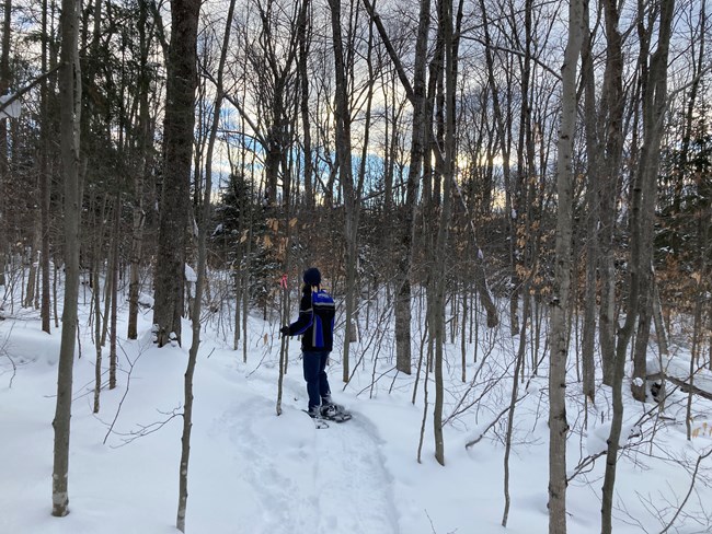
Snowshoer traveling a deep powder forest corridor on the Munising Snowshoe Trail at Pictured Rocks National Lakeshore
Photo: National Park Service · Pictured Rocks · NPS public-domain guidance · Munising Snowshoe Trail, January 2021
Upper Tahquamenon Falls flowing between snow-covered banks in January 2004
Photo: James Phelps · CC BY 2.0 · Upper Tahquamenon Falls, January 2004
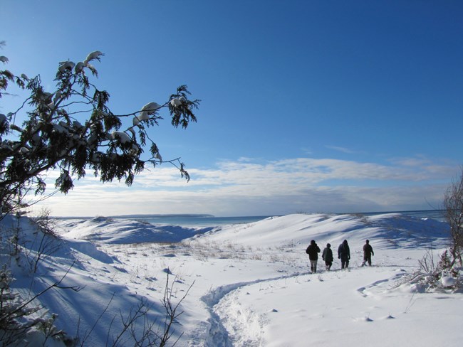
Snow-covered Sleeping Bear bluff overlooking Lake Michigan in February 2009
Photo: Sleeping Bear Dunes NPS · CC BY 2.0 · Sleeping Bear winter bluff, February 2009
01 · Pick a drive windowUnder 3 hrs (I-75 / West Coast) vs. 3.5–4.5 hrs (Up North) vs. U.P. snowbelt
02 · Anchor + backup planEvery base below pairs a snow/ice headline with a storm-or-thaw alternative
03 · Verify live signalsCheck NOAA snow depth, NWS lake-effect warnings & seasonal road closures

Critical winter weekend logistics · source checked Oct 28, 2026

Four seasonal realities that make or break a Michigan winter trip.

1. Seasonal road closures change your GPS route: In the Upper Peninsula, M-107 to Lake of the Clouds in the Porcupine Mountains, H-58 segments near Pictured Rocks, and Munising Falls Trail (April 2025 washout / 2026–27 repair) are closed to cars or foot traffic in winter. 2. Snowbelt weather vs. southern Michigan bare ground: Western and northern snowbelts (Gaylord, Boyne, Traverse City, Marquette, Munising, Houghton) frequently hold 10–30+ inches of lake-effect snow when Metro Detroit or Grand Rapids is bare—check Michigan Snow Depth before canceling or booking. 3. Afternoon twilight arrives early: In November and December, northern Michigan sunset falls between 4:55 PM and 5:15 PM; pair morning trail or waterfall outings with after-4:30 PM heated vineyard igloos, craft distilleries, or dark-sky parks. 4. Never assume lake or river ice is safe: Enjoy Great Lakes ice curtains, piers, and frozen bays strictly from land-based overlooks.

All 4 seasonal weekend guides · available year-round

One weekend guide for each Michigan season

Every season in Michigan has its own weekend playbook below—no season selector required. All four seasonal guides stay visible at once, with the current Michigan calendar season automatically highlighted.

Summer · Jun – Aug

Lake Superior Shores, Sleeping Bear Dunes & Bay Vineyards

Warm-season weekends across these same 12 Michigan base towns anchor Lake Superior Circle Tour road trips, Pictured Rocks cliff cruises, Porcupine Mountains ridges, Mackinac Straits ferries, and Grand Traverse / Little Traverse Bay patio wine trails.

Summer weekend bases: Marquette · Porkies · Traverse City · Petoskey & Harbor Springs · Mackinac Straits · Silver Lake Dunes

Open Summer Destination Guide →
Fall · Sep – Nov

Peak Canopy Drives, Harvest Vineyards, Freighters & First Snow

Autumn brings peak hardwood color along M-119, M-22, and the U.P., orchard cider pressing in Traverse City and Petoskey, late-fall whitetail woods, November freighter passages at Sault Ste. Marie, and the season's first Lake Superior lake-effect snow.

Fall weekend bases: Tahquamenon & Soo · Marquette · TC Harvest · Tunnel of Trees · Hartwick Pines · Frankenmuth

Open Fall Color & Autumn Guide →

Weekend itinerary architecture

Four ways to match a Michigan weekend to the weather

Select a weekend playbook below to see how to pair your primary outdoor goal with a built-in backup plan before filtering the 12 destination bases.

PLAYBOOK 01 · GUARANTEED SNOWBELT & SKI TOWNS

Chase lake-effect elevation when southern Michigan is bare

When southern Lower Michigan sits in 40°F rain or brown grass, elevation and cold northwest fetch across Lake Superior and Lake Michigan build reliable winter bases further north. In the Upper Peninsula, Marquette, Munising, Houghton/Keweenaw, and the Porcupine Mountains average 140 to 250+ inches of seasonal snow. In the Northern Lower Peninsula, the Gaylord-Grayling plateau (over 1,300 feet elevation along I-75) and the Boyne-Petoskey hills combine lake-effect belts with high-capacity resort snowmaking.

Backup rule: If a heavy lake-effect warning makes rural trailhead roads impassable, pivot to town-adjacent groomed loops (Vasa Pathway, Hartwick Pines, Munising Snowshoe Trail) or lift-served resort slopes.

The winter weekend atlas

Choose your Michigan winter weekend base.

Filter 12 researched weekend destinations by primary winter vibe, Michigan region, effort level, and typical drive window from Southern Michigan / Chicago hubs. Every destination includes a headline outing, a weather-proof backup move, and direct links to live condition tools.

12 of 12 researched Michigan winter weekend getaways shown. Check road conditions, seasonal closures and official sources before travel.

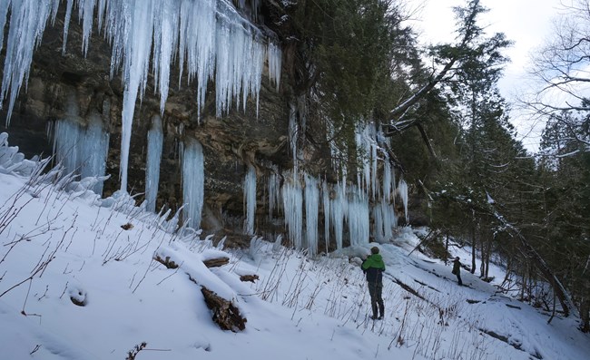
Visitor standing beside towering pale blue ice formations at Pictured Rocks National Lakeshore
Photo: National Park Service · Pictured Rocks · NPS public-domain guidance · Pictured Rocks ice curtains · archival winter scene

Upper Peninsula · Munising & Pictured Rocks · moderate · 5.5–6.5 hr drive

Munising & Pictured Rocks: Ice Curtains, Sand Point & Snowshoe Woods

90%+ historical snowbelt base · Day 1 ice curtains + Day 2 snowshoe loop

Michigan's iconic mid-winter ice weekend: spend Day 1 viewing land-based sandstone seepage ice curtains along Sand Point Road and shoreline ice ridges at Sand Point Beach, then spend Day 2 on the marked 2.65-mile Munising Snowshoe Trail or nearby Eben Ice Caves.

2-Day Framework: Day 1: Sand Point shore walk & inland cliff ice curtains → Munising harbor dinner. Day 2: Munising Snowshoe Trail (2.65 mi) or Wagner Falls Scenic Site (0.5 mi).

The backup move: When early-winter warmth delays ice curtain formation or lake-effect whiteouts close M-28 along the bay, stay in the sheltered hemlock woods of the Munising Snowshoe Trail and Wagner Falls.

Before you go: Munising Falls Trail remains closed until further notice following the April 2025 slope washout and 2026–27 repair project. Never walk onto Lake Superior shelf ice toward Grand Island.

Red Marquette Harbor Lighthouse standing on rocky point above Lake Superior in Marquette, Michigan
Photo: Paul R. Burley · CC BY-SA 4.0 · Marquette Harbor Light, June 2022 · warm-season landmark reference

Upper Peninsula · Marquette · moderate · ~96% NOAA White Christmas odds

Marquette & Superior Snowbelt: Presque Isle Shore, Ski Hill & Harbor Town

U.P.'s most walkable winter city base · Downhill, fat-bike & Lake Superior gale watching

Marquette gives you deep Upper Peninsula snowpack (~96% historical White Christmas probability) without isolating you in a remote cabin: pair downhill turns at Marquette Mountain or groomed fat-bike/Nordic loops with land-based Lake Superior wave-and-ice viewing at Presque Isle Park and Lower Harbor ore docks.

2-Day Framework: Day 1: Marquette Mountain downhill or Noquemanon Nordic/fat-bike trails → Third Street / downtown dinner. Day 2: Presque Isle Black Rocks land-based winter overlook & Iron Ore Heritage Trail.

The backup move: If a fierce northwest Lake Superior gale closes rural highways, keep your entire weekend inside city limits along the plowed Iron Ore Heritage Trail, Lower Harbor overlooks, and downtown breweries/cafes.

Before you go: High waves and ice spray along Presque Isle and Black Rocks sweep coastal rocks without warning; stay behind barriers on safe high ground, and note that rural Anderson Lake Pathway roads are unplowed in winter.

Close view of Bond Falls winter ice and snow-covered cascades in the Western Upper Peninsula
Photo: Stefan.Anderson · CC BY-SA 4.0 · Bond Falls in the Western U.P., January 2015

Western U.P. · Porcupine Mountains & Ontonagon · demanding · 200+ in. snowbelt

Porcupine Mountains & Ontonagon: Deep Lake-Effect Forest & Nordic Trails

Deep-wilderness snowpack base · East M-64 entrance & Bond Falls pairing

For travelers chasing the deepest natural snowpack in the Midwest, the Porkies' eastern M-64 corridor near Silver City anchors lift-served glade/alpine skiing, groomed Nordic loops through old-growth hemlock, and an easy regional pairing with Bond Falls' frozen cascades near Paulding.

2-Day Framework: Day 1: Porkies Winter Sports Complex & Nordic/snowshoe loops at the East M-64 entrance. Day 2: Union Bay Lake Superior shore & Bond Falls winter boardwalk view via US-45.

The backup move: When wind chill drops below zero on exposed ridges, drop down into the sheltered hemlock lantern and Nordic trails at the base of the Porkies ski hill.

Before you go: M-107 west to the Lake of the Clouds overlook and South Boundary Road are closed to wheeled motor vehicles in winter (snowmobile corridor only); route all winter car arrivals to the eastern M-64 entrance near Silver City.

Snow and ice along the Keweenaw Waterway and Portage Lake Lift Bridge near Houghton in December 2004
Photo: Dcclark · CC BY 2.5 · Keweenaw Waterway in winter, December 2004

Upper Peninsula · Houghton, Hancock & Keweenaw · demanding · Copper Country snowbelt

Houghton & The Keweenaw: Snowmobile Capital, Mont Ripley & Waterway

Surrounded by Lake Superior fetch · Dec 1–Mar 31 snowmobile corridor & college town

Jutting into Lake Superior, the Keweenaw Peninsula catches lake-effect snow from three wind directions—creating Michigan's premier late-fall through March snowbelt base for snowmobile trail riders, Mont Ripley skiers, Maasto Hiihto / Michigan Tech Nordic skiers, and historic mining-town explorers.

2-Day Framework: Day 1: Mont Ripley ski slopes or Michigan Tech / Maasto Hiihto Nordic trails → downtown Houghton & Portage Lift Bridge views. Day 2: Calumet historic district or snowmobile trail corridor north toward Copper Harbor.

The backup move: During intense Keweenaw blizzard warnings on US-41 north of Calumet, stay in the twin cities of Houghton and Hancock for lift-bridge photography, indoor heritage sites, and sheltered canal trails.

Before you go: Michigan's designated snowmobile trail season runs December 1 through March 31, and grooming depends on base depth; never drive passenger vehicles onto unplowed seasonal roads at the tip of the Keweenaw.

Upper Tahquamenon Falls thundering between deep snowbanks and amber ice in January 2004
Photo: James Phelps · CC BY 2.0 · Upper Tahquamenon Falls, January 2004

Eastern U.P. · Tahquamenon Falls & Sault Ste. Marie · easygoing · ~1 hr north of bridge

Sault Ste. Marie & Tahquamenon: Tannery-Gold Winter Falls & Soo Locks

Closest U.P. weekend north of I-75 · Year-round waterfall flow + St. Marys River maritime

Just an hour past the Mackinac Bridge via I-75 and M-123, the Eastern U.P. pairs Michigan's most reliable winter waterfall—the 200-foot-wide Upper Tahquamenon Falls—with late-season freighter passages and winter layup/dewatering heritage along the St. Marys River in Sault Ste. Marie.

2-Day Framework: Day 1: Tahquamenon Upper Falls packed gorge walk (0.75 mi) & marked 1.0-mile snowshoe loop → Lower Falls boardwalk overlook. Day 2: Sault Ste. Marie waterfront, Soo Locks park shoreline & Pine Bowl or Paradise Pathway.

The backup move: After the Poe Lock closes for winter maintenance on January 15, combine your Sault Ste. Marie harbor walk with the Great Lakes Freighter Winter Layup tracker to follow where the 1,000-footers berth for the winter.

Before you go: At Tahquamenon Upper Falls, the 1.0-mile Lantern Loop is cross-country ski only (no snowshoes or boots), and the 4–5 mile River Trail between Upper and Lower Falls is not maintained in winter.

Visitors snowshoeing through deep snow drifts at Sleeping Bear Dunes National Lakeshore near Traverse City
Photo: National Park Service · NPS public-domain guidance · Sleeping Bear snowshoeing

Northern Lower · Traverse City, Leelanau & Old Mission · easygoing · 3.5–4 hr drive

Traverse City, Leelanau & Old Mission: Vasa Trails, Bluffs & Vineyard Igloos

Best all-weather couples & foodie weekend · Trails in the morning + heated domes at 3 PM

Traverse City solves the classic winter trip dilemma: spend the morning on the Vasa Pathway's dedicated snowshoe/Nordic/fat-bike loops or Sleeping Bear Dunes' Heritage Trail, then spend the afternoon on a single peninsula (Old Mission or Leelanau) for snowshoe-and-sip vineyard loops, heated igloos, and after-5 PM downtown craft distilleries.

2-Day Framework: Day 1: Vasa Pathway snowshoe/ski loops → Old Mission Peninsula snowshoe trail at Brys Estate & heated pavilion at Bowers Harbor → Front Street dinner. Day 2: Sleeping Bear Dunes Dune Climb / Empire Bluff → Leelanau heated igloos (Aurora Cellars / Black Star Farms).

The backup move: If a mild spell leaves trails thin for skiing, switch to winter boot hikes with microspikes at Empire Bluff and focus on The Village at Grand Traverse Commons (Left Foot Charley cidery) and Old Mission/Leelanau tasting rooms.

Before you go: Never try to visit both Old Mission and Leelanau peninsulas in the same afternoon, book heated vineyard igloos ahead of time, and stay off set classic ski tracks on the Vasa Pathway and Sleeping Bear Heritage Trail.

Night sky above treetops at Headlands International Dark Sky Park near Mackinaw City and Petoskey
Photo: radicalespresso · Public Domain Mark · Headlands Dark Sky Park · July 2025 night reference

Northern Lower · Petoskey, Harbor Springs & Boyne · easygoing · 3.5–4.25 hr drive

Petoskey, Harbor Springs & Boyne: Downhill Resorts, Dark Sky & Bay Villages

Downhill ski hub + Gaslight District shopping + Headlands Dark Sky Park

Anchored by Michigan's highest concentration of major downhill ski resorts (Boyne Mountain, The Highlands at Harbor Springs, and Nub's Nob), the Little Traverse Bay region pairs reliable machine-augmented and lake-effect ski slopes with historic Victorian downtowns, heated vineyard/farm igloos, and world-class winter stargazing at Headlands International Dark Sky Park.

2-Day Framework: Day 1: Downhill or XC skiing at Boyne Mountain / The Highlands / Nub's Nob → Boyne Valley Vineyards igloos or Pond Hill Farm heated tent → Petoskey Gaslight District & High Five Spirits. Day 2: Petoskey State Park winter beach walk → evening aurora/stargazing check at Headlands Dark Sky Park.

The backup move: If clouds block night-sky viewing at Headlands or winds hold ski lifts, pivot to the walkable Petoskey Gaslight District, Gypsy Distillery's estate lounge, and Maple Moon Sugarbush.

Before you go: Check live cloud cover and KP index before driving up to Headlands Dark Sky Park at night, and use dimmed red-light flashlights rather than white beams on the dark-sky viewing shore.

The Mackinac Bridge spanning ice-covered waters of the Straits of Mackinac in March 2018
Photo: U.S. Fish & Wildlife Service · Public domain · Mackinac Bridge & Straits ice, March 2018

Straits of Mackinac · Mackinaw City & St. Ignace · easygoing · ~4 hr drive via I-75

Mackinac Straits & St. Ignace: Winter Bridge Watch & Ice Bridge Tradition

Dramatic Straits ice & maritime vantage · Land-based bridge overlooks on both peninsulas

In deep winter, the Straits of Mackinac transform into a dramatic expanse of shifting blue-ice floes, USCG icebreaker tracks, and towering suspension-bridge silhouettes viewed safely from McGulpin Point, Old Mackinac Point, Bridge View Park in St. Ignace, and Straits State Park.

2-Day Framework: Day 1: Old Mackinac Point & McGulpin Point shoreline views in Mackinaw City → cross the Mackinac Bridge to Bridge View Park in St. Ignace. Day 2: Straits State Park overlooks & Castle Rock / Hiawatha National Forest winter drive.

The backup move: Always check live Mackinac Bridge wind and escort restrictions before crossing; if high winds or falling-ice advisories delay bridge crossings, keep your day on the southern shore between Mackinaw City, Headlands, and Cheboygan.

Before you go: Never assume summer Mackinac Island ferry schedules operate in winter, and never step onto Straits of Mackinac ice—the Mackinac Ice Bridge tracker is strictly an educational NOAA ice-chart monitor, not a crossing guide.

Towering white pines along the forest footpath at Hartwick Pines State Park near Grayling in July 2016
Photo: Guettarda · CC BY-SA 4.0 · Hartwick Pines old growth · July 2016 summer forest reference

Northern Lower I-75 · Gaylord, Grayling & Hartwick Pines · easygoing · ~2.5–3 hr drive

Gaylord, Grayling & Hartwick Pines: 45th Parallel Snowbelt & Old-Growth Pines

Fastest straight-up-I-75 snowbelt escape · 75–80% historical Christmas snow plateau

Sitting atop Northern Lower Michigan's 1,300-foot inland plateau right along I-75, Gaylord and Grayling catch persistent lake-effect snow bands from Lake Michigan while offering direct highway access to Hartwick Pines State Park's 1.25-mile Old Growth Forest Loop, Forbush Corner /anson-area Nordic skiing, Treetops / Otsego Resort, and quiet Au Sable River overlooks.

2-Day Framework: Day 1: Hartwick Pines Old Growth Forest Loop (1.25 mi) & Mertz Grade (2.0 mi) → Grayling or Gaylord Alpine Village dinner. Day 2: Otsego / Treetops slopes, Gaylord City Elk Park viewing, or Au Sable River land-based winter overlooks.

The backup move: When thin early-winter snow limits backcountry snowshoeing, walk the paved/packed 1.25-mile Old Growth Forest Loop at Hartwick Pines with winter boots or microspikes and stop by Gaylord's city elk viewing pasture.

Before you go: At Hartwick Pines State Park, an indefinite footbridge closure on the 3.0-mile Au Sable River Foot Trail restricts that trail to out-and-back travel only; stick to the 1.25-mile Old Growth Loop and 2.0-mile Mertz Grade.
White brick Tawas Point Lighthouse tower and red keeper dwelling at Tawas Point State Park on Lake Huron
Photo: Johnkan0301 · CC BY-SA 4.0 · Tawas Point Light Station, August 2018 · warm-season reference

Sunrise Side · Tawas Point, Oscoda & Au Sable River · easygoing · ~2.5–3 hr drive via US-23

Tawas Point, Oscoda & Au Sable River: Winter Bald Eagles & Lake Huron Light

Premier Sunrise Side winter wildlife & lighthouse base · Works with or without deep snow

Along Lake Huron's Sunrise Side, open water below the lower Au Sable River hydro dams (Foote, Cooke, Five Channels) attracts wintering bald eagles and waterfowl even during deep freezes, pairing naturally with a flat sandy spit walk out to Tawas Point Lighthouse and scenic drives along the River Road National Scenic Byway.

2-Day Framework: Day 1: Tawas Point State Park sandy point walk & lighthouse grounds → East Tawas harbor lunch. Day 2: River Road National Scenic Byway overlooks (Lumberman's Monument / Largo Springs / Iargo Springs) & Au Sable River winter eagle watching.

The backup move: If biting Lake Huron winds cut short your walk on the exposed Tawas Point sand spit, head inland along the sheltered Au Sable River valley overlooks and Corsair ski/walking trails in Huron National Forest.

Before you go: Steep wooden stairways at Highbanks / Iargo Springs can ice over in winter (bring microspikes and respect any gated steps), and stay completely off shore ice around Tawas Bay.

Timber blockhouse overlook above forested dunes at Muskegon State Park in March 2019
Photo: rossograph · CC BY-SA 4.0 · Muskegon State Park Blockhouse, March 2019

West Michigan Coast · Muskegon & Silver Lake Dunes · moderate · 1–2.75 hr drive

Muskegon & Silver Lake Dunes: Ice Luge Track, Fat-Bike Dunes & Pier Ice

West Coast winter action hub · Public ice luge, lighted XC loops & Dec 15–Mar 15 fat-bike dunes

Less than an hour from Grand Rapids and under three hours from Chicago or Detroit, Muskegon State Park hosts one of only four public natural-ice luge tracks in the United States alongside lighted cross-country ski/snowshoe trails—paired 35 minutes north with Silver Lake State Park's December 15 through March 15 winter fat-tire dune riding window.

2-Day Framework: Day 1: Muskegon Luge Adventure Sports Park (public luge, ice skating, lighted XC/snowshoe loops) & Scenic Drive Blockhouse overlook. Day 2: Silver Lake State Park winter fat-tire dune riding (Dec 15–Mar 15) or Grand Haven / Muskegon pier viewing from land.

The backup move: If warm weather pauses natural snow or luge ice at Muskegon, hike the 12 miles of dune-ridge and Lost Lake footpaths at Muskegon State Park (including synthetic/wheel-luge options when offered) and tour downtown Muskegon museums and breweries.

Before you go: Silver Lake winter fat-tire riding is open December 15–March 15 only, requires tires at least 3.5 inches wide, and parks at the DNR pedestrian lot (8962 W. Fox Road, Mears)—never walk onto ice-covered Lake Michigan piers.

Snow-covered reeds and frozen marsh channels at Tobico Marsh in Bay City State Park during February 2016
Photo: Guettarda · CC BY-SA 4.0 · Tobico Marsh at Bay City State Park, February 2016

East-Central / Saginaw Bay · Bay City, Shiawassee & Frankenmuth · easygoing · 1.5–2 hr drive

Saginaw Bay, Bay City & Frankenmuth: Tobico Marsh, Frozen Bay & Holiday Lights

Zero-snow-stress weekend · Flat marsh trails, migrating waterfowl & Bavarian holiday lights

Only 90 minutes north of Metro Detroit off I-75, the Saginaw Valley pairs daytime coastal wetland hikes at Bay City State Park's Tobico Marsh and wildlife viewing along the Shiawassee National Wildlife Refuge with evening holiday lights, covered-bridge walks, and Bavarian dinners in Frankenmuth.

2-Day Framework: Day 1: Bay City State Park Andersen Nature Trail & Tobico Marsh Loop (3.4 mi) + Saginaw Bay land-based ice observation → Bay City waterfront antiques & dining. Day 2: Shiawassee NWR / Saginaw River eagle & waterfowl viewing → Frankenmuth Bronner's & Main Street lights.

The backup move: Because Tobico Marsh's flat paved/gravel loops and Frankenmuth's holiday displays do not depend on deep snowpack, this is Michigan's most reliable late-November and December weekend when snow belts are stormy or southern trails are bare.

Before you go: Saginaw Bay ice shifts rapidly with wind and Saginaw River current—observe pressure ridges strictly from Bay City State Park land overlooks, never infer ice safety from shore appearance.

Live decision tool handoffs

Check the live weather, snowpack & maritime engines before you drive

Once you pick a weekend base town above, use these six live specialist tools to verify real-time snow depth, lake-effect bands, ski resort snow, White Christmas odds, and freighter layups.

Natural Snow on the Ground

Michigan Snow Depth Finder

Compare NOAA/NOHRSC modeled snow depth, station reports, and 1-to-5 hour drive rings before packing skis or snowshoes.

Open Michigan Snow Depth ↗
Hourly Snowbelt Warnings

Lake-Effect Snow Forecast

Track NWS hourly snowbelt outlooks, wind fetch shifts, and winter storm warnings across MI, WI, OH, PA and NY.

Open Lake-Effect Snow Tool ↗
Holiday Trip Planning

White Christmas & Holiday Escapes

Compare Michigan towns by NOAA 1991–2020 December 25 snow odds and check live local Christmas-week snow outlooks.

Open White Christmas Escapes ↗
Downhill & Nordic Trails

Michigan Ski Hills & Winter Trails

Compare downhill resorts by weekend snow and drive time, or browse 15 audited DNR/NPS snowshoe, ski and fat-bike systems.

Open Michigan Winter Trails ↗
Ice Curtains & Waterfalls

Frozen Michigan & Ice Caves

Inspect 11 Michigan ice curtains, frozen waterfalls, and shore overlooks with formation physics and closure notices.

Open Frozen Michigan Guide ↗
Tasting Rooms & Winter Harbors

Wine/Cider Igloos & Winter Layup

Book heated vineyard igloos around Traverse City and Petoskey, or track where Great Lakes freighters berth for winter layup.

Open Wine, Cider & Spirits Guide ↗

Field judgment

The photo inspires. The evidence decides.

Keep every Michigan winter weekend flexible. A heavy lake-effect band can transform highway visibility in minutes, while a December thaw can shift an outing from classic skis to microspikes and heated vineyard domes. Maps show general destination areas, never guaranteed plowed winter parking or safe ice routes.

Michigan DNR winter activities ↗ · MDOT MiDrive road conditions ↗ · Michigan DNR closures ↗